Hello again! Today, I would like to show you a little bit of Lisbon, the capital city of Portugal! Lisbon is the westernmost large city located in Europe (with a population of half a million in central Lisbon), as well as its westernmost capital city and the only one along the Atlantic coast.
Above: A panorama of downtown Lisbon outskirts as seen from the deck of the Ryndam!
Lisbon is one of the oldest cities in the world, and the oldest city in Western Europe, predating other modern European capitals such as London, Paris and Rome by hundreds of years. Julius Caesar made it a municipium and it was later ruled by a series of Germanic tribes from the fifth century, before being captured by the Moors in the eighth century. In 1147, the Crusaders under Afonso Henriques reconquered the city and since then it has been a major political, economic, and cultural centre of Portugal.
Above: I walked to the top of Eduardo VII Park (named after Britain's Edward VII) on my travels through Lisbon. You can see the River Tagus where the Ryndam docked, in the background.
You may be surprised to hear that I did not take a tour during any of our visits to Lisbon! Instead, I walked around the city, with friends from the crew and also on my own. The city is very vibrant, with trams crisscrossing streets, and lots of pedestrians!
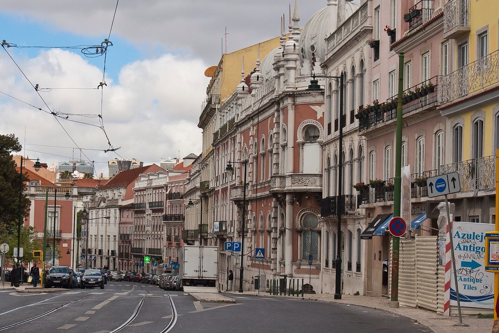
Above: Tram lines in a typical downtown Lisbon street.
Locally, Lisbon inhabitants refer the spaces of Lisbon in terms of historic bairros (neighbourhoods). These communities have no clearly defined boundaries but represent special quarters with a common historical culture, identifiable architectural landmarks, livings standards and/or local personality, such as Bairro Alto, Alfama and Chiado. Different parts of the city did exhibit very different feels, from the main touristy areas to quieter backstreets like this:
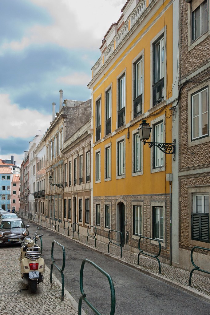
Above: A quiet Lisbon backstreet.
I took in many of the famous tourist sites in Lisbon, including the Square of Commerce ('Praça do Comércio') which is located on the waterfront of the Tagus River. The bronze statue in the middle of the square is of King José I, and was inaugurated in 1775. Opening towards the Augusta Street, which links the square with the other traditional Lisbon square, the Rossio, there is a triumphal arch, created in 1875. This arch, usually called the Arco da Rua Augusta, was designed by Veríssimo da Costa.
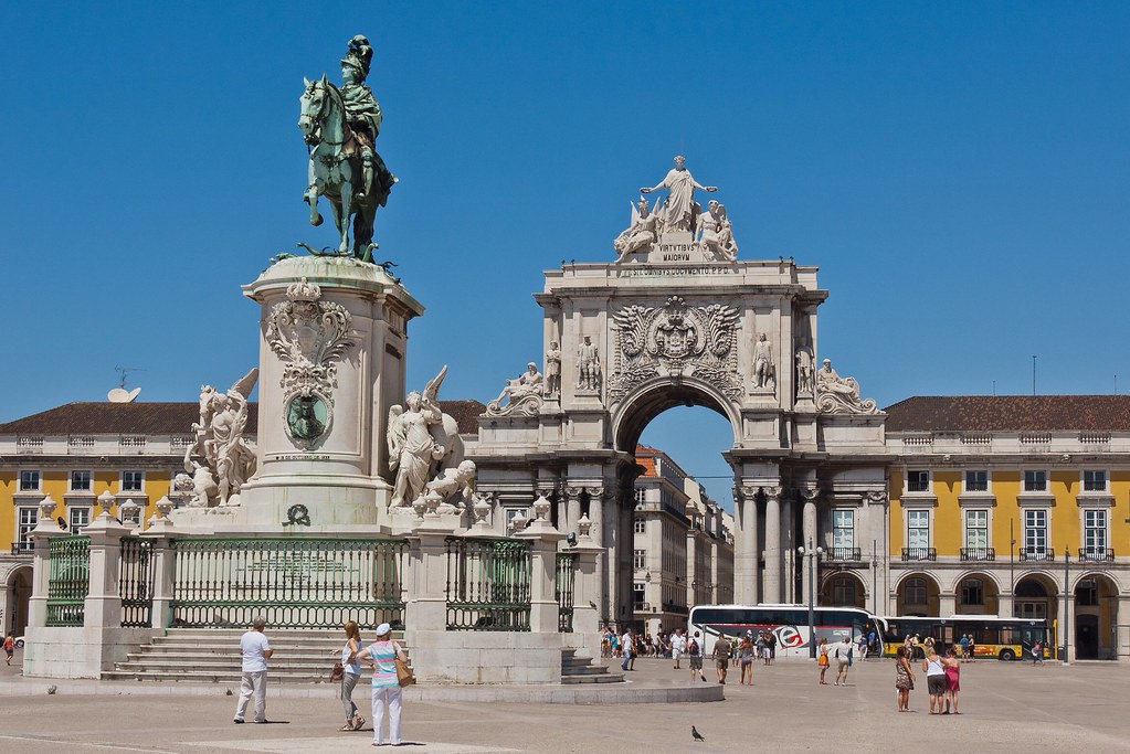
Above: King José I with the arch behind in the Square of Commerce.
Another tourist hotspot nearby is the Santa Justa Lift which connects the lower streets of the Baixa with the higher Carmo Square. Completed in 1902, the Lift has since become a tourist attraction for Lisbon as, among the urban lifts in the city, Santa Justa is the only remaining vertical one. Lisbon is very hilly, and this lift was a way for pedestrians to access a higher part of the city without breaking a sweat.
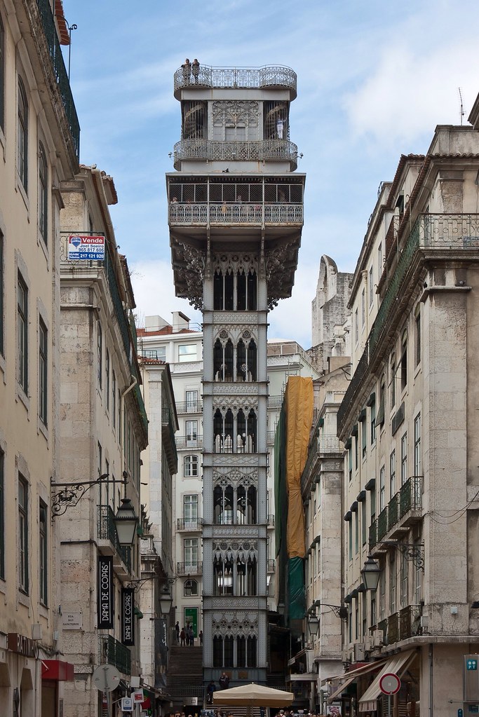
Above: The Santa Justa Lift.
A little further inland from the river is the famous Rossio Square which features one of the most prestigious theatres in Portugal, the National Theatre D. Maria II as well as a number of statues.
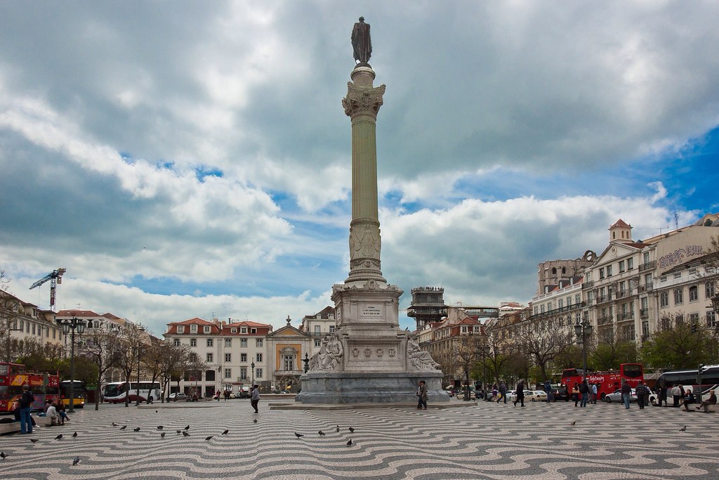
Above: Rossio Square. You can see the Santa Justa Lift on the right, behind the statue.
Another key building on Rossio Square is the Rossio Railway Station, commissioned by the Portuguese Royal Railway Company and designed between 1886 and 1887 by Portuguese architect José Luís Monteiro. A rail tunnel was excavated under the city in 1890 to connect Lisbon to the region of Sintra, a tunnel which is today considered one of the most important engineering works of 19th century Portugal.
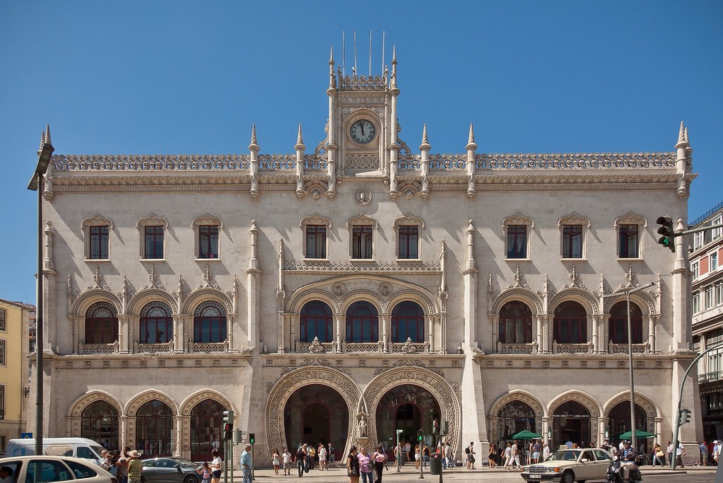
Above: Rossio Railway Station.
The Neo-Manueline façade of the station is a Romantic recreation of the exuberant Manueline style, typical of early 16th century Portugal. Its most interesting features are the two intertwined horseshoe portals at the entrance, the clock in a small turret and the abundant sculptural decoration.
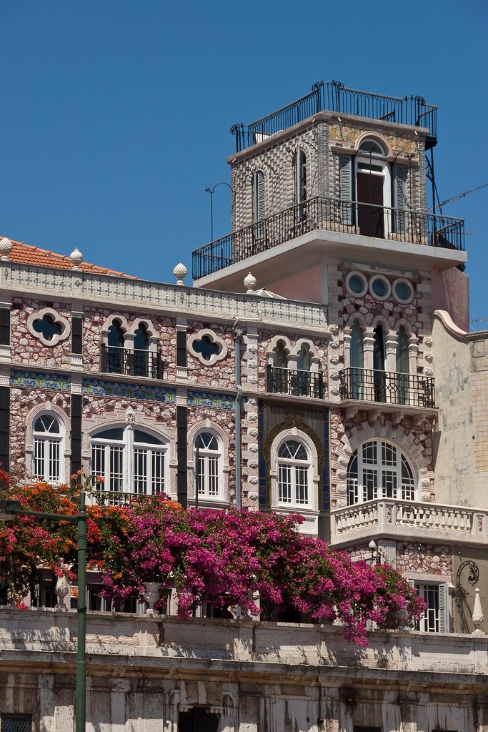
Above: More interesting architecture and colours in Lisbon.
Whilst exploring the city - sometimes it is fun to just wander without a plan - I came across the National Pantheon - the Church of Santa Engrácia. The interior of the church was beautiful so I grabbed a shot before I was charged for entering!
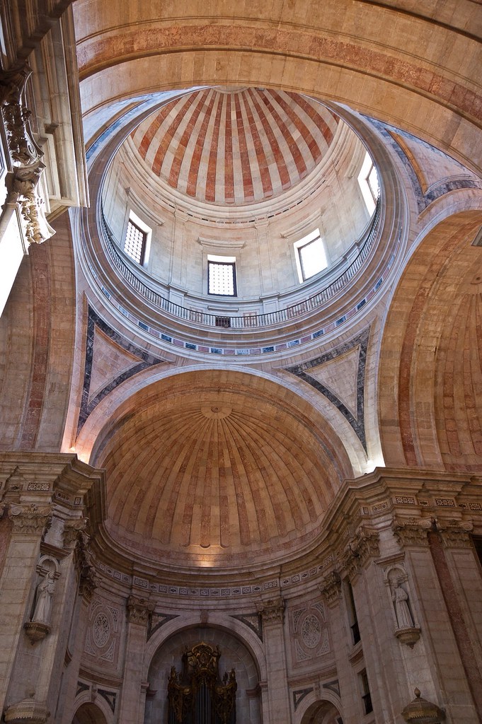
Above: Inside the Church of Santa Engrácia.
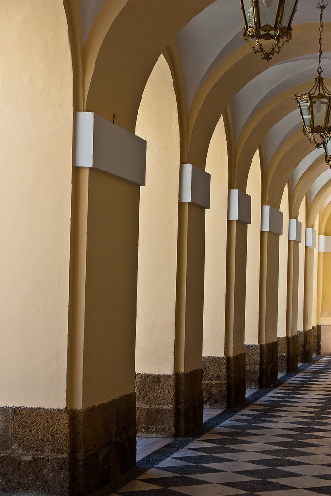
I'll leave you with a final shot from the walk back to the Ryndam from downtown Lisbon. This is a great city - despite its reputation as a hotspot for pickpockets - and I had fun wandering up and down its many and varied streets.
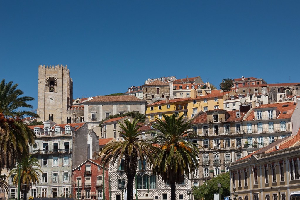
Saturday, 29 December 2012
Thursday, 27 December 2012
Monaco
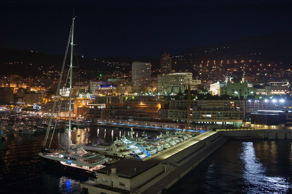
Welcome back to my blog. I'm going to try and do a '12 Days of Christmas' thing to speed me through the rest of Europe and get on to Australia and Asia! Today it's Monaco!
Above: Monaco (specifically the ward of Monte Carlo) with the famous casino on the top right.
Officially the Principality of Monaco, this city state is located on the French Riviera in Western Europe. Bordered by France on three sides, with one side bordering the Mediterranean Sea, its centre is about 10 miles from Italy, and is only 8 miles north east of Nice, France. It has an area of 0.79 square miles, and a population of 36,371, making Monaco the second smallest, and the most densely populated country in the world. The country is subdivided into ten Wards, the most famous of which is Monte Carlo.
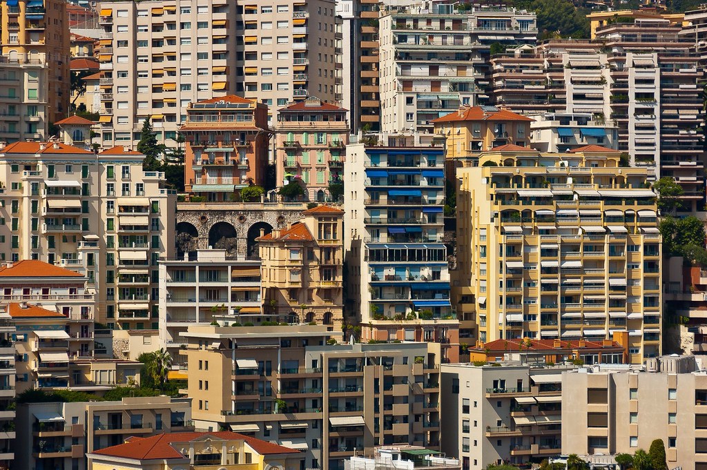
Above: The density of the high rises is fairly astonishing!
Monaco is a principality governed under a form of constitutional monarchy, with Prince Albert II as head of state. Even though Prince Albert II is a constitutional monarch, he still has immense political power; the House of Grimaldi have ruled Monaco, with brief interruptions, since 1297. Despite Monaco's independence and separate foreign policy, its defence is the responsibility of France. Whilst Monaco is not a member of the European Union, it is very closely linked via a customs union with France, and as such, its currency is the same as that of France, the euro.
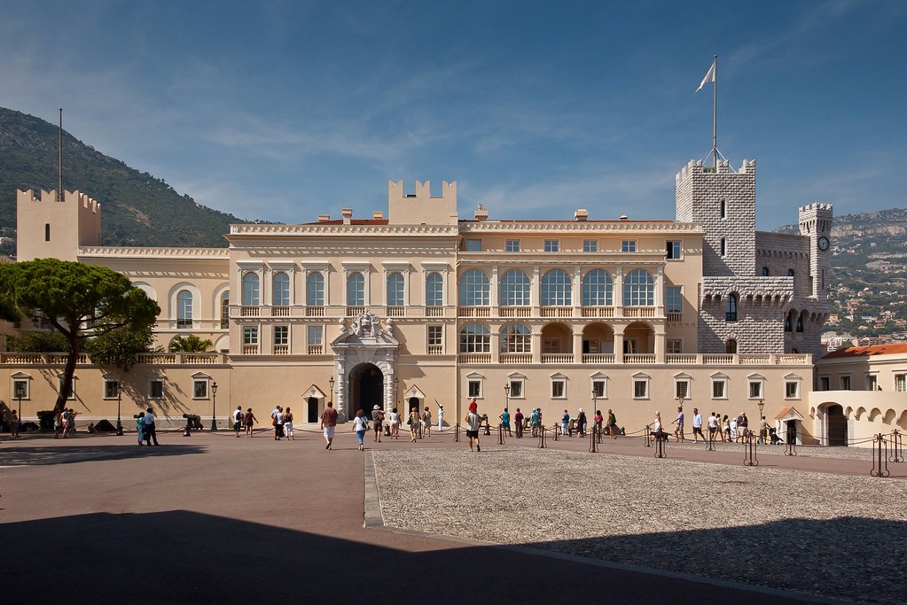
Above: The Palace of Monaco.
Economic development was spurred in the late 19th century with a railroad line to France, and the opening of the first casino, Monte Carlo. Since then, the principality's mild climate, splendid scenery, and gambling facilities have made Monaco world-famous as a tourist and recreation centre for the rich and famous. However, in more recent years Monaco has become a major banking centre holding over €100 billion worth of funds and is well known for being a tax haven. Some of its famous residents include Roger Moore, Novak Djokovic, Shirley Bassey, Lewis Hamilton and Ringo Starr.
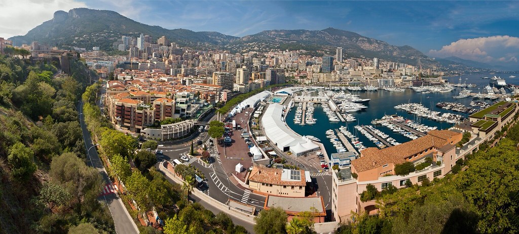
Above: A panoramic shot of Monaco, with the Palace to the left, Monte Carlo in the centre and our ship on the far right.
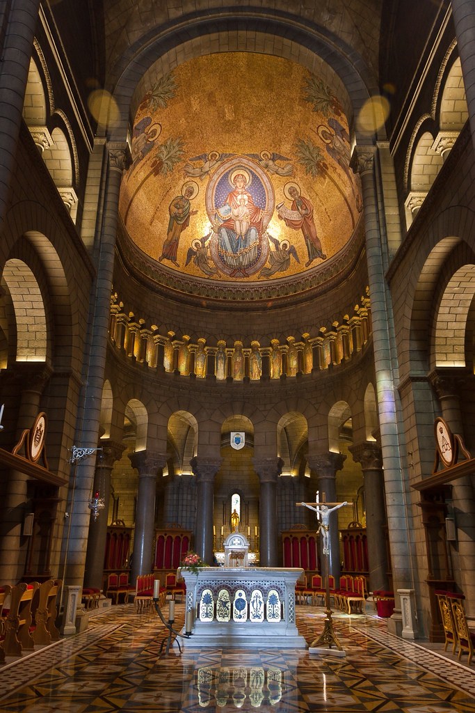
Whilst in Moncao, I took a tour (again!) as an escort on an overview of the country with stops at the Palace, the Cathedral and of course, the Grand Casino. In Saint Nicholas Cathedral, we were shown the graves of Prince Rainier and Grace Kelly and told their story: on 19 April 1956, Prince Rainier married American actress Grace Kelly; the event was widely televised and covered in the popular press, focusing the world's attention on the tiny principality.
Above: Saint Nicholas Cathedral, the location of Grace Kelly's marriage.
Kelly died in 1982 after suffering a stroke and consequently crashing the car she was driving along the steep winding roads of Monaco. Prince Rainier never re-married and was buried next to his wife when he died on 6 April 2005 after a reign of 56 years. Their son Prince Albert II, is now the ruling monarch of Monaco.
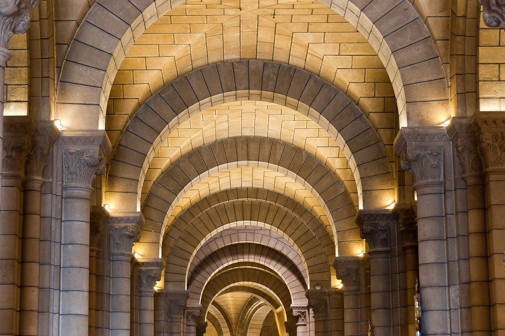
Above: Grace Kelly's grave inside Saint Nicholas Cathedral.
Above: This alcove runs around the back of the altar and is where all of the graves are located.
Driving in Monaco is fairly crazy as the traffic is always very busy but we eventually made it over to Monte Carlo to explore the Grand Casino! 'Le Grand Casino de Monte Carlo' opened in 1858, and the casino benefited from the tourist traffic the newly built French railway system created. Due to the combination of the casino and the railroads, Monaco finally recovered from the previous half century of economic slump, and the principality's success attracted other businesses.
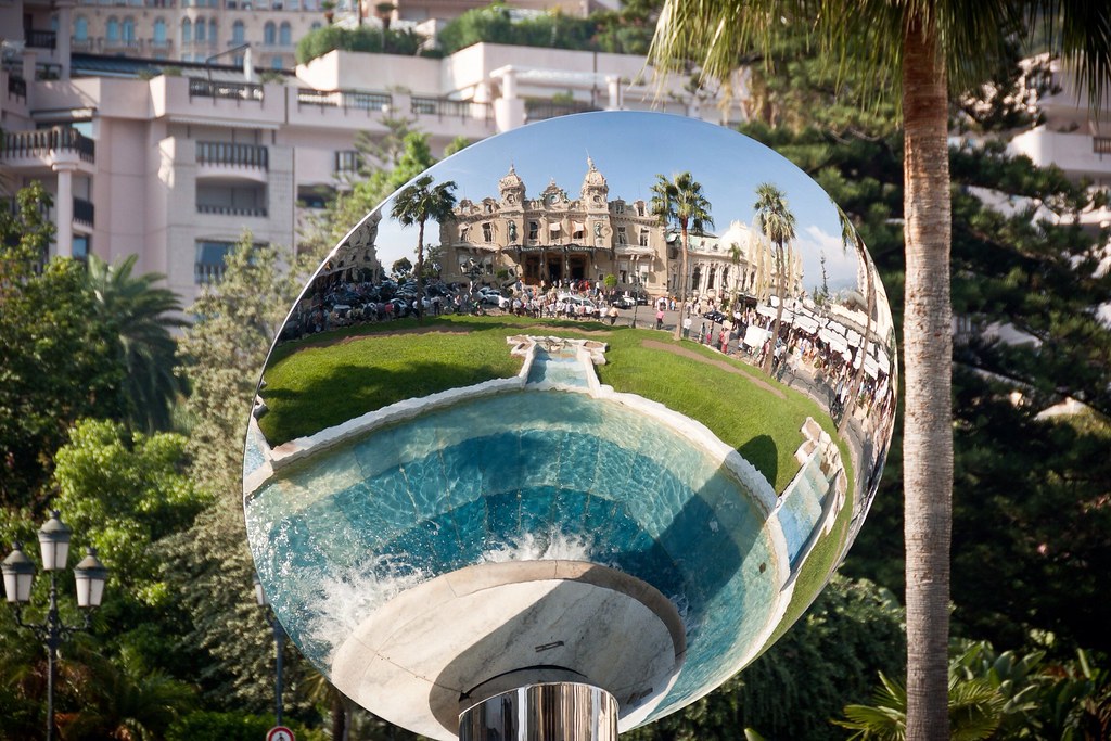
Above: The Grand Casino, mirrored in a fountain.
By 1869, the casino was making such a vast sum of money that the principality could afford not to collect tax from the Monegasques; a master stroke that was to attract affluent residents from all over Europe. Today, Société des bains de mer de Monaco, which owns Le Grand Casino still operates in the original building, and has since been joined by several other casinos. Curiously, Monaco's own citizens are not allowed to gamble in the casino.
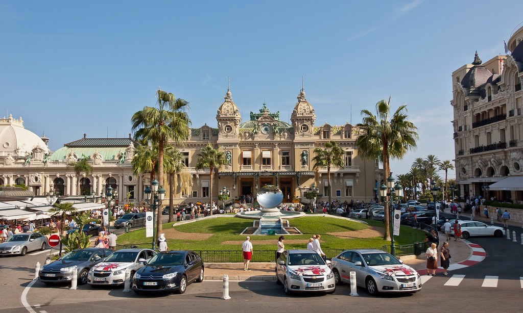
Above: The Grand Casino
We were allowed inside the Casino but we could not take pictures and the bouncers did not want anyone looking too 'touristy' - so no shorts, excursion stickers, hats etc! It was incredibly opulent with many rooms, including a bar with a piano trio set up - I want that gig! Just on the right of the photo above is The Hôtel de Paris, established in 1864 by Charles III of Monaco and one of the most famous hotels in the country.
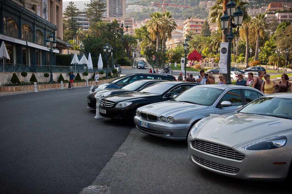
Above: Some of the cars, parked outside the The Hôtel de Paris. The chauffer would start the engine, drive the car two feet forward and then get out and hand the keys to the guest!
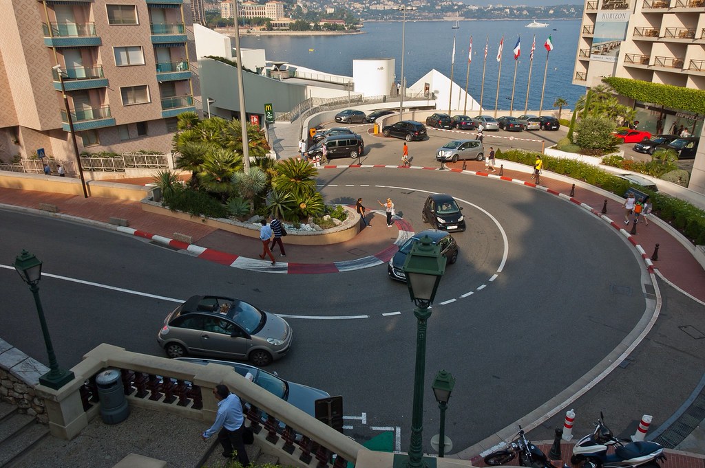
One of my favourite part of visiting a new place is to find out what films have been filmed there! Hitchcock's 'To Catch a Thief' (1954) and 'GoldenEye' (1995) feature scenes in Monaco and 'Iron Man 2' (2010) featured a set piece at the Grand Prix. Since 1955, the Monaco Grand Prix has been held annually in the streets of Monaco. The circuit has many elevation changes and tight corners, along with a tunnel and it takes six weeks to set up, and three to pack down!
Above: One of the Grand Prix corners close by the Casino.
Thanks for reading - I really enjoyed my visit to Monaco; it is such a unique destination being so small and so wealthy!
Wednesday, 26 December 2012
Portimão, Portugal and Palermo, Italy
Welcome back to my blog. Sorry it's been so long! I've been busy with composing but I'm finally getting round to finishing off those pesky last destinations from the Ryndam. Today, my alliterative locations are Portimão, Portugal and Palermo, Italy!
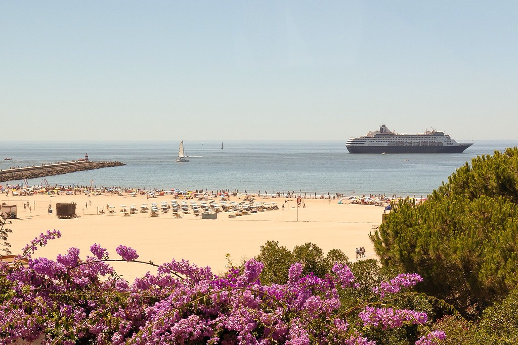
Above: The famous beaches of the Algarve in Portimão.
Portimão is a Portuguese town in the Algarve region on the southern coast of Portugal. The town has 41,000 inhabitants and known for its sporting events which include the Lisbon to Dakar Rally as well as sailing and surfing.
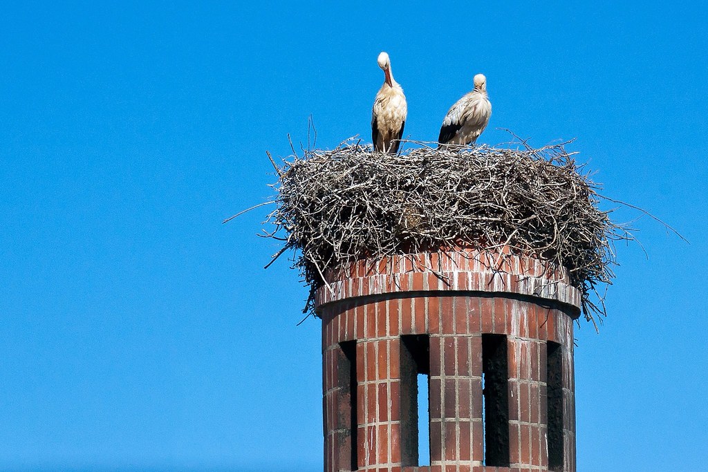
Above: We saw a lot of nesting cranes on chimney stacks!
On our one and only visit here, I took a shore excursion to the nearby city of Silves, which was very important historically. The region of Silves has been inhabited since the Palaeolithic, thanks to the river Arade, which linked to the open ocean and allowed for the transport of produce and commerce. The town of Silves was possibly founded during the times of Roman domination, when the region was part of the Lusitania province.
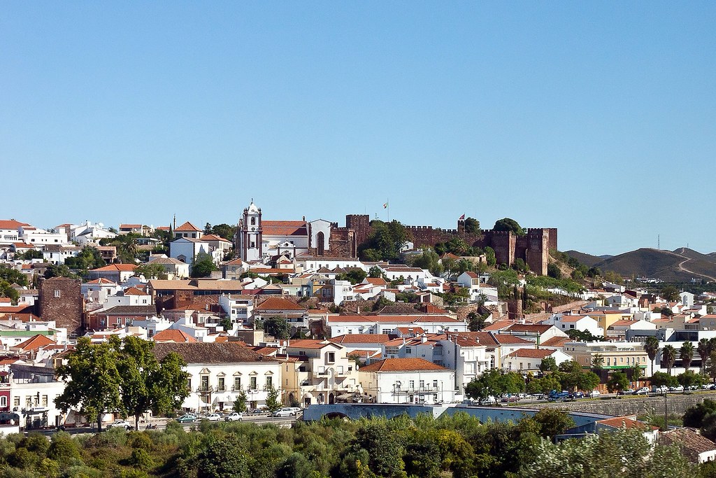
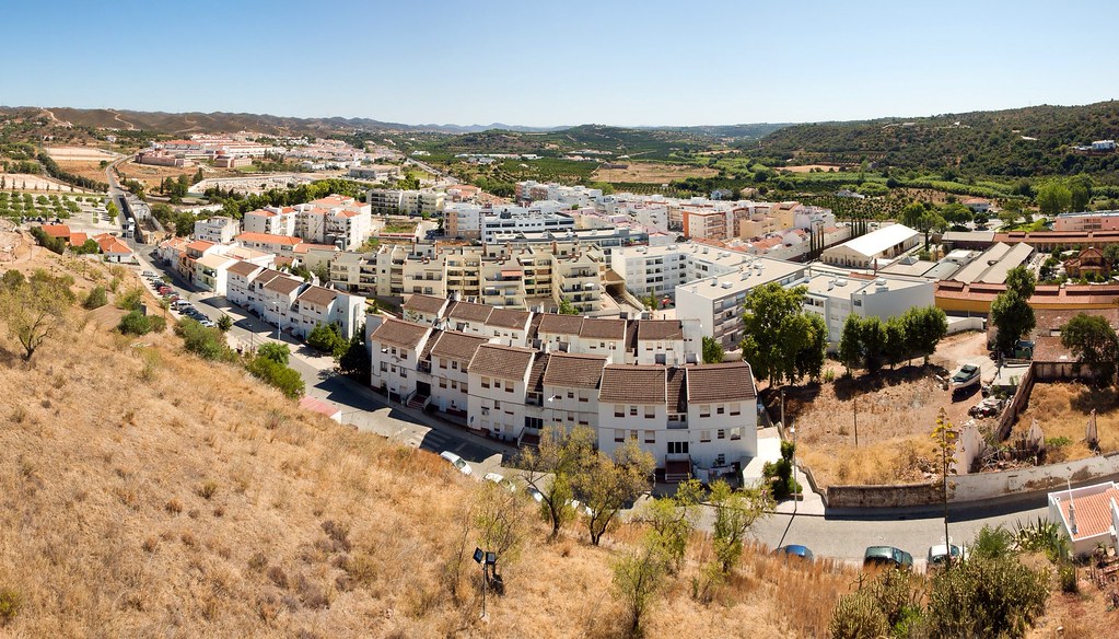
Above: A view of Silves from the road leading into the town. Note the Moorish Castle on the right.
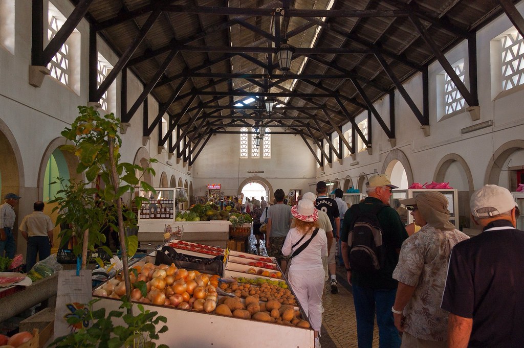
After walking through an indoor market and up the narrow streets, we visited the Archaeological Museum of Silves with collections from pre-history including both Roman and Moorish periods.
Above: The Indoor Market.
After 713, when the Moors invaded Iberia, Silves became part of the Umayyad kingdom of Córdoba. The town was finally taken from the last Muslim king Ibn Afan by Paio Peres Correia, Grand-Master of the Order of Santiago in 1242. The great mosque was changed into Silves Cathedral (Sé Catedral). In 1491 the town was given to queen Leonora by King João.
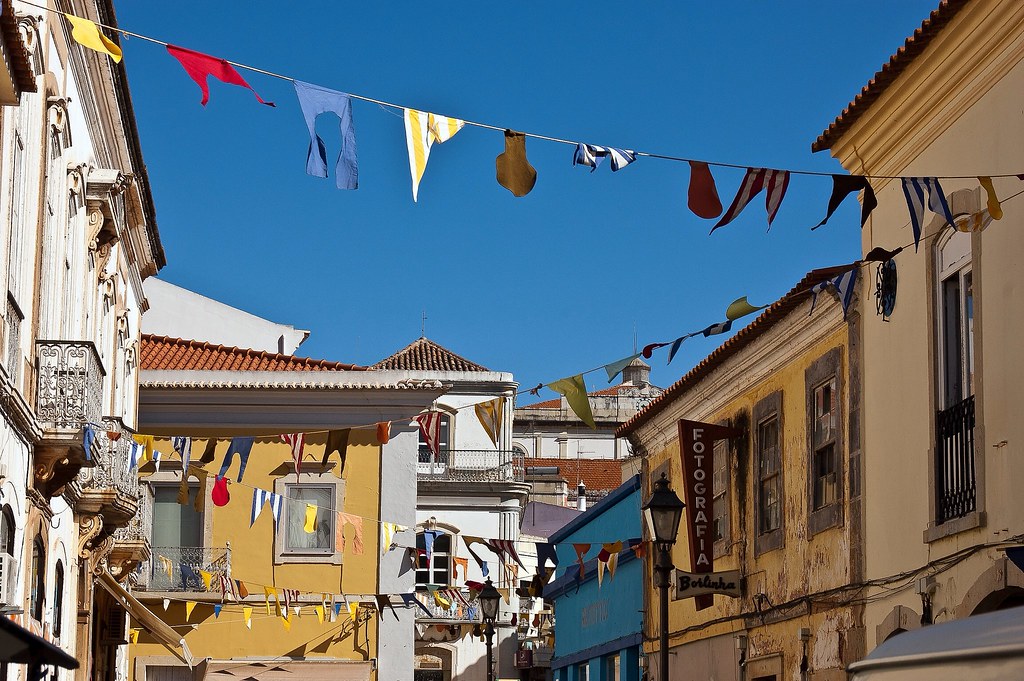
Above: Quaint and narrow streets abound in Silves.
After visiting the museum, we then continued up the steep streets (the passengers were complaining about the climb by this point!) towards the Moorish Castle.
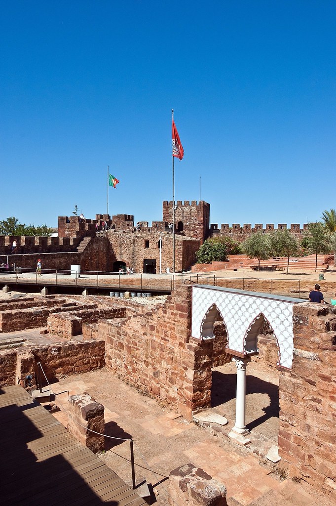
Above: Inside the Castle.
Silves Castle is located on the top of the hill and has walls of red sandstone which were heavily restored in the 1940s. We walked all the way around the ramparts which feature protruding towers to protect the castle. After the Christian conquest, the castle served as the seat of the provincial governor until the middle of the 16th century, when it was used as a prison.
Above: A view from the castle of a more modern housing development.
PALERMO, Italy
I also want to briefly give you a glimpse of Palermo, a city over 2,700 years old and the capital of Sicily, noted for its history, culture, architecture and gastronomy. I was an escort for a very basic tour which showed us some of the sights of Palermo. The tour was so basic that I had to tell the guests what the places were and how long we had to stay there. The worst part was that the driver didn't speak any English!
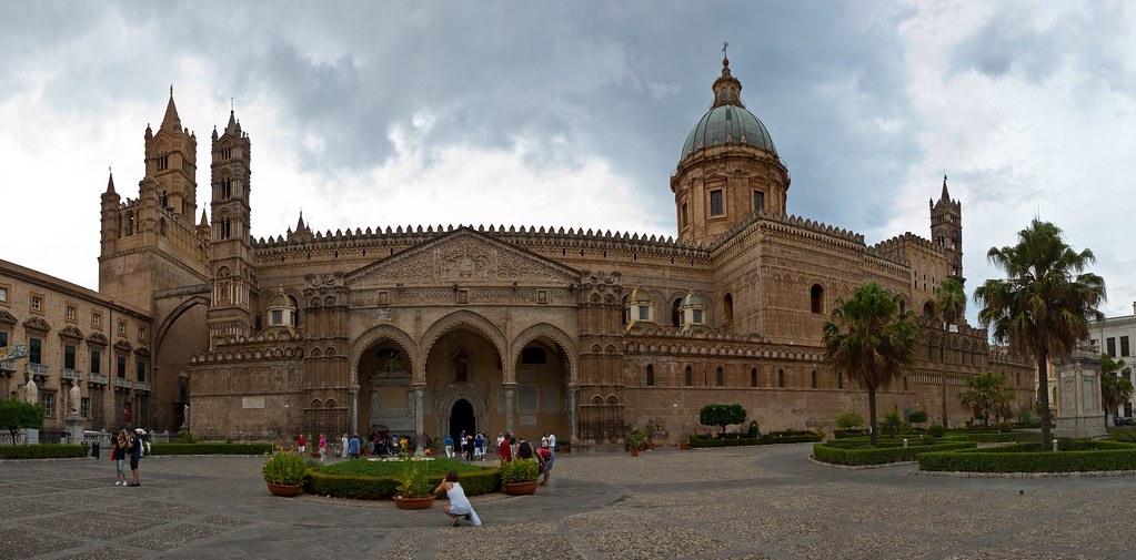
Above: Palermo Cathedral
The city was founded by the Phoenicians and later became part of the Roman Empire and eventually part of the Byzantine Empire, for over a thousand years. From 827 to 1071 it was under Arab rule during the Emirate of Sicily when it first became a capital. Following the Norman reconquest, Palermo became capital of a new kingdom (from 1130 to 1816), the Kingdom of Sicily. Eventually it would be united with the Kingdom of Naples to form the Two Sicilies until the Italian unification of 1860.
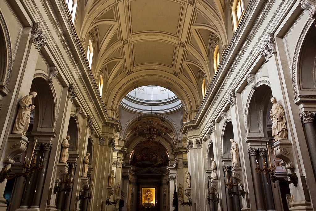
Above: Inside Palermo Cathedral.
Palermo Cathedral is the city's cathedral and main church. It is characterized by the presence of different architectural styles, due to a long history of additions, alterations and restorations, the last of which occurred in the 18th century. The best part of the Cathedral however, was the location of the toilets! They were hidden through a tunnel behind an altar which you had to walk through! The craziest location for toilets ever!
Above: Many people in Sicily including here in Palermo, are quite poor and these concrete housing estates are common - the less glamorous side of Italy.
We also visited the Orto botanico di Palermo (Palermo Botanical Gardens), founded in 1785, which are the largest in Italy. They were distinctly underwhelming but there was an impressive temple-like structure at the entrance!
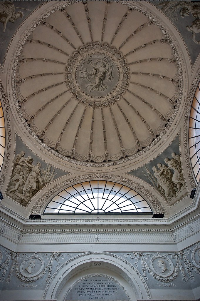
Above: The 'Temple' at the Botanic Gardens which housed a small museum.
Above: Inside the 'Temple'.
Other attractions in Palermo include the Teatro Massimo ("Greatest Theatre") which was opened in 1897 and is the largest theatre in Italy and the third largest in Europe as well as the many city gates which are often all that remains of the city walls, built in medieval times.
Above: One of the city gates.
Thanks for reading. I promise to have some more blog posts coming soon!
Tuesday, 27 November 2012
Vigo and Valencia - Spain
Welcome back to my blog. Today I would like to show you two Spanish cities, located on opposite sides of the country - Vigo and Valencia.
VIGO
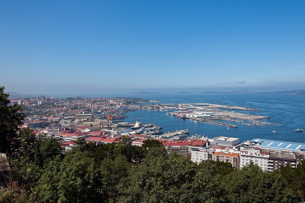
Above: Part of Vigo's large harbour area, as viewed from the hill fort (Castro).
The earliest records of Vigo as a village began around the 15th century. During the 16th and 17th centuries, the city was attacked several times. In 1585 and 1589, Francis Drake raided the city and temporarily occupied it, leaving many buildings burnt.
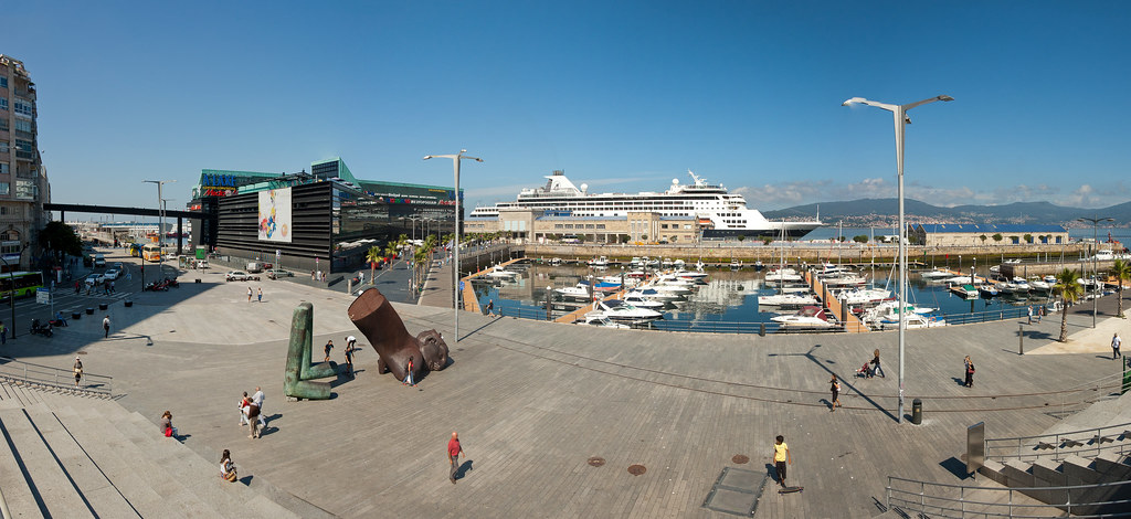
Above: The harbour where the Ryndam docked with modern art and a shopping mall on the left.
Several decades later a Turkish fleet tried to attack the city. As a result the walls of the city were built in 1656 during the reign of Philip IV of Spain. They are still partially preserved.
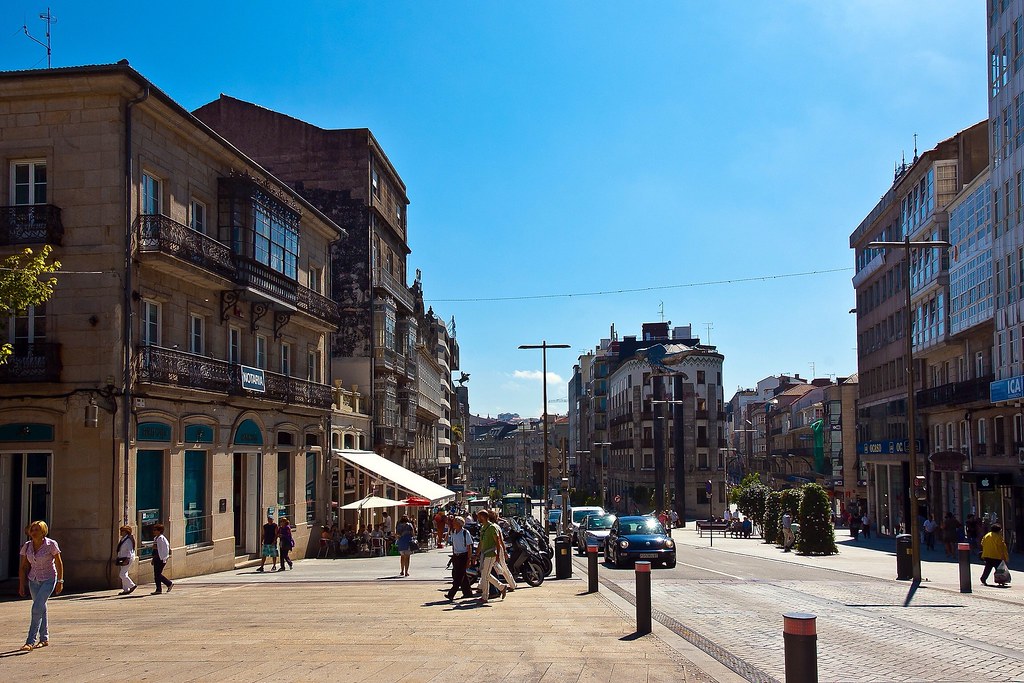
Above: Downtown Vigo.
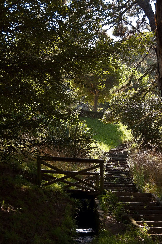
The urban area of Vigo is built over both a hill-fort (Castro) and a Roman settlement. During our time here, I walked up to the fort and explored the gardens inside it.
Above: One of the paths that led up to the fort.
Vigo was the first city of Galicia to be freed from French rule in what is now celebrated as the Reconquista (reconquest from French in the context of the Peninsular War) on 28 March each year.
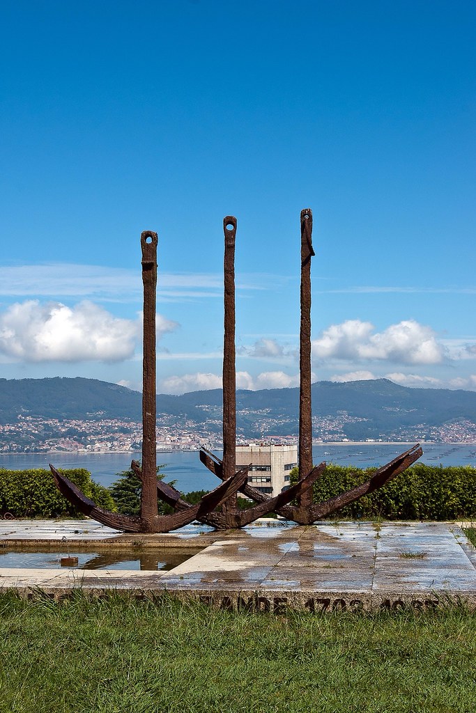
Above: A nautical monument, near the top of the fort.
The city grew very rapidly in the 19th and 20th centuries. This resulted in continuous urban planning changes, making Vigo less structured than other Galician towns.
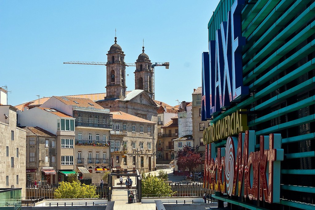
Above: The shopping mall with Vigo Cathedral in the background.
After exploring the fort, I walked back down the hill through the old town, taking in the cathedral and general atmosphere of the place. I did not have any tours in either of these ports, but sometimes it is nice to explore on your own, without having to chat to passengers all the time!
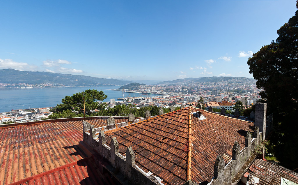
Above: The view from the top of the fort.
VALENCIA
Valencia is the third largest city in Spain after Madrid and Barcelona, with around 809,000 inhabitants. The Port of Valencia which is about a 20 minute drive from the centre, is the 5th busiest container port in Europe and the largest on the Mediterranean Sea. The traditional Spanish dish, paella, originated in Valencia.
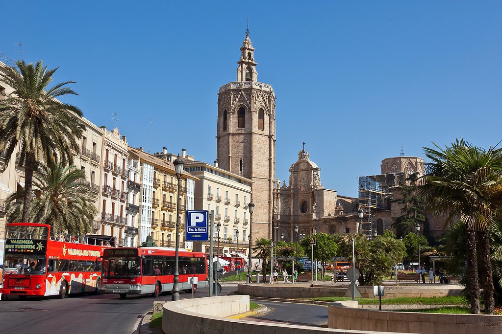
Above: One of the main squares of Valencia with the Cathedral in the background and the obligatory tourist buses.
Valencia was founded as a Roman colony in 138 BC. Its historic centre is one of the largest in Spain, and this heritage of ancient monuments, views and cultural attractions makes Valencia one of the country's most popular tourist destinations.
Above: One of the many monuments found in the city.
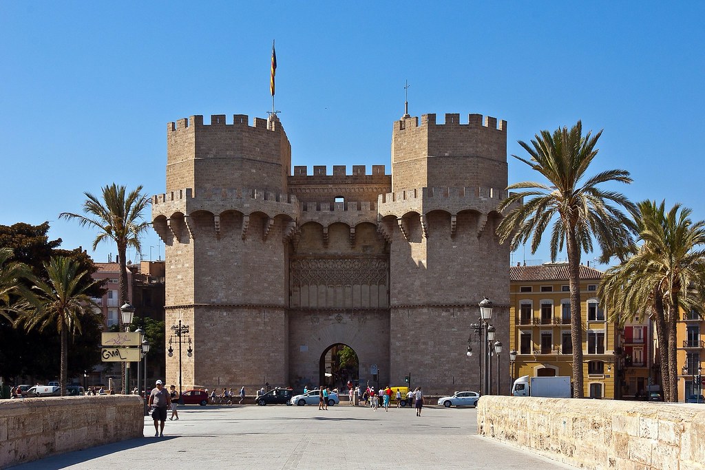
The ancient winding streets of the Barrio del Carmen contain buildings dating to Roman and Arabic times. The Cathedral, built between the 13th and 15th centuries, is primarily of Gothic style but contains elements of Baroque and Romanesque architecture. The 15th century Serrano and Quart towers are part of what was once the wall surrounding the city.
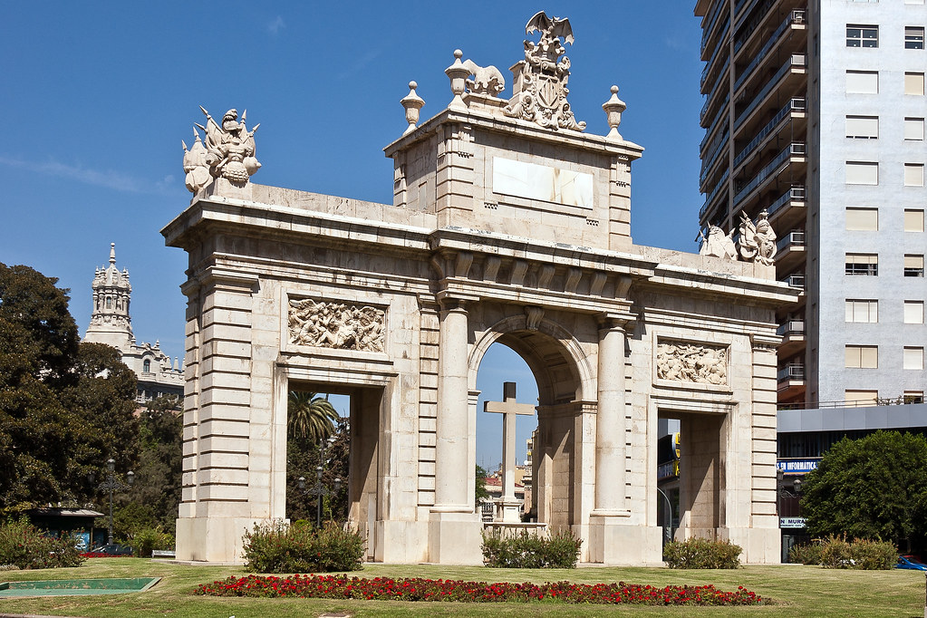
Above: The 15th century Towers of Serranos, once part of the city wall.
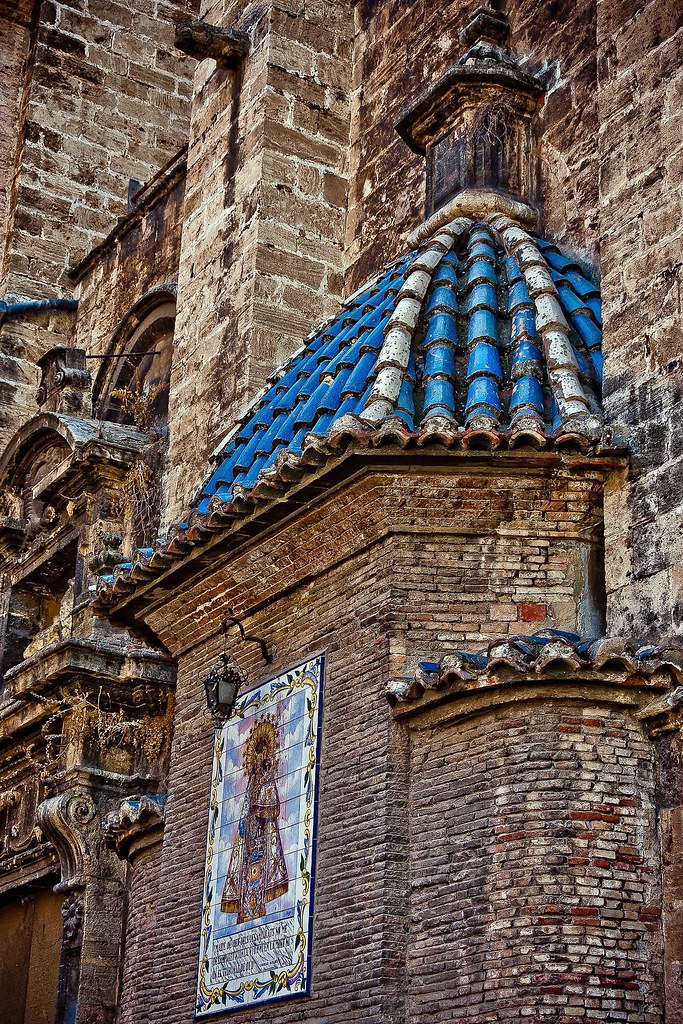
The city surrendered without a fight to the invading Moors (Berbers and Arabs) in 714 AD, and the cathedral of Saint Vincent was turned into a mosque. When Islamic culture settled in, Valencia prospered from the 10th century, due to a booming trade in paper, silk, leather, ceramics, glass and silver-work. The architectural legacy of this period is abundant in Valencia and can still be appreciated today in the remnants of the old walls and even the Cathedral and the tower, El Micalet, which was the minaret of the old mosque (see first picture).
Above: Rich details and colours on one of the many historical buildings.
In the early 20th century Valencia was an industrialized city. The silk industry had disappeared, but there was a large production of hides and skins, wood, metals and foodstuffs, this last with substantial exports, particularly of wine and citrus. Among the most architecturally successful buildings of the early 20th century were those designed in the Art Nouveau style, such as the North Station (Gare du Nord) and the Central and Columbus markets.
Above: The historic Central Market (Mercado Central) of Valencia.
I would have liked more time to explore Valencia (we only visited the city once) but I saw a lot on my walking exploration! Thanks for reading.
VIGO
Above: Part of Vigo's large harbour area, as viewed from the hill fort (Castro).
The earliest records of Vigo as a village began around the 15th century. During the 16th and 17th centuries, the city was attacked several times. In 1585 and 1589, Francis Drake raided the city and temporarily occupied it, leaving many buildings burnt.
Above: The harbour where the Ryndam docked with modern art and a shopping mall on the left.
Several decades later a Turkish fleet tried to attack the city. As a result the walls of the city were built in 1656 during the reign of Philip IV of Spain. They are still partially preserved.
Above: Downtown Vigo.
The urban area of Vigo is built over both a hill-fort (Castro) and a Roman settlement. During our time here, I walked up to the fort and explored the gardens inside it.
Above: One of the paths that led up to the fort.
Vigo was the first city of Galicia to be freed from French rule in what is now celebrated as the Reconquista (reconquest from French in the context of the Peninsular War) on 28 March each year.
Above: A nautical monument, near the top of the fort.
The city grew very rapidly in the 19th and 20th centuries. This resulted in continuous urban planning changes, making Vigo less structured than other Galician towns.
Above: The shopping mall with Vigo Cathedral in the background.
After exploring the fort, I walked back down the hill through the old town, taking in the cathedral and general atmosphere of the place. I did not have any tours in either of these ports, but sometimes it is nice to explore on your own, without having to chat to passengers all the time!
Above: The view from the top of the fort.
VALENCIA
Valencia is the third largest city in Spain after Madrid and Barcelona, with around 809,000 inhabitants. The Port of Valencia which is about a 20 minute drive from the centre, is the 5th busiest container port in Europe and the largest on the Mediterranean Sea. The traditional Spanish dish, paella, originated in Valencia.
Above: One of the main squares of Valencia with the Cathedral in the background and the obligatory tourist buses.
Valencia was founded as a Roman colony in 138 BC. Its historic centre is one of the largest in Spain, and this heritage of ancient monuments, views and cultural attractions makes Valencia one of the country's most popular tourist destinations.
Above: One of the many monuments found in the city.
The ancient winding streets of the Barrio del Carmen contain buildings dating to Roman and Arabic times. The Cathedral, built between the 13th and 15th centuries, is primarily of Gothic style but contains elements of Baroque and Romanesque architecture. The 15th century Serrano and Quart towers are part of what was once the wall surrounding the city.
Above: The 15th century Towers of Serranos, once part of the city wall.
The city surrendered without a fight to the invading Moors (Berbers and Arabs) in 714 AD, and the cathedral of Saint Vincent was turned into a mosque. When Islamic culture settled in, Valencia prospered from the 10th century, due to a booming trade in paper, silk, leather, ceramics, glass and silver-work. The architectural legacy of this period is abundant in Valencia and can still be appreciated today in the remnants of the old walls and even the Cathedral and the tower, El Micalet, which was the minaret of the old mosque (see first picture).
Above: Rich details and colours on one of the many historical buildings.
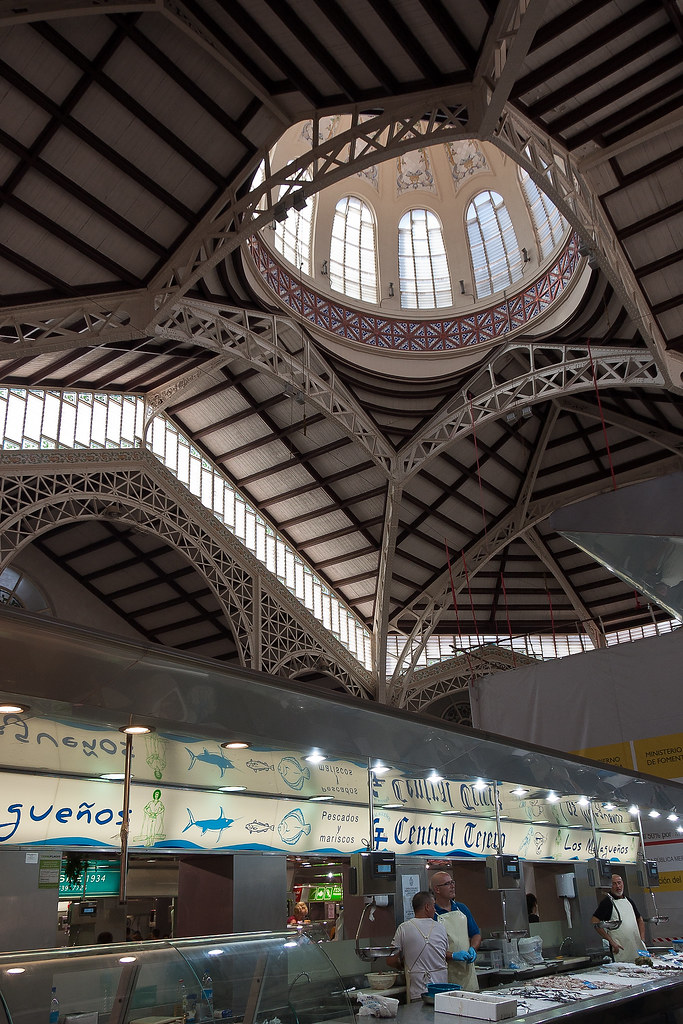
In the early 20th century Valencia was an industrialized city. The silk industry had disappeared, but there was a large production of hides and skins, wood, metals and foodstuffs, this last with substantial exports, particularly of wine and citrus. Among the most architecturally successful buildings of the early 20th century were those designed in the Art Nouveau style, such as the North Station (Gare du Nord) and the Central and Columbus markets.
Above: The historic Central Market (Mercado Central) of Valencia.
I would have liked more time to explore Valencia (we only visited the city once) but I saw a lot on my walking exploration! Thanks for reading.
Saturday, 10 November 2012
Cadiz and Jerez, Spain
Welcome back to my blog! Today I would like to show you my favourite Spanish port - Cadiz, along with its neighbouring town Jerez. Cadiz is the oldest continuously-inhabited city in the Iberian Peninsula and possibly all southwestern Europe, and it was a regular stop on our Mediterranean runs.
Above: One of the main squares in the Old Town of Cadiz.
The city was originally founded as Gadir (Phoenician for "walled city") by the Phoenicians from Tyre. Traditionally, its founding is dated to 1104 BC although no archaeological strata on the site can be dated earlier than the 9th century BC. One resolution for this discrepancy has been to assume that Gadir was merely a small seasonal trading post in its earliest days.
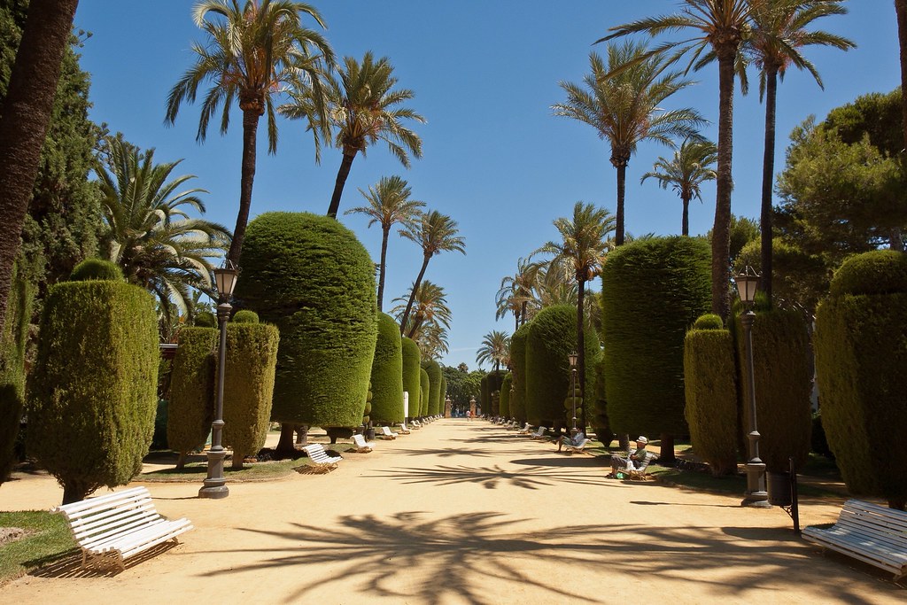
Above: One of the many beautiful gardens found throughout the Old Town.
The older part of Cadiz, within the remnants of the city walls, is commonly referred to as the Old Town and features narrow winding alleys connecting large plazas. The city is dotted with numerous parks where exotic plants flourish, including giant trees supposedly brought to Spain by Columbus from the New World.
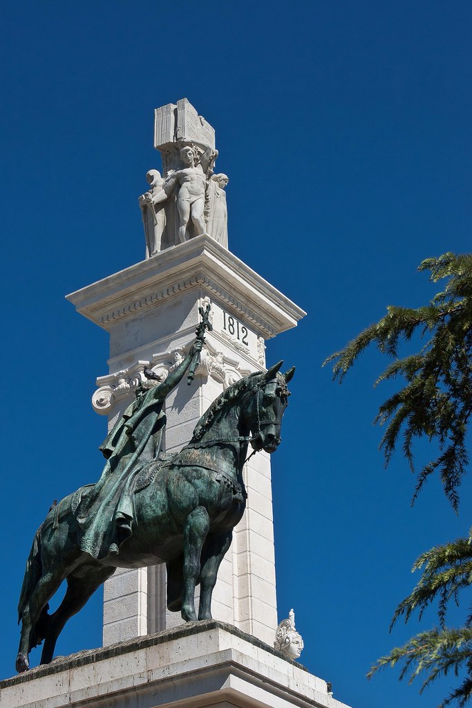
Above: The Monument to the Constitution of 1812, constructed between 1912 and 1929 in order to mark the hundredth anniversary of the liberal constitution. The monument is in a large square, the Plaza de España, close to the ship.
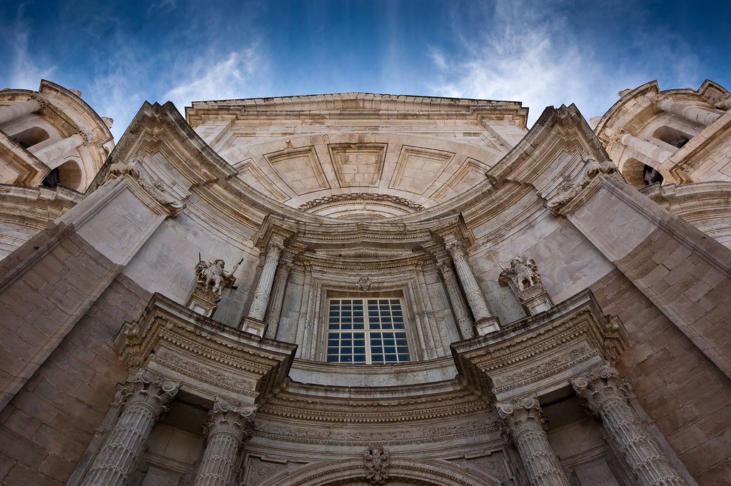
One of Cadiz's most famous landmarks is its cathedral. It sits on the site of an older cathedral, completed in 1260, which burned down in 1596. The reconstruction, which was not started until 1776, was supervised by the architect Vicente Acero, who had also built the Granada Cathedral. Acero left the project and was succeeded by several other architects. As a result, this largely Baroque-style cathedral was built over a period of 116 years, and, due to this drawn-out period of construction, the cathedral underwent several major changes to its original design.
Above: The front facade of Cadiz Cathedral.
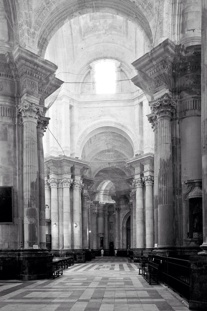
Its chapels have many paintings and relics from the old cathedral and monasteries from throughout Spain. Like many cathedrals in Spain there was an entry fee but you can simply walk up to the barrier, take a picture and walk back out!
Above: Inside the Cathedral.
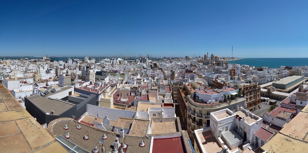
In the 18th century, Cadiz had more than 160 towers from which local merchants could look out to sea for arriving merchant ships. The Torre Tavira, named for its original owner, stands as the tallest remaining watchtower and I paid it a visit during one of our stops. It has a cámara oscura, a room that uses the principal of the pinhole camera (and a specially-prepared convex lens) to project panoramic views of the Old City onto a concave disc. Despite the rather 'old-school' technology that this oscura utilises it is still quite an amazing experience to view the city projected right in front of you.
Above: The view from the Torre Tavira. You can see how narrow the strip of land is which Old Town Cadiz occupies. Note the Cathedral on the right and the Ryndam on the left.
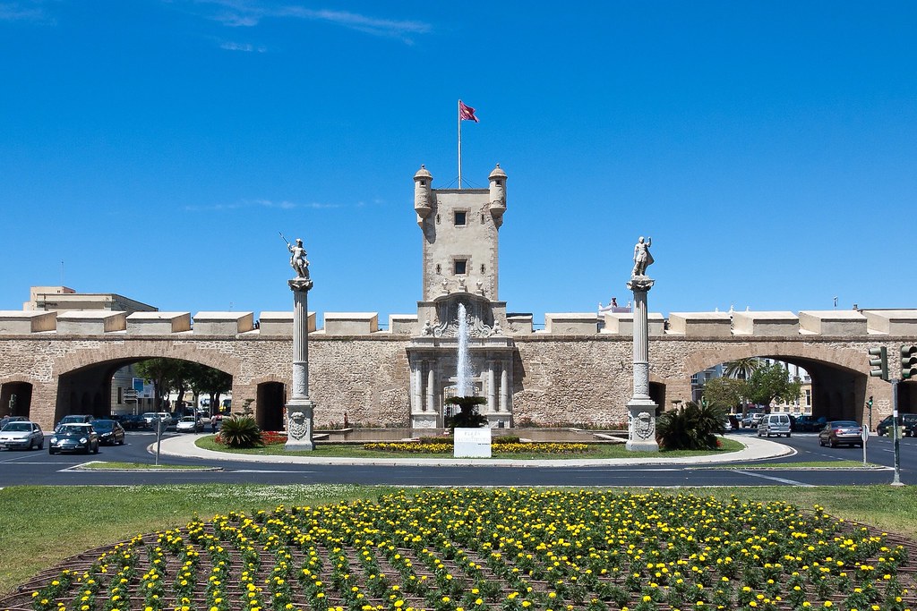
On my fairly exhaustive walking tour (independent) of the city, I also passed by the city gates of Las Puertas de Tierra. These originated in the 16th century, although much of the original work has disappeared. Once consisting of several layers of walls, only one of these remain today. By the 20th century it was necessary to remodel the entrance to the Old City to accommodate modern traffic. Today, the two side-by-side arches cut into the wall serve as one of the primary entrances to the city.
Above: The city gates of Las Puertas de Tierra.
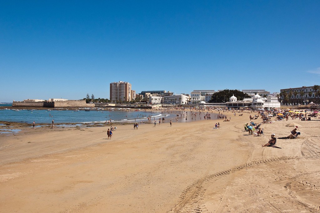
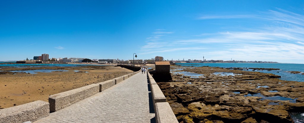
Those of you who have been following my blog know that I love to find locations from movies on my travels and Cadiz is no exception. La Playa de la Caleta is the best-loved beach of Cadiz and is the beach of the Old City, situated between two castles, San Sebastian and Santa Catalina. La Caleta and the boulevard show a lot of resemblance to parts of Havana, the capital city of Cuba, like the malecon. Therefore it served as the set for several of the Cuban scenes in the beginning of the James Bond movie 'Die Another Day'.
Above: La Playa de la Caleta, where Halle Berry's entrance from the 'Cuban' waters was filmed!
I walked out to one of the castles flanking the beach, San Sebastián which is an old military fortification built in 1706. Today the castle remains unused, although its future uses remain much debated.
Above: The view of Cadiz from San Sebastián.
On another stop in Cadiz, I took a tour to neighbouring Jerez de la Frontera, situated midway between the sea and the mountains. It has become the transportation and communications hub of the province, surpassing even Cádiz, the provincial capital, in economic activity and its sprawling outlying areas are a fertile zone for agriculture.
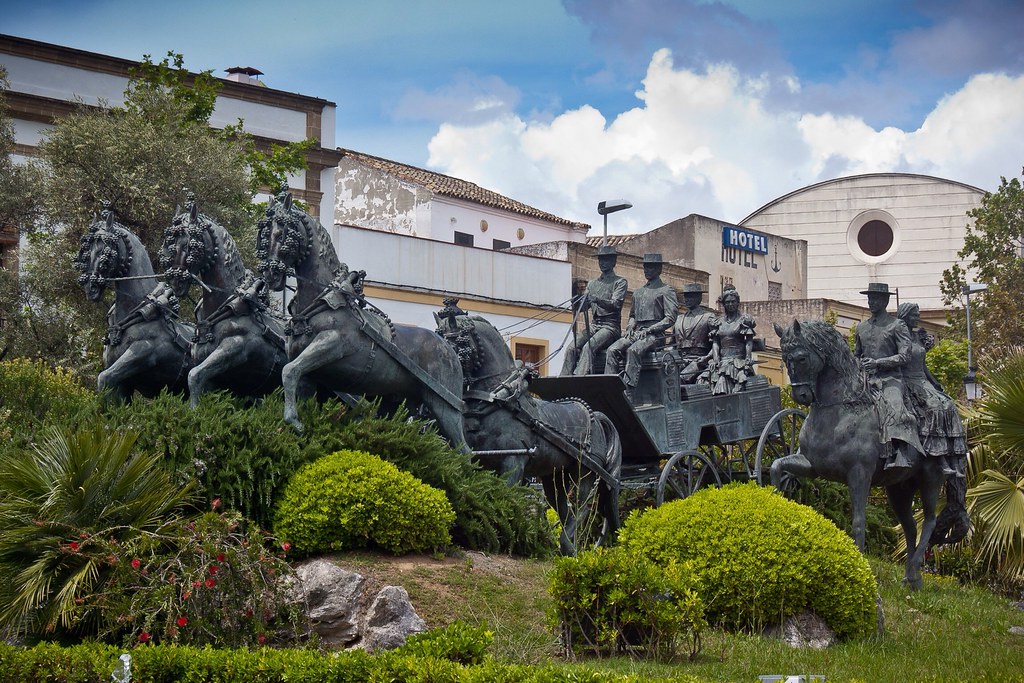
Above: There are many horse statues in downtown Jerez.
Jerez is known as the capital of sherry wine, horsemanship, and flamenco dancing. It is the home of the Royal Andalusian School of Equestrian Art, a riding school comparable to the world-famous Spanish Riding School in Vienna. Jerez, the city where flamenco singing began, is also proud of its Andalusian Centre of Flamenco.
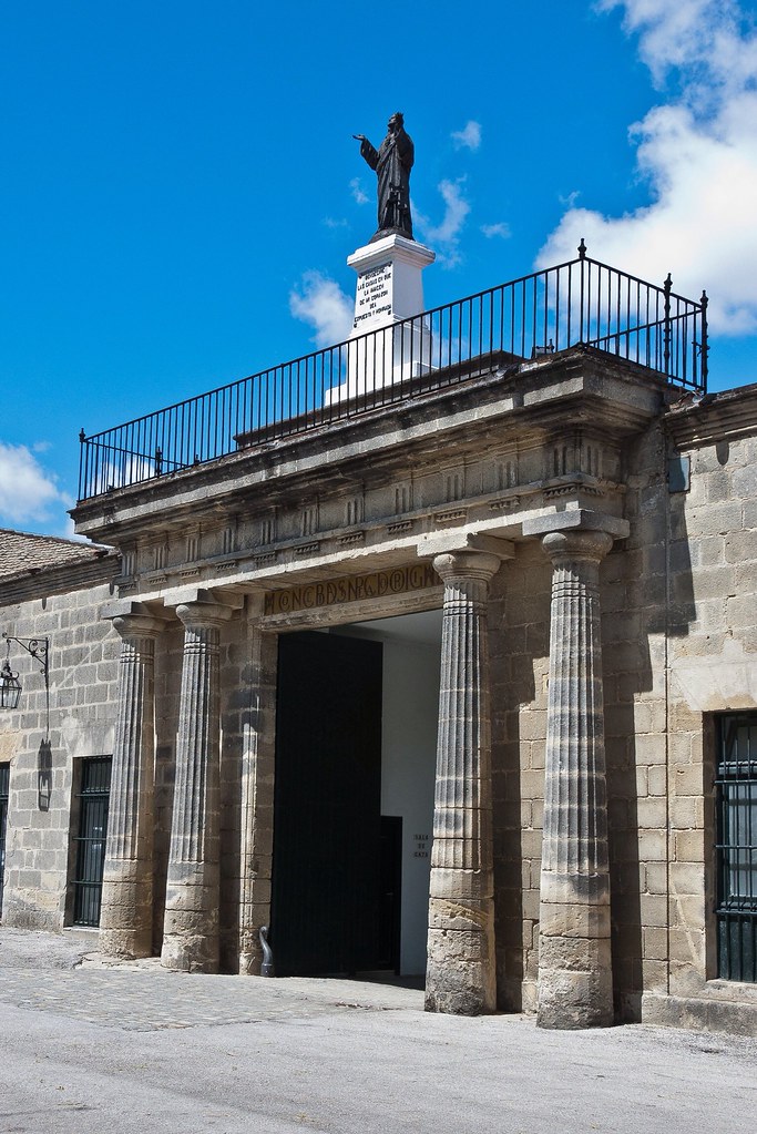
Above: The entrance to the Harveys Bristol Cream factory.
During our time in Jerez, we visited a Harveys Bristol Cream factory for a tour and a tasting session. Originally Bristol imported large quantities of sherry from different places, mainly from Jerez, Oporto and Maderia and sherry was then shipped from Bristol up to the 1960s. Today Harveys ships Bristol Cream directly from Jerez and current exports go to around 100 countries.
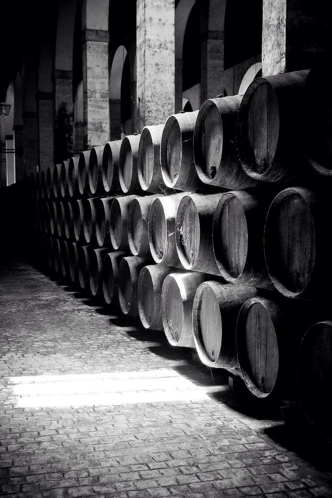
Above: 2328 butts of Finos and Olorosos are aged in this bodega, it was built in the 19th Century and it is where the Sherry butts are prepared before being shipped.
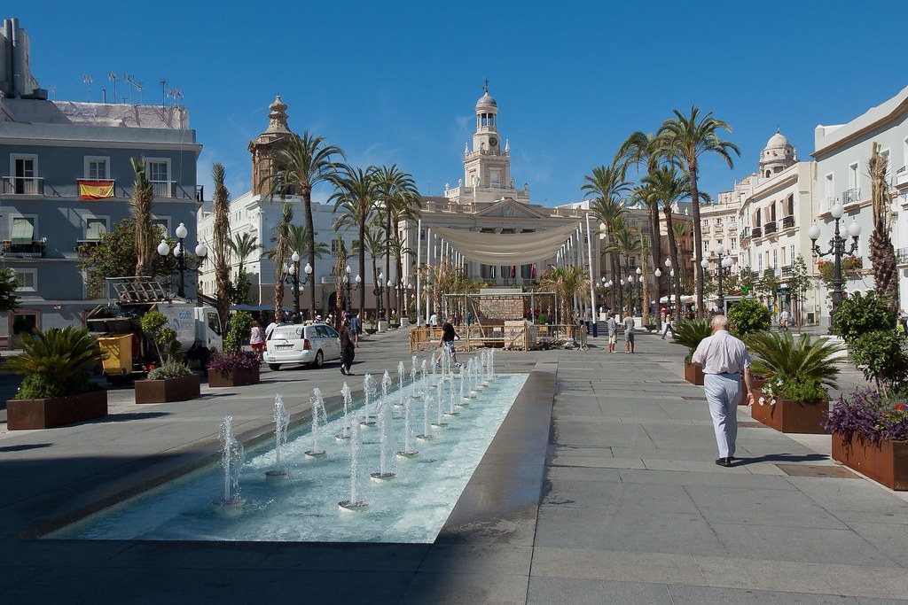
I will leave with you with a final arty shot of the Town Hall in old town Cadiz. Thanks for reading!
Subscribe to:
Posts (Atom)