CRUISE MAP


View Cruise Destinations in a larger map

Friday 26 October 2012

Tangier, Morocco

Hello again! Today, I want to tell you about my second visit to the African continent; our stop at Tangier, Morocco. Check out my previous post for a look at Casablanca, Morocco!

Untitled
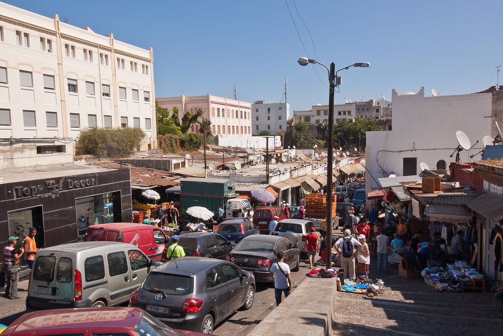
Above: Walking through the streets of Tangier; lots of traffic and lots of street vendors!

Tangier is a city in northern Morocco with a population of about 700,000. It lies on the North African coast at the western entrance to the Strait of Gibraltar where the Mediterranean meets the Atlantic Ocean off Cape Spartel. Famous for its distinctive Moroccan souks (marketplaces), Tangier also exhibits Spanish, French and Berber characteristics.

Untitled
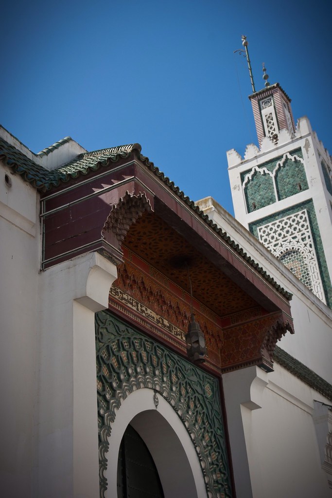
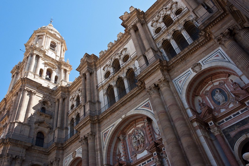
Above: A local Mosque on the streets of Tangier.

The history of Tangier is very rich due to the historical presence of many civilizations and cultures starting from the 5th century BC. Between the period of being a Berber settlement and then a Phoenician town to the independence era around the 1950s, Tangier was a refuge for many cultures.

Untitled
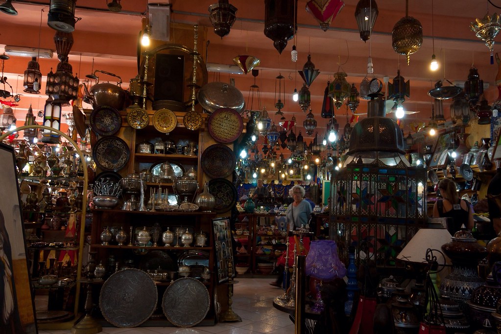
Above: Inside one of the many cave of wonders-type stores that lined the streets!

I visited Tangier with a group of fellow crew members (always a good idea in these sorts of places) and we spent many hours wandering about the city, just exploring the place. We passed through several indoor markets including the one you see in the picture below. This was a rare fruit stall; most of the other stalls were selling lots and lots of meat!

Untitled
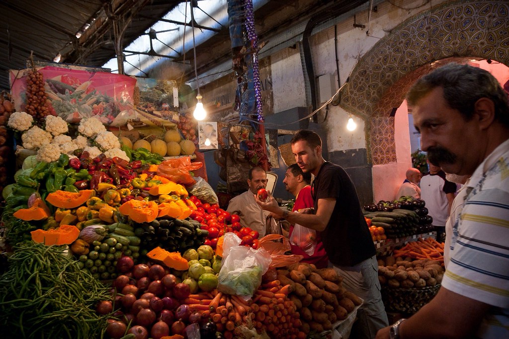
Above: An indoor market selling fruit.

We spied a familiar looking 'M' from lower down in the city and decided to walk up to this little piece of America. The interior was pretty standard but it was cool to see 'McDonalds' in Arabic!

Untitled
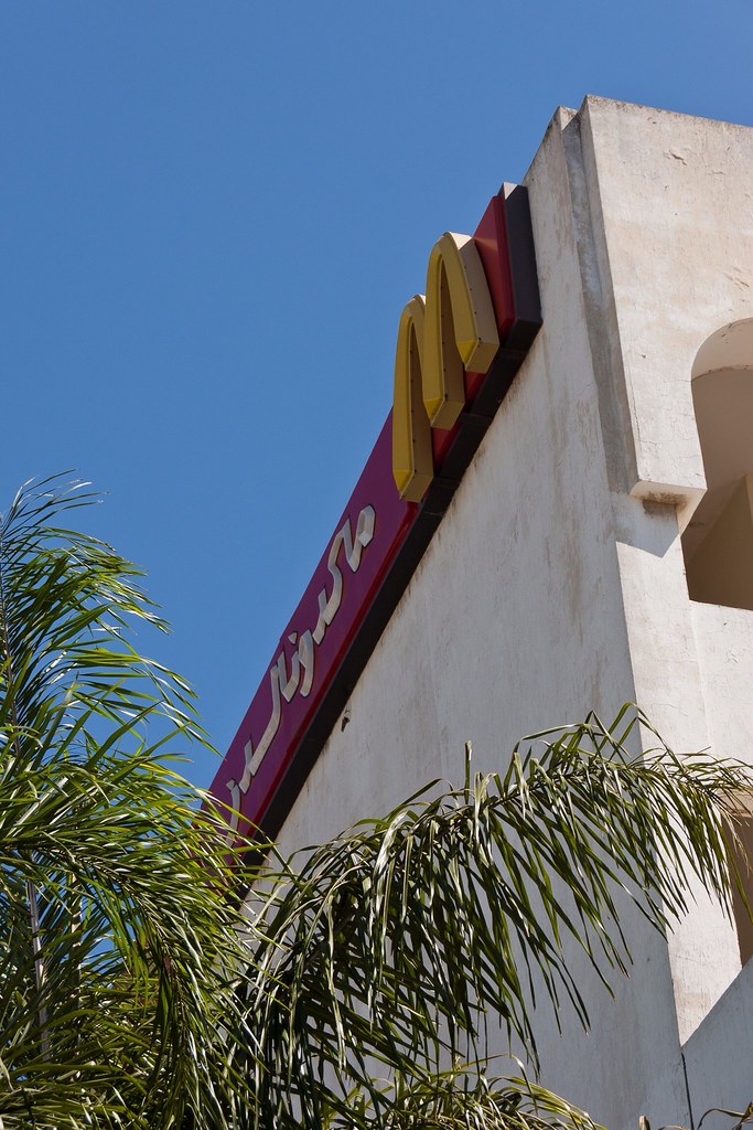
Above: Arabic McDonalds!

This particular McDonalds had one of the best views I had seen from that particular fast food chain so I snapped a picture of Ryndam, docked at Tangier's port.

Untitled
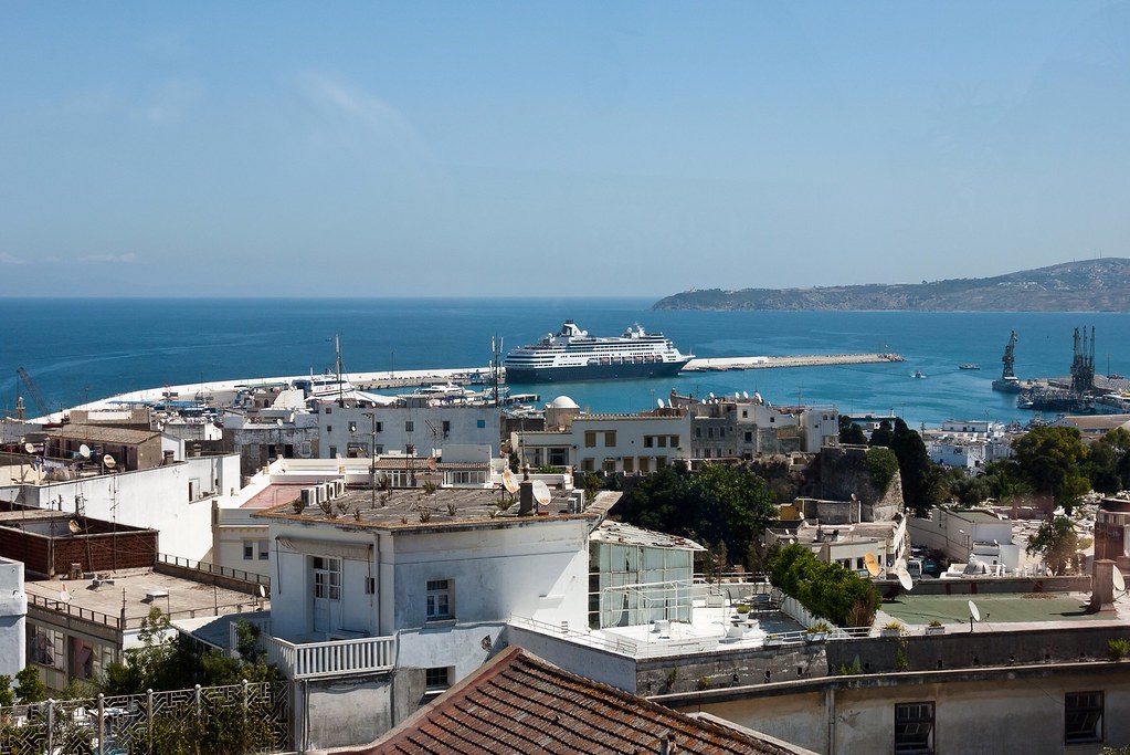
Above: The view from McDonalds!

In 1923, Tangier was considered as having international status by foreign colonial powers, and became a destination for many European and American diplomats, spies, writers and businessmen. Indeed, Tangier has been reputed as a safe house for international spying activities and its position during the Cold War and other spying periods of the 19th and 20th centuries is legendary.

Untitled
Above: Another shot of the Ryndam in a more scenic part of town.

I am something of a movie fan and so I was interested to learn that Tangier has also been a subject for many spy fiction films, largely due to its legendary status as a real spying centre. Movies that have shot here include 'Inception', 'The Bourne Ultimatum' and two Bond films - 'The Living Daylights' and 'From Russia with Love'.

Untitled
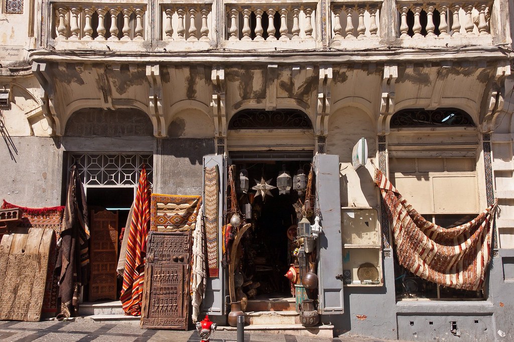
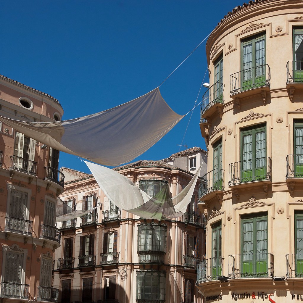
Above: Another intriguing shop facade. Parts of the movie 'Inception' was filmed in and around this area of the city.

The city is currently undergoing rapid development and modernization. Projects include new 5-star hotels along the bay, a modern business district called Tangier City Center, a new airport terminal and a new football stadium. Tangier's economy is also set to benefit greatly from the new Tanger-Med port which is opening soon.

Untitled
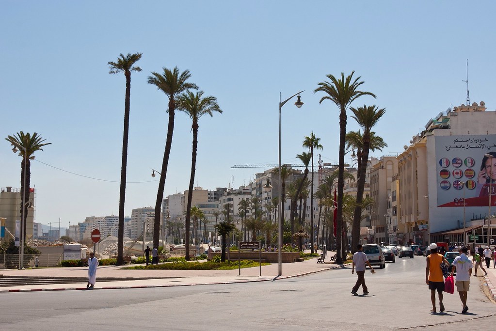
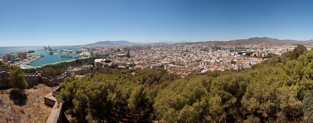
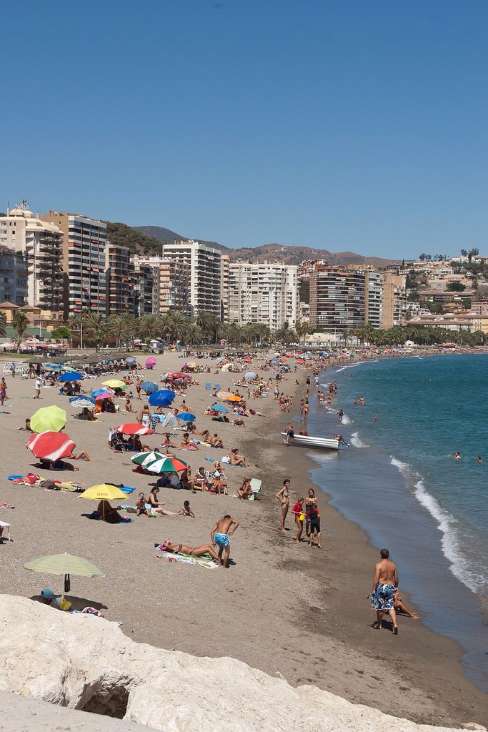
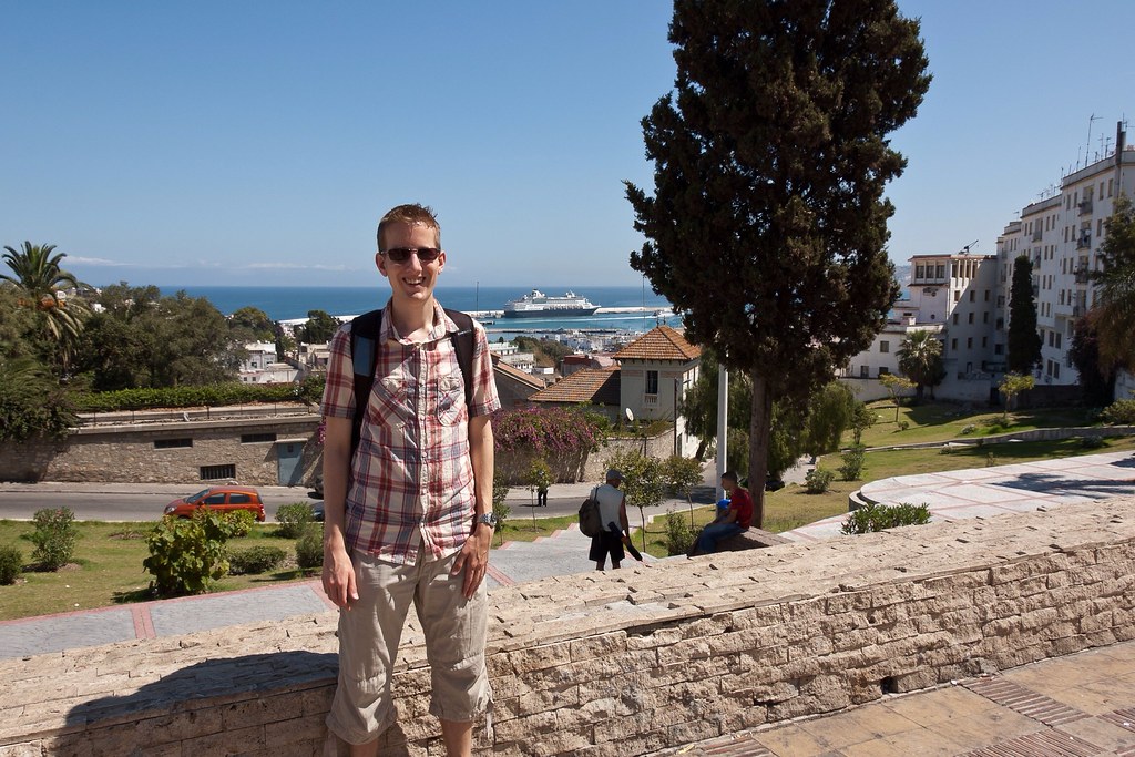
Above: The cityscape curves around the bay with a long sandy beach beginning just past this picture.

Untitled
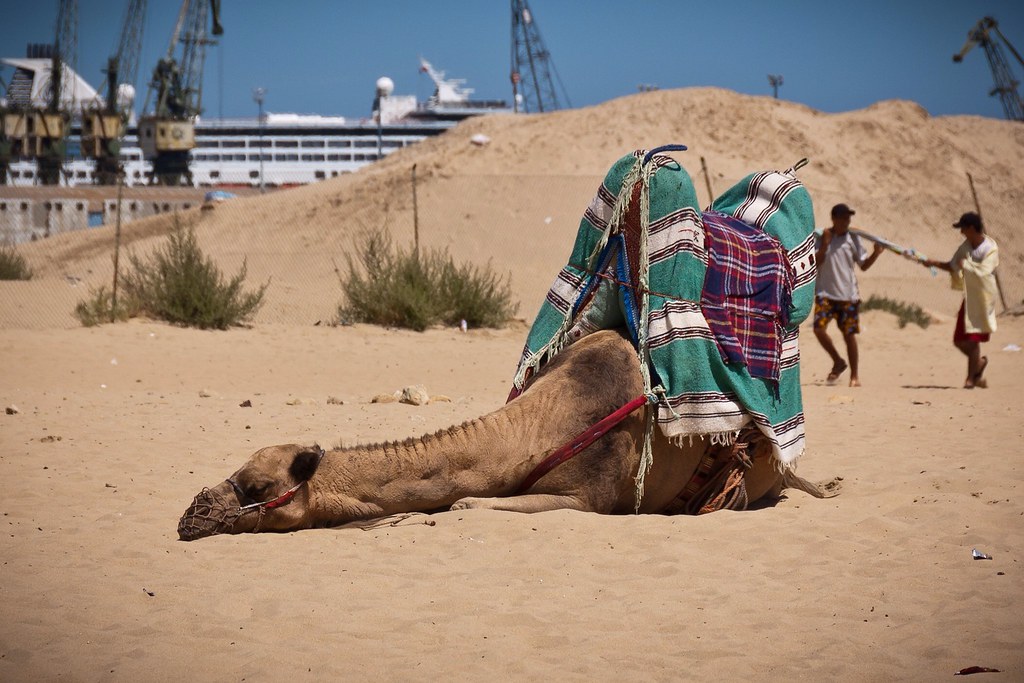
Above: Camel rides for sale on the beach!

Tangier was an exciting city to explore, if a little bit intimidating with lots of street vendors trying to sell you their wares. This was our last time in North Africa, as sadly our visit to Tunisia was cancelled due to the riots over the Muhammad video last month. I will leave you with a shot of the city, taken from the Ryndam. Thanks for reading.

Untitled
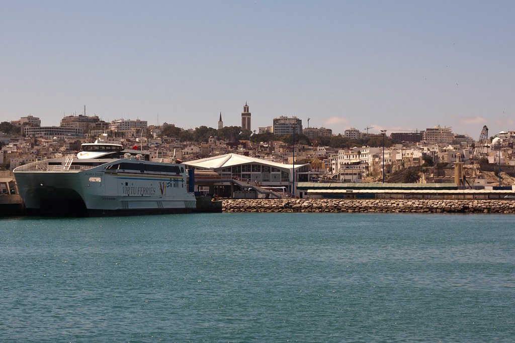
Above: Tangier from the cruise ship pier.


Wednesday 24 October 2012

Málaga, Spain

Welcome back to my blog! Today I would like to show you a little of Málaga, Spain. The sixth largest city in Spain and the southernmost large city in Europe, Málaga lies on the Costa del Sol (Coast of the Sun) of the Mediterranean. Little bit of trivia before we get started: Pablo Picasso and actor Antonio Banderas were both born in Málaga!

Untitled
Above: A panoramic shot of Málaga, taken from the Castle of Gibralfaro. The Ryndam is docked on the far left.

Málaga's history spans about 2,800 years, making it one of the oldest cities in the world. It was founded by the Phoenicians in about 770 BC, then from 218 BC it was ruled by the Roman Republic and later the Roman Empire. After the fall of the empire it was under Islamic Arab domination as for 800 years, but in 1487 it came under the dominion of the Spaniards in the Reconquista.

Untitled
Above: Historic streets of Málaga.

Our visit to the city took place on a very hot August day, but rather than lay on the beach (not my style!) I decided to walk around the city and climb up to visit the castles.

Untitled
Above: One of Málaga's many beaches, very close to where the Ryndam docked.

The archaeological remains and monuments from the Phoenician, Roman, Arabic and Christian eras make the historic centre of the city an "open museum", displaying its rich history of more than 3,000 years. The Roman theatre of Málaga, which dates from the 1st century BC, was rediscovered in 1951 and I wandered around it briefly (it is not as impressive as the one in Cartagena - see previous post).

Untitled
Above: Málaga Cathedral.

I also visited the cathedral which was quite imposing but very beautiful. Málaga Cathedral along with the Episcopal Palace were planned with Renaissance architectural ideals but there was a shortfall of building funds and they were finished in Baroque style.

Untitled
Above: Inside the cathedral.

Two of the main attractions in Málaga are the Castle of Gibralfaro, which is connected to the Alcazaba, the lower fortress and royal residence ('Alcazaba' comes from the Arabic al-qasbah, meaning 'citadel'). Both were built during the Taifa period (11th century) and extended during the Nasrid period (13th and 14th centuries). The Alcazaba stands on a hill within the city. Originally, it defended the city from the incursions of pirates. Later, in the 11th century, it was completely rebuilt by the Hammudid dynasty.

Untitled
Above: The Alcazaba.

The Alcazaba is arguably the best preserved citadel in Spain and like many of the military fortifications that were constructed in Islamic Spain, it features a quadrangular plan. It was protected by an outer and inner wall, both supported by rectangular towers, between which a covered walkway led up the slope to the Gibralfaro Castle (this was the only exchange between the two sites).

Untitled
Above: The outer walls of the Alcazaba.

The entrance gate of the Alcazaba doubles back on itself, a design intended to make progress difficult for attacking forces. The pathway winds up through gardens, with a number of elaborate fountains, passing the gateways of Puerta de las Columnas, which reuses materials from the Roman ruins, and Torre del Cristo which turns at right angles to again impede the progress of attackers.

Untitled
Above: Arches in the Governor's palace, the inner citadel.

After passing through several gates, open yards with beautiful gardens of pine and eucalyptus trees, and the inner wall through the Puerta de Granada, one finds the 11th and 14th century Governor's palace, the inner citadel. It was organized around a central rectangular courtyard with a triple-arched gateway and some of the rooms have been preserved to this day.

Untitled
Above: More architectural detailing leading out into the courtyard garden.

After visiting the Alcazaba, I continued up to the hill to Castle of Gibralfaro. On the way up to the castle, there was a great view of an old bullring which is still in use today for concerts and tours.

Untitled
Above: An old Spanish bull ring.

The castle was even more impressive than the Alcazaba, and one of the highlights was walking around the castle walls and exploring turrets and dungeons!

Untitled
Above: The castle wall - it was possible to walk all the way around which took a good 30 minutes!

Untitled
Above: One of the many turrets along the castle wall.

Thanks for reading this post. I'll leave you with a shot of me on the castle walls, overlooking downtown Málaga. You can see the Alcazaba on the bottom left, and the cathedral just above it.

Untitled


Thursday 18 October 2012

Catania & Mt Etna, Italy

Today, I thought it was high time that I took you to some destinations in Italy, a country we visited frequently on the final few cruises of my Ryndam contract. Catania, a city on the east coast of Sicily, was a stop we only made once, so I took the chance to visit the famous local volcano - Mount Etna.

Untitled
Above: Mount Etna from the approach road.

Before I show you some great photos from Etna, let me tell you a little about Catania. The second largest city in Sicily (the 'football' part of the Italian 'boot') and the tenth in the whole of Italy, Catania was founded in the 8th century BC. In the 14th century and the Renaissance, Catania was one of Italy's most important and flourishing cultural, artistic, and political centres, having witnessed the opening in 1434 of the first university in Sicily.

Untitled
Above: Catania as viewed from the deck of the Ryndam.

After the conflict of World War II (during which Catania was bombed by the Allies) and the constitution of Italian Republic (1946), the history of Catania was, like other cities of southern Italy, an attempt to catch up with the economic and social development of the richer northern regions in the country. This attempt was partially hindered by a heavy gap in industrial development, and the threat of the mafia but despite these problems, Catania enjoyed economic and social development during the 1960s. In the first decade of the 21st century, this faltered somewhat and the city is again facing economic and social stagnation, aggravated by the economical crisis left by the Forza Italia administration of mayor Scapagnini in 2008.

Untitled
Above: Impressive sculptures adorn the sides of many buildings in Catania.

Catania is known for its seismic history, having been destroyed by a catastrophic earthquake in 1169, another in 1693, and several volcanic eruptions from the neighbouring Mount Etna volcano, the most violent of which was in 1669. However, the city also benefitted from its location at the foot of Etna; volcanic ashes produced fertile soil, adapted especially for the growth of vines. The city has been buried by lava a total of seven times in recorded history, and in layers under the present day city are the Roman city that preceded it, and the Greek city before that. On our drive around the city we saw the ruins of the Roman Amphitheatre in the centre of town.

Untitled
Above: The Roman Amphitheatre.

The opera composer Vincenzo Bellini was born in Catania, and a museum exists at his birthplace. The Teatro Massimo 'Vincenzo Bellini', which opened in 1890, is named after the composer and the opera house presents a variety of operas through a season, which run from December to May, many of which are the work of Bellini.

Untitled
Above: Looking down the street towards Teatro Massimo 'Vincenzo Bellini'.

Just before I take you to Mount Etna, I want to mention a visit we made to the Gi.Val. Jewellery factory and shop. I normally dislike these parts of tours - compulsory visits to factories and shops where you are pressured into purchasing items - but this visit was different. Based in a luxurious private house, the small factory put on a very posh buffet for the passengers and gave us an interesting tour of the workshops.

Untitled
Above: Touring the Gi.Val. Jewellery factory.

The highlight of my tour was the visit to Mount Etna which is the tallest active volcano in Europe, currently 3,329m (10,922 ft) high - two and a half times the height of the next largest, Mount Vesuvius (Pompeii blog coming soon!). The highest Italian mountain south of the Alps, Etna covers an area of 459 square miles and is one of the most active volcanoes in the world, in an almost constant state of activity.

Untitled
Above: Looking towards the summit of Mount Etna.

Volcanic activity first took place at Etna about half a million years ago, with eruptions occurring beneath the sea off the ancient coastline of Sicily. About 170,000 years ago eruptions built up the first major volcanic edifice, forming a stratovolcano in alternating explosive and effusive eruptions. Our bus wound up the side of the volcano and the fertile lands below soon gave way to lava both new and old.

DSC_2585
Above: A more recent eruption buried houses such as this one.

Eruptions of Etna follow a variety of patterns. Most occur at the summit, where there are currently six distinct craters. Other eruptions occur on the flanks, which have more than 300 vents, ranging in size from small holes in the ground to large craters hundreds of metres across. Summit eruptions can be highly explosive and spectacular, but rarely threaten the inhabited areas around the volcano. In contrast, flank eruptions can occur down to a few hundred metres altitude, close to or even well within the populated areas.

Untitled
Above: A cable car takes visitors to the summit of Etna.

Numerous villages and small towns lie around or on cones of past flank eruptions. Since the year AD 1600, at least 60 flank eruptions and countless summit eruptions have occurred; nearly half of these have happened since the start of the 20th century, and since 2000, Etna has had four flank eruptions and three summit eruptions.

Untitled
Above: You can clearly see trail of lava left here by a recent flank eruption.

Our tour guide took us to the Cateri Silvestri, a flank crater formed in 1986. This is one of the most popular craters for tourists to visit as it is easily accessible.

Untitled
Above: Looking down on Cateri Silvestri, with the small tourist site on the right.

In the short time we had at the site, I decided to scramble up the side of a higher crater, formed in 2001. The path wound around the side of the crater and was difficult to climb owing to the looseness of the lava rocks and sand. The views were definitely worth it though (I took the previous picture standing on the stop of this crater!)

Untitled
Above: The higher crater from 2001 which I climbed.

Thanks for reading this post - I have more Italian posts coming soon!

Monday 15 October 2012

Visby (Gotland), Sweden

Today I would like to take you to Visby, a historic city on the island of Gotland. Gotland is Sweden's largest island with a total area of 3,140 square kilometres. Visby is a popular vacation destination for Scandinavians during the summer and receives thousands of tourists every year.

DSC_0615
Above: The city of Visby as seen from the Ryndam, which had to anchor offshore as there are no docks big enough for cruise ships on Gotland!

The population of the island is about 57,221, of which about 22,200 live in Visby. The island's main sources of income are tourism, agriculture, and concrete production from locally mined limestone. Early in its history, Gotland became a commercial centre and the town of Visby was the most important Hanseatic city in the Baltic Sea.

DSC_9643
Above: Beautiful green spaces are everywhere in Visby.

The earliest history of Visby is uncertain, but it is known to have been a centre of merchandise around 900 AD. It was inhabited as early as the Stone Age, probably because of the access to fresh water and a natural harbour.

During my time on Gotland, I took a tour to Visby's surrounding area and visited a beautiful tiny church. Gotland is famous for its 94 medieval churches, most of which are restored and in active use.

DSC_9598
Above: A restored medieval church located in a tiny hamlet!

These churches exhibit two major styles of architecture: Romanesque and Gothic. The older churches were constructed in the Romanesque style from 1150–1250 AD. The newer churches were constructed in the Gothic architectural style that prevailed from about 1250-1400 AD. The oldest painting inside one of the churches on Gotland stretches as far back in time as the 12th century.

DSC_9611
Above: The original altar inside church, restored and repainted.

On our tour we also visited a small fishing village with wooden-hut houses! There wasn't much to see but there were toilets - a very important consideration for Holland America's clientele!

DSC_9614
Above: Fishing Village.

Also on our tour, we made a brief stop at an ancient stone circle - smaller than Stonehenge, but from a similar time.

DSC_9625
Above: An ancient stone circle surrounded by woodland.

On our return to Visby we took a tour of the town, walking through the Botanical Gardens before heading up to the north of the town and entering through the northern city wall.

DSC_9672
Above: The northern part of the city wall.

Visby is arguably the best-preserved medieval city in Scandinavia and has been named a UNESCO World Heritage Site. Among the most notable historical remains are the 2 mile long stone wall called Ringmuren ("the Ring Wall"), that encircles the city. The work on the ring wall was likely begun in the 12th century. Around 1300, it was rebuilt to reach its current height, acquiring the characteristic towers, although some towers were not constructed until the 15th century.

DSC_9681
Above: The ruins of Visby's church (left) which was burned down in 1525 by the Germans. You can see the Ryndam anchored offshore on the right.

Our final stop on the tour was Visby Cathedral, dedicated to Saint Mary and constructed in the 12th century. It was reshaped in the 13th century to its current appearance, and was officially opened in 1225 by the bishop of the Swedish city of Linköping.

DSC_9678
Above: Visby Cathedral.

I will leave you with a shot from inside the Cathedral. After five months in Europe, many of these ancient buildings began to blend into one but there were still individual moments of beauty waiting to be discovered such as this:

DSC_9699

Thursday 11 October 2012

Saint Petersburg, Russia - Part Two

Welcome back to the second part of my Saint Petersburg trip. Today's post will focus on the amazing palaces of Peterhof and Catherine, located in the suburbs of the city.

The Peterhof Palace is a series of palaces and gardens laid out on the orders of Peter the Great. These Palaces and gardens are sometimes referred as the "Russian Versailles" and are most famous for their fountains.

DSC_9232
Above: Peterhoff Palace with the Grand Cascade in front.

Peter began construction of the Palace in 1714 based on his own sketches. This was Peter's Summer Palace that he would use on his way coming and going from Europe through the harbour at Kronstadt (an island protecting Saint Petersburg from the Baltic). On my tour we visited inside the Palace (which is not actually very large) but sadly we were not allowed to take photos!

DSC_9189
Above: The Grand Cascade at Peterhoff.

The Grand Cascade is modelled on one constructed for Louis XIV at his Château de Marly but here, the Cascade enters a sea channel which stretches out into the Baltic and is one of the most extensive waterworks of the Baroque period. The channel bisects the Lower Gardens containing the majority of Peterhof's fountains, as well as several small palaces and outbuildings. The expanse of the Lower Gardens is designed in the formal style of French formal gardens of the 17th century.

DSC_9190
Above: One of the Grand Cascade statues. In celebration of Saint Petersburg's 300th anniversary in 2003, much of the building and statuary in Peterhof has been restored and new gilt-work abounds.

Perhaps the greatest technological achievement of Peterhof is that all of the fountains operate without the use of pumps. Water is supplied from natural springs and collects in reservoirs in the Upper Gardens. The elevation difference creates the pressure that drives most of the fountains of the Lower Gardens, including the Grand Cascade.

DSC_9174
Above: One of the smaller palaces in the Upper Gardens.

The occupying forces of the German Army captured Peterhof in 1941, and despite the frantic attempts by employees to save treasures and dismantle and bury the fountain sculptures in the weeks prior to the invasion, many of them were destroyed, and the palace was partially exploded and left to burn. Restoration work began almost immediately after the end of the war and continues to this day.

DSC_9247
Above: We took a hydrofoil back to the city centre from the jetty at Peterhof.

After lunch in the Lower Gardens, we caught a hydrofoil back to Saint Petersburg, which was a very smooth and fast ride! We finished our tour with a visit to the Church of the Saviour on Spilled Blood (see previous post,) and then on my next visit to Russia, I took a tour to the Catherine Palace.

DSC_0438
Above: The north side of Catherine Palace - all the stucco details sparkled with gold until 1773, when Catherine II had gilding replaced with olive drab paint!

The Catherine Palace was the Rococo summer residence of the Russian tsars, located in the town of Tsarskoye Selo (Pushkin), 25 km south-east of Saint Petersburg. The residence originated in 1717, when Catherine I of Russia engaged the German architect Johann-Friedrich Braunstein to construct a summer palace for her pleasure.

DSC_0448
Above: The Chapel as seen from the north side of the Palace.

In 1733, Empress Anna commissioned Mikhail Zemtsov and Andrei Kvasov to expand the Catherine Palace. Empress Elizabeth, however, found her mother's residence outdated and incommodious and in May 1752 asked her court architect Bartolomeo Rastrelli to demolish the old structure and replace it with a much grander edifice in a flamboyant Rococo style. Construction lasted for four years and on 30 July 1756 the architect presented the brand-new 325-meter-long palace to the Empress.

DSC_0461
Above: On the day that we visited there was a long queue to enter the palace, but a brass band kept the crowds amused.

In front of the palace a great formal garden was laid out. It centres on the azure-and-white Hermitage Pavilion near the lake, designed by Zemtsov in 1744 and overhauled by Rastrelli in 1749.

DSC_0518
Above: The Hermitage Pavilion where we were lucky enough to hear a Russian male choir perform!

Although the palace is popularly associated with Catherine the Great, she actually regarded its 'whipped cream' architecture as old-fashioned. When she ascended the throne, a number of statues in the park were being covered with gold, in accordance with the last wish of Empress Elizabeth, yet the new monarch had all the works suspended upon being informed about the expense.

DSC_0487
Above: Royal outfit!

The palace is best known for Rastrelli's grand suit of formal rooms known as the Golden Enfilade. It starts at the spacious airy ballroom, the "Grand Hall" or the "Hall of Lights", with a spectacular painted ceiling, and comprises numerous distinctively decorated smaller rooms, including the reproduced Amber Room.

DSC_0467
Above: The Grand Hall, also called the Hall of Lights.

When the German forces retreated after the siege on the city, they had the residence intentionally destroyed, leaving only the hollow shell of the palace behind. Prior to World War II, the Russian archivists managed to document a fair amount of the contents, which proved of great importance in reconstructing the palace. Although the largest part of the reconstruction was completed in time for the Tercentenary of St Petersburg in 2003, much work is still required to restore the palace to its former glory. One of the most spectacular reconstructions is the amber room - a room with walls made of amber:

DSC_0500
Above: The Amber Room - photography strictly prohibited but I snuck in a quick pic anyway!

Thanks for reading - I hope you enjoyed this glimpse of Saint Petersburg!