CRUISE MAP


View Cruise Destinations in a larger map

Tuesday 24 January 2012

Panama - My final Zuiderdam post!

Hello again and welcome to the final post from my Zuiderdam cruise. As you have seen, we visited a lot of destinations over the three months I was on the ship, starting in Alaska and finishing in the Caribbean. We passed through the Panama Canal fully only once, but during each 10/11 day Caribbean cruise, we entered the first set of locks on the Atlantic side (Gatun locks) in order to give passengers a taste of the canal.

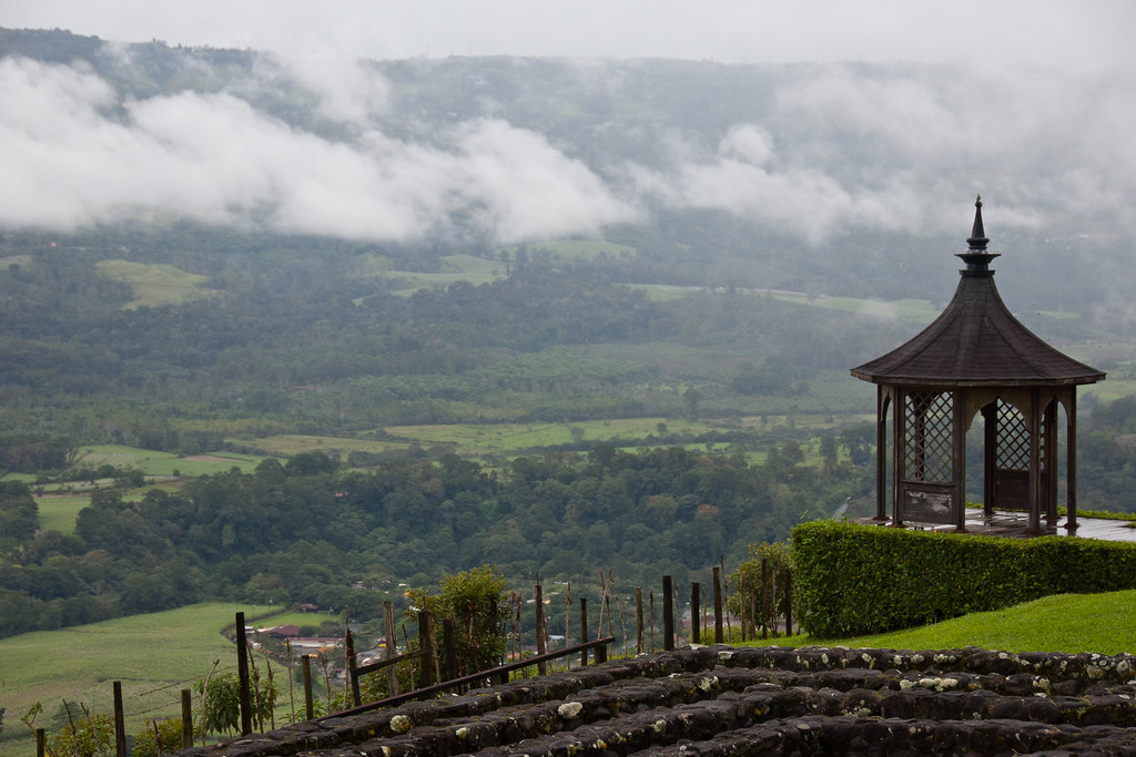
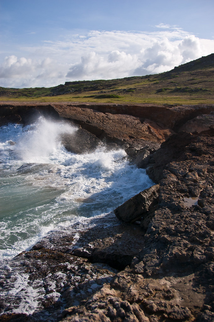
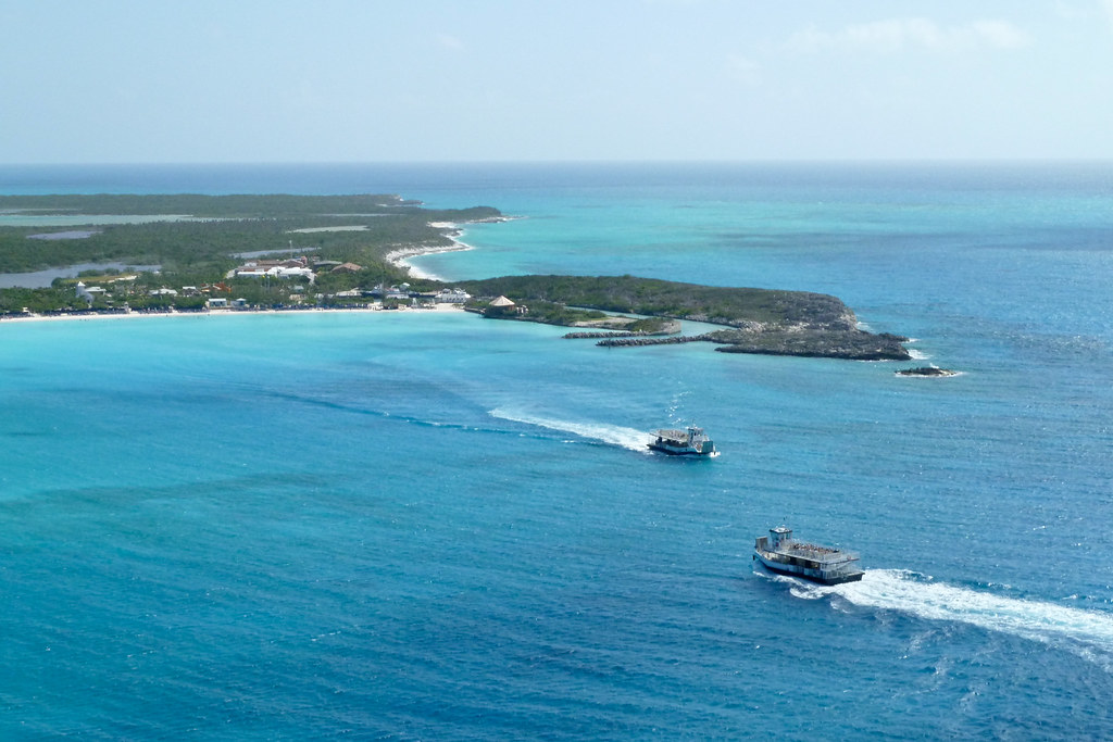
After entering Gatun lake - the body of water behind the Gatun locks - passengers who had booked Panama shore excursions were able to leave the ship via tenders. After about half the total number of guests had left, the ship turned around, exited the Canal through the Gatun Locks again and docked in Colon, ready to pick up the guests several hours later!

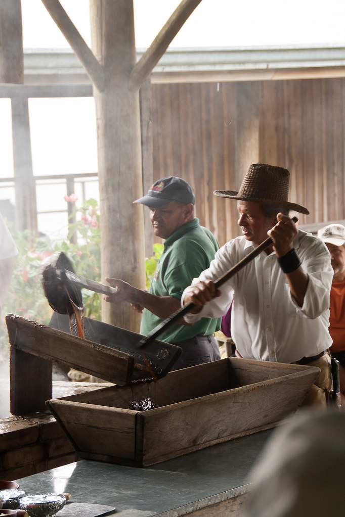
I managed to take part in three shore excursions in Panama: a tour of Panama City, a trip to the Miraflores Lock Observation Centre and Panama train journey and finally, the very exciting visit to a native Indian village.

During our visit to Panama City, on the Pacific side of Panama (it only takes about an hour to travel between the oceans via bus), we saw the ruins of the old city, the colonial section and of course, the modern skyscrapers.

DSC_3304
Above: A view of the skyscrapers from a bridge.

Panama was founded on August 15, 1519 by Spanish conquistador Pedro Arias Dávila. The city was the starting point of expeditions that conquered the Inca Empire in Peru (1532). The city was destroyed by a devastating fire, when the pirate Henry Morgan sacked it on January 28, 1671. It was rebuilt and formally established on January 21, 1673 in a peninsula located 8 km from the original settlement. The place where the previously devastated city was located is still in ruins, and has become a tourist attraction known as "Panama Viejo".

DSC_3277
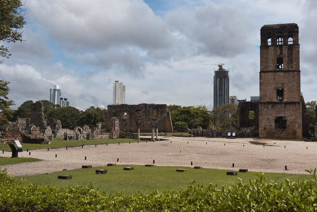
Above: Ruins of the old city - Panama Viejo.

Panama's old quarter features many architectural styles, from Spanish colonial buildings to French and Antillean townhouses built during the construction of the Panama Canal.

DSC_3364
Above: Colonial architecture in the old quarter of Panama.

Built and settled in 1671, after the destruction of Panama Viejo the historic district of Panama City (known as "Casco Viejo", "Casco Antiguo" or "San Felipe") was conceived as a walled city to protect its settlers against future pirate attacks.

DSC_3401
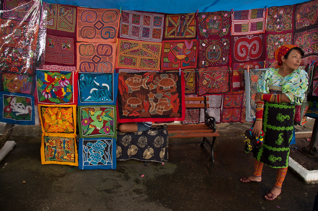
Above: A woman selling famous fabric designs in the old quarter.

The more modern areas of the city have many high-rise buildings, which together form a very dense skyline. There are currently more than 110 high-rise projects being constructed, with 127 high-rise buildings already built. Some of the skyscrapers have very intriguing designs!

DSC_3394
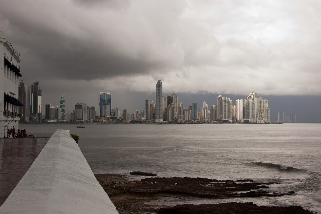
Above: The skyline of Panama City, as seen from the old quarter.

Poverty and wealth sit side by side in Panama City. The authorities have offered lots of money to the slum dwellers to get them to make way for new construction, but the locals - many of whom are fisherman - do not want to leave their homes and livelihood.

DSC_3291
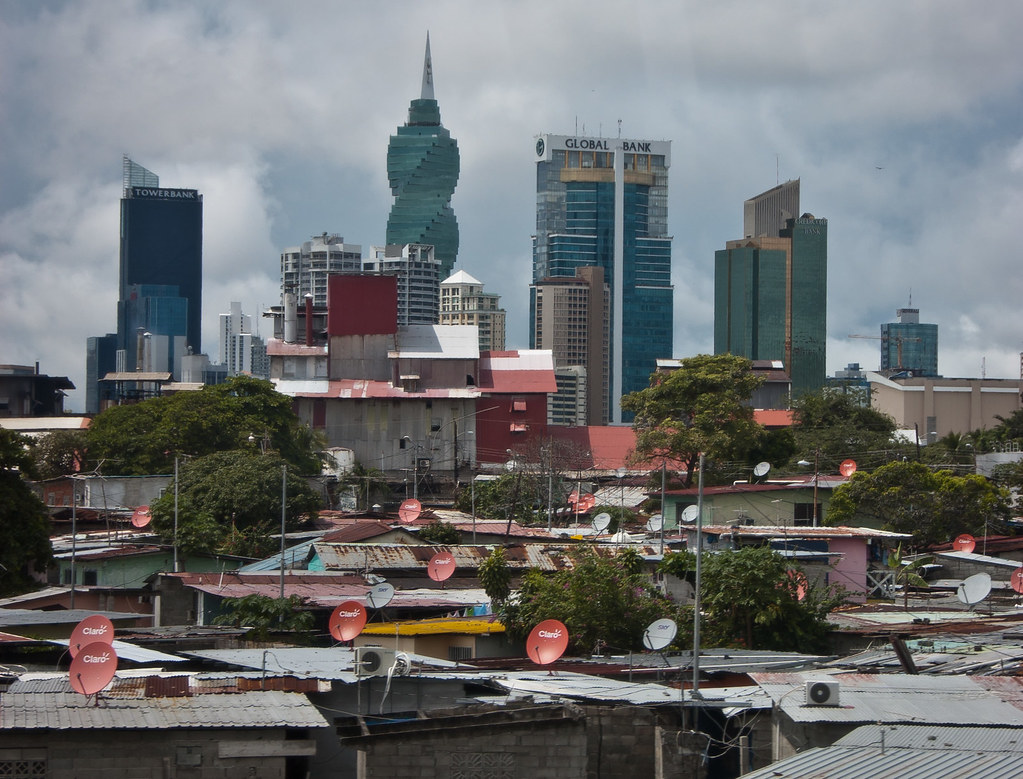
Above: Slums and sky-scrapers.

The government building that oversees the running of the Panama Canal, is located in the American quarters of the city which was an area run by the USA during the construction and ownership of the Canal by the Americans.

DSC_3320
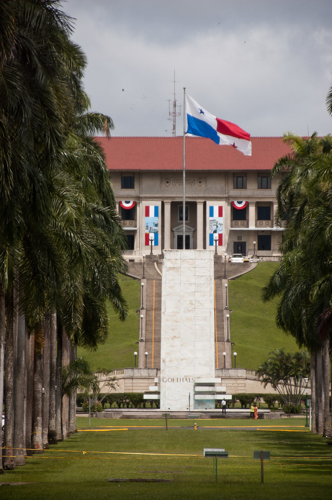
Above: Panama Canal HQ. The boulevard with trees in the front of the shot, is the exact same dimensions as the locks in the Canal.

The second trip, I went on visited the Miraflores Lock Observation Centre which overlooks ships passing through the locks, and has many exhibits.

DSC_4339
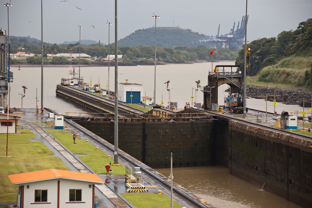
Above: The view from the Miraflores Lock Observation Centre.

After visiting the centre, we took a train along the Panama Railway, back to the Atlantic side of the country. The railway was built before the Canal's construction and is still used to transport goods, as it runs alongside the Canal.

DSC_4362
Above: Our Panama Train!

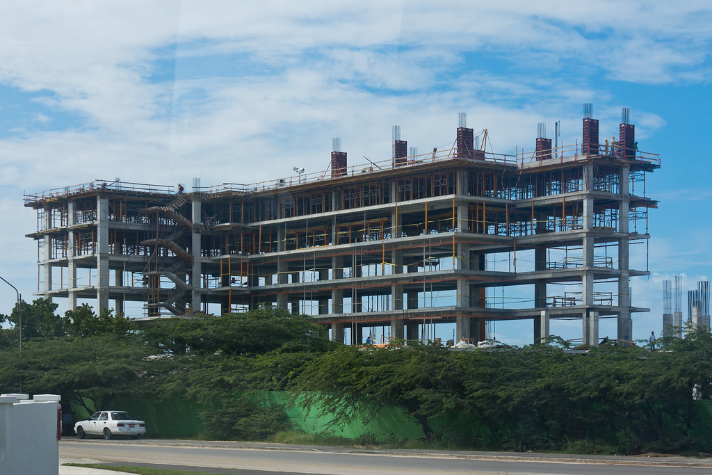
During my trips in Panama, we also caught glimpses of the new locks construction. To read more about this, see my previous Panama Canal post here.

DSC_3260
Above: New locks being constructed.

This city where the Zuiderdam docked in Panama, after exiting the Canal was called Colon. It is the second largest duty-free zone in the world but the city itself is not particularly pleasant.

DSC_4401
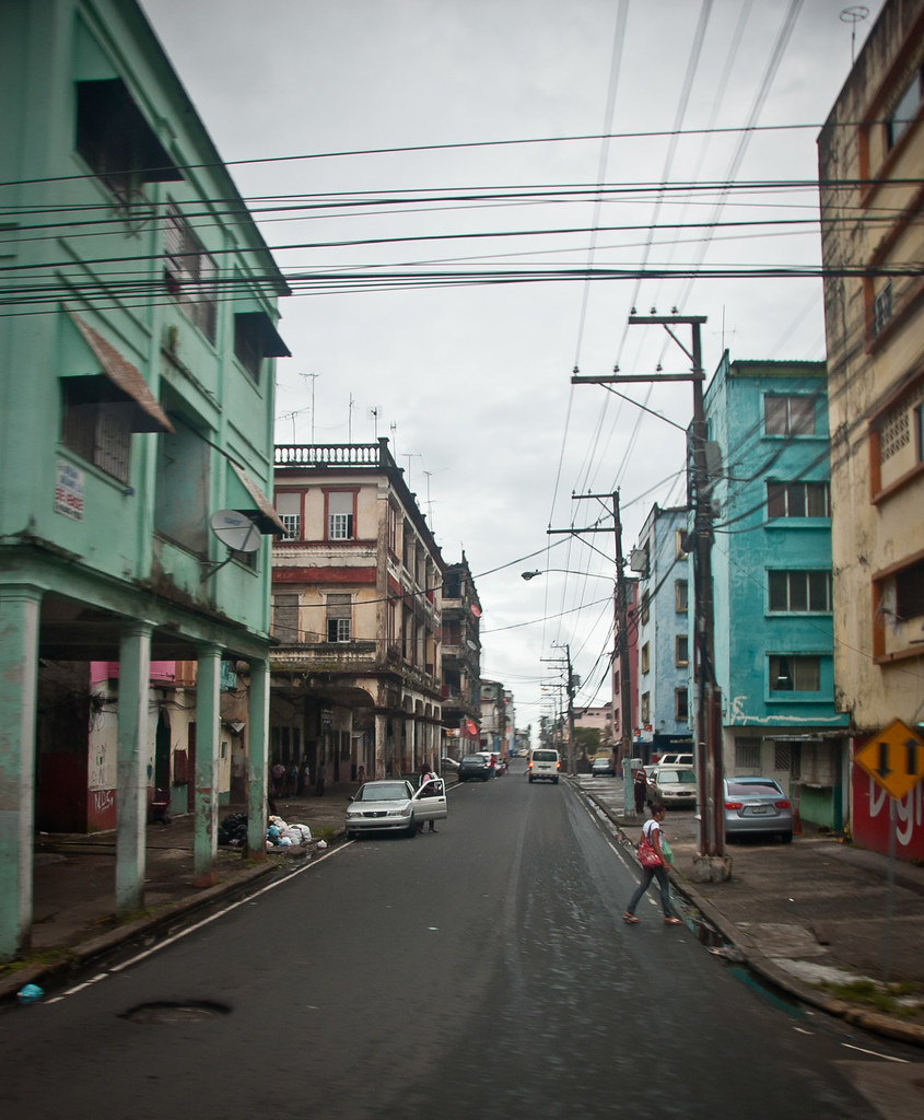
Above: A street in Colon. Please excuse the picture quality - photos from behind a darkened bus window do not come out very well!

Finally, we come to my favourite shore excursion from my time on the Zuiderdam - the authentic Embera Indian Village. Watching my YouTube video below will give you some more information about this trip and the people who we visited. I won't repeat the same text here, so watch the video and enjoy the pictures below!

WARNING: Some of these pictures contain cultural nudity.


DSC_4591
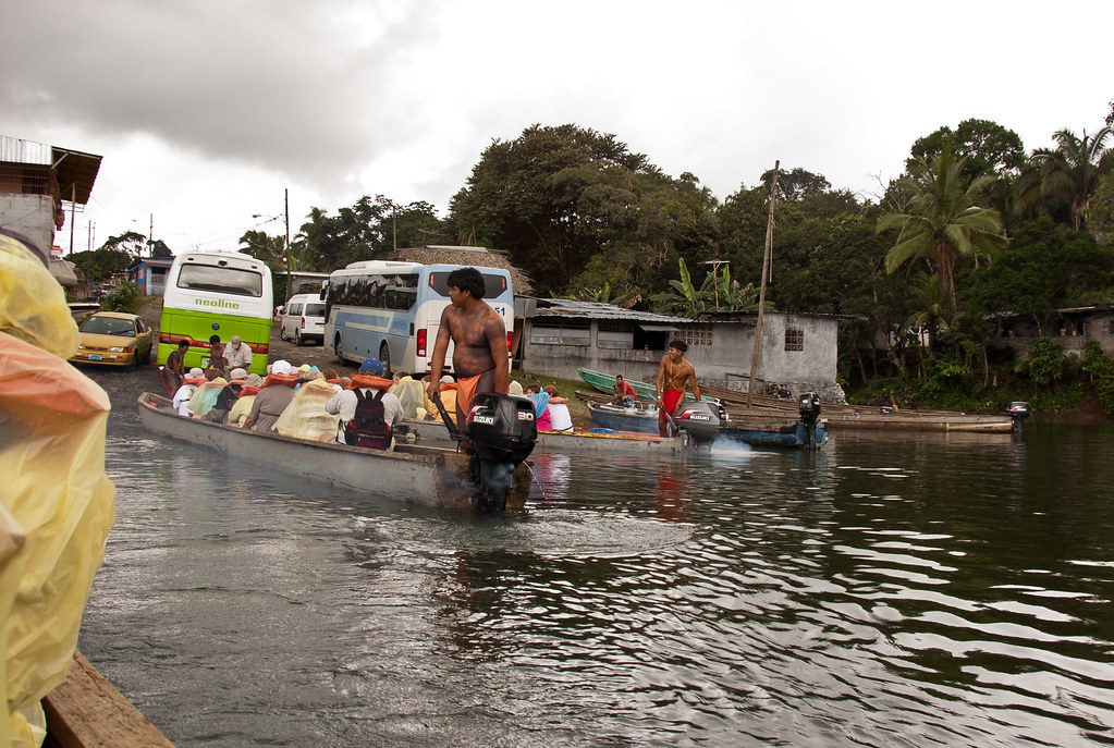
Above: Leaving modern civilisation behind, departing on our (admittedly motorized) canoes.

DSC_4655wide
Above: A shot of the village 'square'

DSC_4647
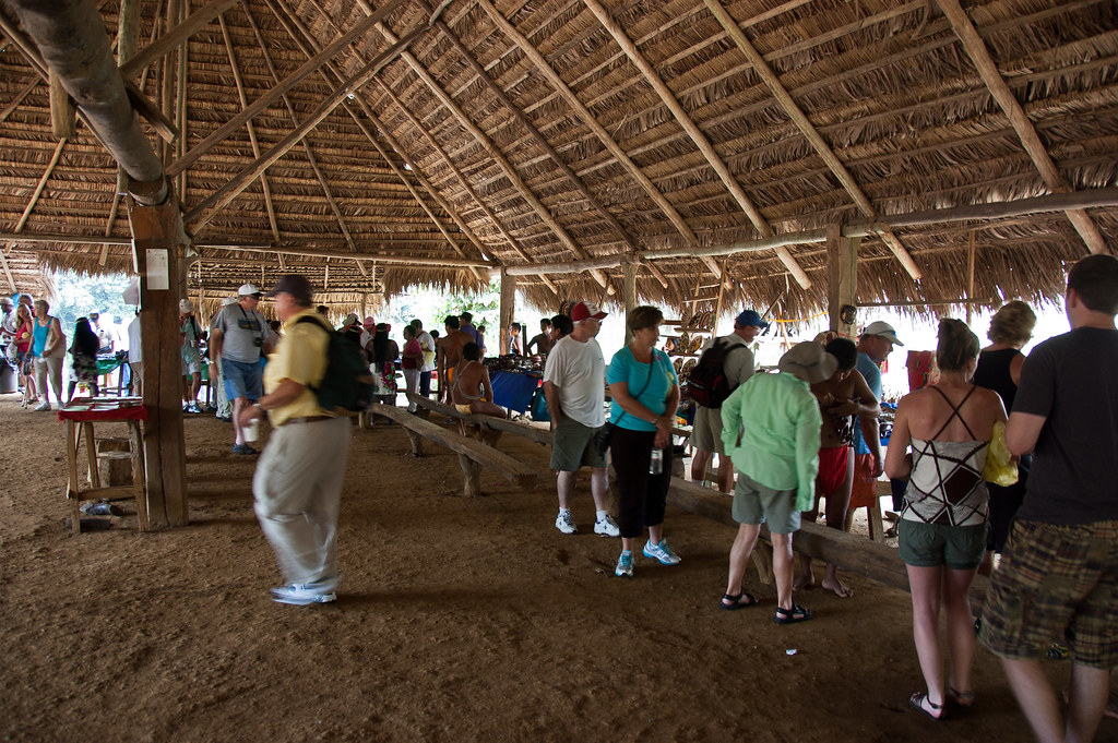
Above: Guests under the main 'marquee' in the village.

DSC_4643
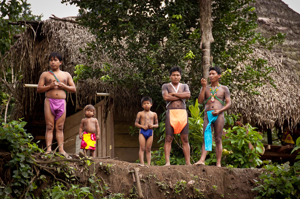
Above: Some of the men waiting to greet us on arrival.

DSC_4716
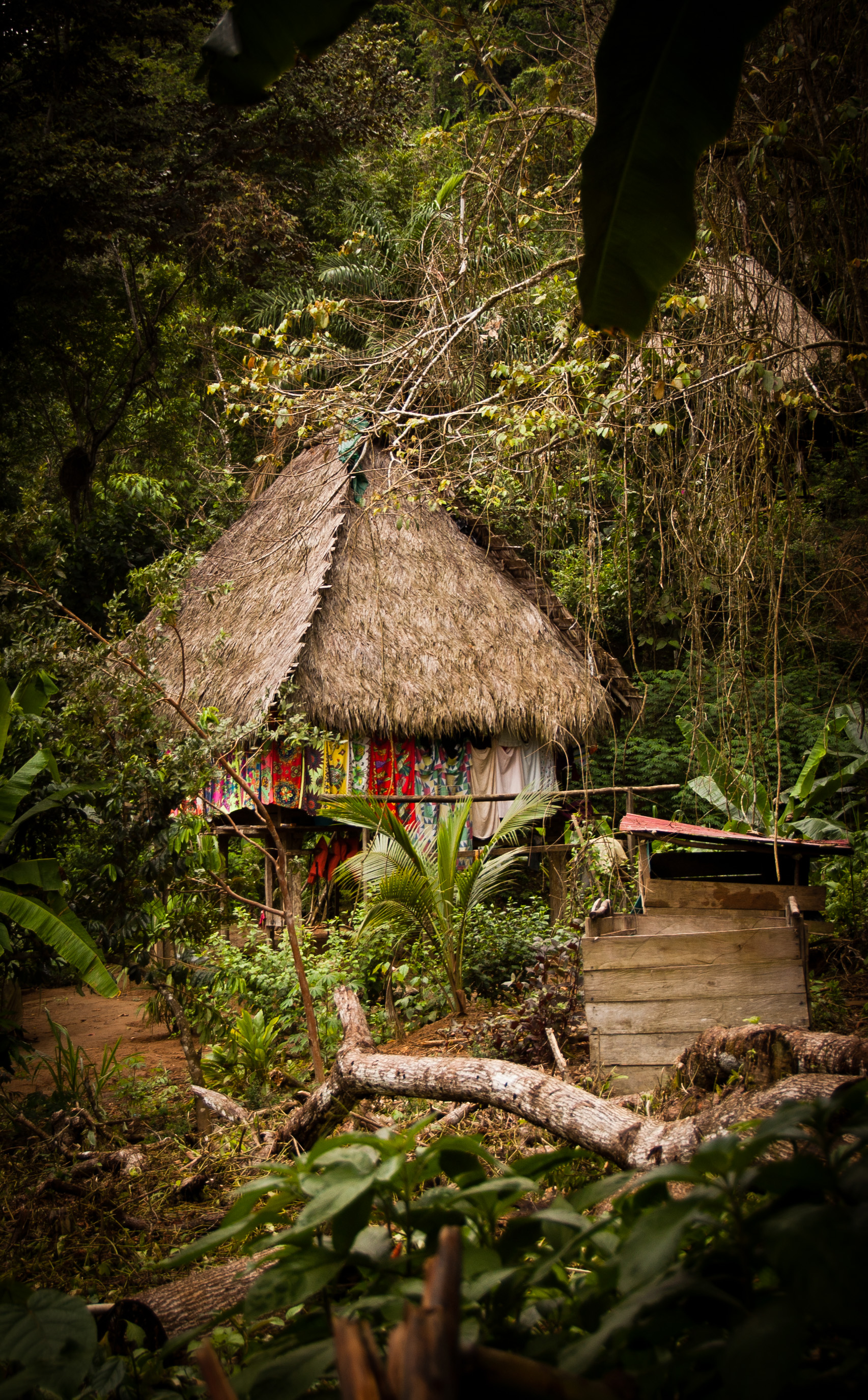
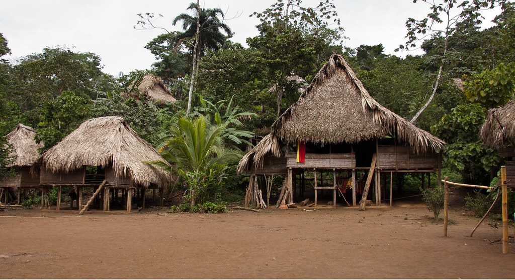
Above: A dwelling deep in the jungle.

DSC_4724
Above: Guests were invited to join in with the dancing.

DSC_4731
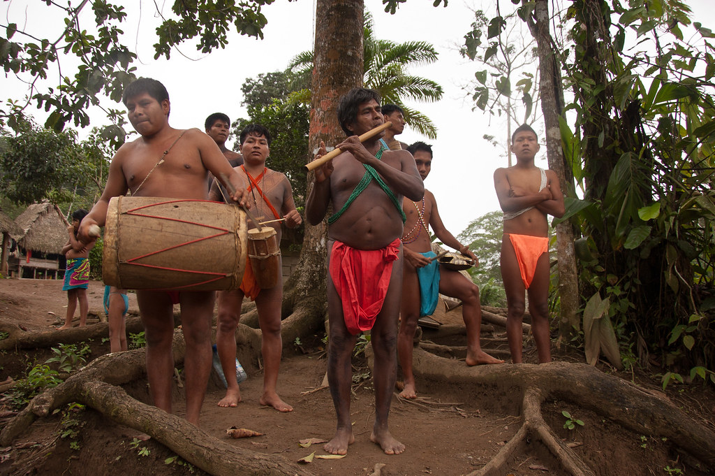
Above: The band welcoming and bidding us farewell at the end of the trip.

This was an amazing trip and I would recommend it if you ever happen to be in Panama!

Thanks so much for reading this blog - I really hope it gives you a glimpse into my adventures. I fly back to Miami this Thursday for the start of my eastern Caribbean cruise which will include trips to the Bahamas and many of the other tiny islands. Rest assured, I'll be blogging about them!

Costa Rica Part 2

Welcome back to my blog. One of the last trips I took on the Zuiderdam was to a farm in Costa Rica called the Tayutic Hacienda. Located in the hills of Turrialba, the farm belongs to the Ortuño family, whose wealth comes from sugar cane, coffee and macadamias.

DSC_4795
Above: The view of the valley from the farm's hotel and chapel area.

DSC_4790
Above: Sugar cane growing in the fields below us.

On the tour, we learnt about the ancient methods of cultivation and processing sugar cane, where we saw how the extract of the sugar cane is cooked, filled into the moulds and converted into a sweet with macadamia nuts.

DSC_4811
Above: The farm still uses oxen to crush the sugar cane and extract the juice.

DSC_4814
Above: Oxen helping to crush the sugar cane.

DSC_4826
Above: It was a fascinating process to watch how the juice from the sugar cane was beaten and heated.

DSC_4842
Above: The finished product!

We also saw the process of cultivating coffee—from the red coffee berry to the roasted coffee bean and learnt how awful instant coffee is (they use all the rejected coffee beans for instant coffee).

DSC_4800
Above: The chapel which often hosts weddings for guests staying at the farm.

We also visited the green house, with exotic orchids:

DSC_4742

DSC_4739

...as well as the macadamia drying and peeling plant:

DSC_4760

DSC_4865
Above: Macro shot of a Costa Rican till!

Untitled_Panorama1
Above: The view of the valley with the Reventazon River and its dam in the centre of the shot.

The last blog from the Zuiderdam is on its way - a huge report from Panama including the native Indian village and Panama City.

Friday 13 January 2012

Aruba and Bonaire

Welcome back! Today I've got the other two 'ABC' islands to show you: Aruba and Bonaire (click here for my Curacao post).

DSC_4528
Above: Oranjestad - the capital of Aruba - at night.

Aruba is the smallest and westernmost of the ABC islands at 33km long and 69 square miles but it is densely populated with a total of just over 100,000 inhabitants.

closerhotelpan
Above: A panorama of Aruba's hotel district. Can you spot the Zuiderdam?

As you can see in the picture above, Aruba is more developed than Bonaire or Curacao with casinos, shopping malls and hotel districts lining the western and southern coasts.

DSC_3127
Above: Dutch colonial architecture is less visible than on the neighbouring islands, but several modern recreations have emerged, such as this outdoor shopping mall at Royal Plaza.

Aruba is known for its white sandy beaches on the western and southern coasts of the island which are relatively sheltered from fierce ocean currents, and this is where most tourist development has taken place. In fact hotels are still being built all the time:

DSC_3890
Above: A new hotel - rumoured to be the most expensive on the island - is built.

Many cruise lines call at Aruba as it offers a combination of developed resort and shop facilities as well as beautiful beaches and exciting scenery.

DSC_3105
Above: A helicopter in front of the two cruise ships docked during one of our visits.

DSC_3100
Above: Iguanas are a common sight on the ABC islands.

Aruba is one of the four constituent countries that form the Kingdom of the Netherlands, together with the Netherlands, Curaçao, and Sint Maarten whose citizens share a single nationality: Dutch citizen.

DSC_3119
Above: Downtown Oranjestad.

The northern and eastern coasts, lacking the protection from the ocean currents, are considerably more battered by the sea and have been left largely untouched by humans. On a tour I went on, we visited the wild coastline as well as a famous lighthouse:

DSC_3907
Above: The lighthouse on the northern tip of Aruba.

Two natural rock bridges were big attractions in Aruba, but in 2005 the main bridge collapsed leaving the baby bridge behind which still manages to draw the tourists:

DSC_4030
Above: The baby rock bridge.

DSC_4063
Above: The rough seas and jagged rocks make this side of the island quite dramatic.

DSC_4068
Above: Many tourists that visit Aruba leave towers of pebbles as a symbol of good luck.

Inland, the island features an arid, cactus-strewn landscape with a few hills, and rock formations. One of the unusual and notable rock formations is the Casibari Boulders, which are tonalite rocks rising above the desert landscape giving a panoramic view of the island.

DSC_3966
Above: One of the biggest outcrops at the Casibari Boulders.

The rocks are located amidst cacti, and lizards are commonly encountered here. The boulders have unusual shapes resembling birds and dragons. There is no plausible explanation yet for the presence of these unusual wind-carved boulder formations on a flat sandy island.

arubarockpan
Above: The view from the rock formation. Note Mount Jamanota, the highest hill on the island (617 ft) and the Zuiderdam about three quarters to the right of the shot.

Whilst in Aubra, I also visited another Ostrich farm (as you do) to take yet more pictures of the huge birds:

DSC_3993

DSC_4002

There's just time to show you a few shots from Bonaire, a much more undeveloped island than Aruba. Bonaire was part of the Netherlands Antilles until the country's dissolution on 10 October 2010, when the island (including Klein Bonaire) became a special municipality within the country of the Netherlands.

P1040292
Above: Wild donkeys roam the countryside. Previous generations had worked on the plantations but now the donkeys are free. A donkey sanctuary looks after the beasts.

Bonaire is famous for its many dive and snorkelling sites as well as its rugged landscape. I biked around part of Bonaire:

P1040304
Above: Lake Gotomeer is famous for its flamingos which are drawn to the brackish water, that harbours the shrimp they feed on. Naturally, they were missing on the day I visited.

P1040314
Above: The inland town of Rincon, viewed from one of the highest points in Bonaire.

I'll leave you with a shot of a less-than seaworthy vessel. I'll be back to the ABC islands once more on the Maasdam so maybe I'll find some flamingos then!

P1040200

Thursday 5 January 2012

Half Moon Cay

Welcome back! Just a few more posts from my Zuiderdam cruise before I set sail on the Maasdam at the end of January for the Eastern Caribbean! Today I'll show you around one of the most popular ports in the Caribbean with HAL passengers - Half Moon Cay, Holland America's own private island!

P1040212
Above: The view of Half Moon Cay from my parasailing ride!

The real name of the island is Little San Salvador Island and it is one of about 700 islands that make up the archipelago of the Bahamas.

DSC_3019
Above: The beach with the Zuiderdam anchored offshore.

Holland America purchased the island in December, 1996 for a price of $6 million USD. Since then it has developed 50 acres of the 2,400-acre island, with the stated goal of maintaining as much habitat as possible for wildlife.

HMCpan
Above: A panorama of the island. Much of the land is undeveloped.

Activities which guests can enjoy on the island include swimming (obviously), scuba diving, jet-skiing, cycling, snorkelling and horse riding. Deep-sea fishing, parasailing, glass-bottom boat rides, and nature walks also are available.

DSC_3051
Above: Guests arrive and leave the island on special tender boats which take them back to the ship anchored offshore.

About 40 people live on the island full time, and the rest of the workers commute by boat from surround populations like Nassau. All the food and drink is brought off the ship by crew - it's a huge operation!

DSC_3669
Above: This colourful courtyard is the first sight to greet disembarking guests.

Most of the development is along the shore of the island, with some development out towards the lagoon where jet skiing and stingray encounters take place.

DSC_3682
Above: The view from the tender boat of the shore with the new Captain Morgan bar centre.

The pirate ship which sits on the shore is a newly constructed bar, with a stage area for the HAL Cats - a party band that play on the ship.

DSC_3012
Above: The Captain Morgan Bar.

DSC_3016
Above: HAL Cats entertaining the crowd in the Captain Morgan Bar.

Whilst on the island, I had the opportunity to do horse riding and parasailing - both of which were great fun!

DSC_3038
Above: Pegasus Ranch.

P1040260
Above: We began the horse ride riding through some of the island's sandy paths...

P1040251
Above: ...before going for a walk along the sand.

Afterwards, we rode the horses into the sea (just like in Jamaica earlier this year) which was fine until the horse in front of me pooped, and everything came floating towards me - up to my waist in sea water!

DSC_3763
Above: Parasailing was one of the best experiences on this cruise.

Parasailing was a lot of fun, although it was a more sedate experience than I was expecting. You sat on the back of the boat and were gently 'let out' by the winch on the back of the boat, before being reeled back in about 5 minutes later.

DSC_3781
Above: My fellow parasailer got a great picture of me with the Zuiderdam.

DSC_3738
Above: Trying not to drop the camera.

I'll leave you with my favourite shot of the parasailing - the feet help to give the picture some perspective! I've saved some of the best trips until last so check back here soon for Panama City, authentic Indian Villages and more!

P1040225