CRUISE MAP


View Cruise Destinations in a larger map

Sunday 20 November 2011

Cartagena, Colombia

Welcome back! In today's post, I'll show you the beautiful city of Cartagena, in Colombia - the final stop on our repositioning cruise.

Cartagena_pan3
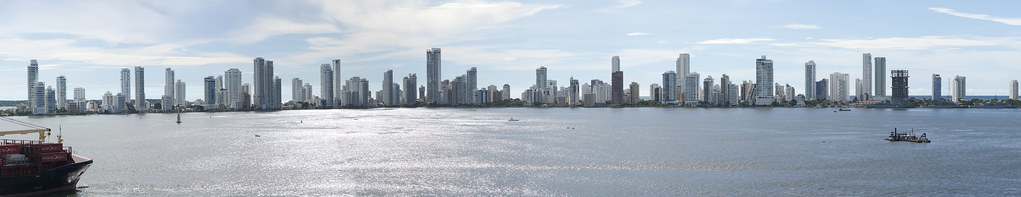
Above: View from the ship of the modern part of Cartagena.

Records of development and activity in Cartagena date back to 4000 B.C. around Cartagena Bay by varying cultures of indigenous peoples. The Spanish colonial city was founded on June 1, 1533 and named after Cartagena, Spain.

DSC_2752
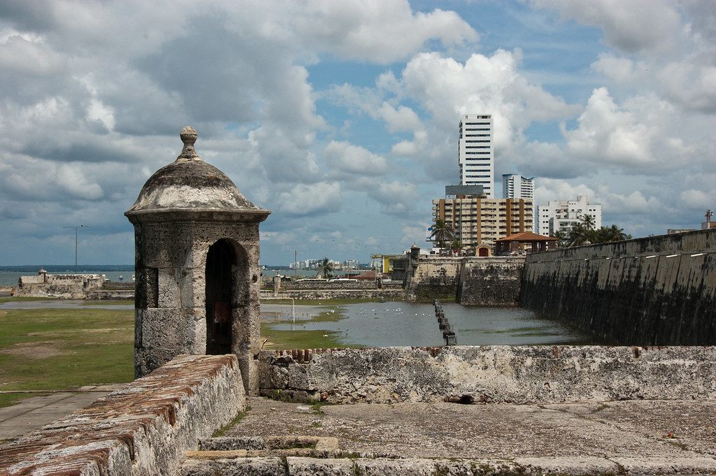
Above: The old sea wall which surrounds the colonial downtown district.

Cartagena served a key role in the development of the region during the Spanish eras; it was a centre of political and economic activity due to the presence of royalty and wealthy viceroys. In 1984, Cartagena's colonial walled city and fortress were designated a UNESCO World Heritage Site.

DSC_2810
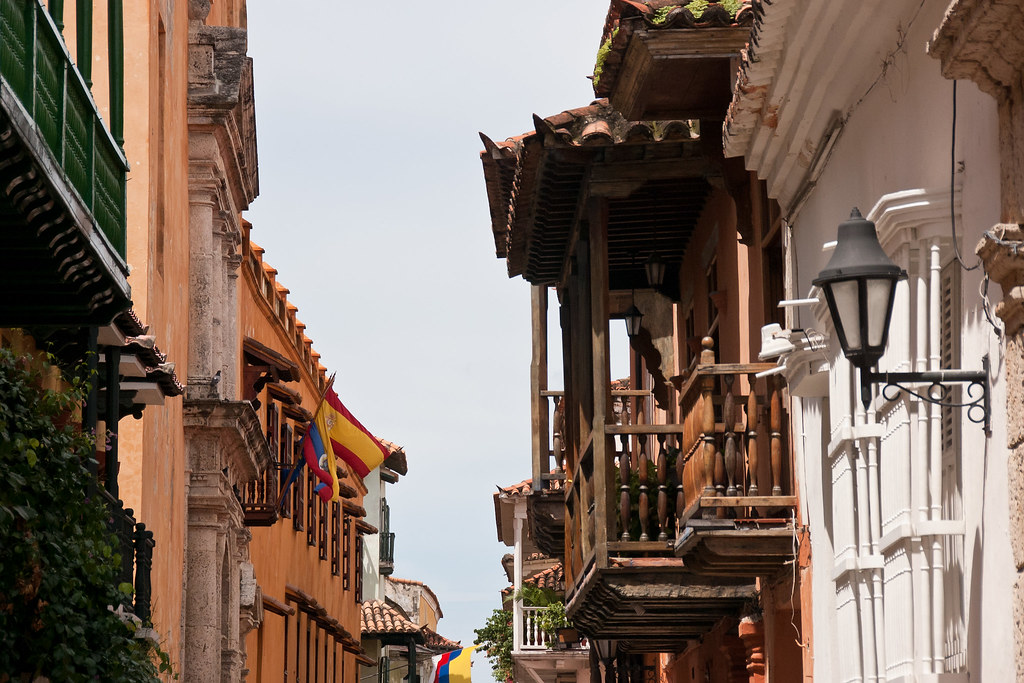
Above: Some of the colonial buildings in the downtown district.

The Downtown area of Cartagena has varied architecture, mainly a colonial style, but republican and Italian style buildings, such as the Cathedral's bell tower, can also be seen.

DSC_2815
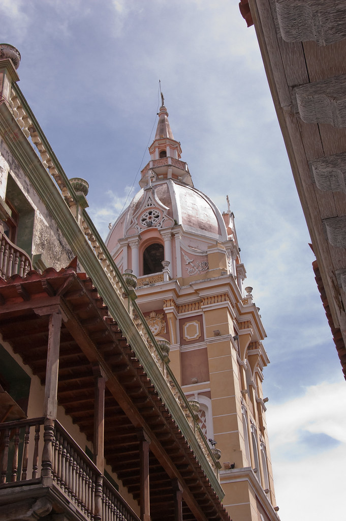
Above: The Cathedral's Bell Tower, dating back to the 16th century.

DSC_2760
Above: The downtown area boasts some incredible colours.

The official entrance to the downtown area is the Puerta del Reloj (Clock Gate), which comes out onto Plaza de los Coches (Square of the Carriages):

DSC_2781
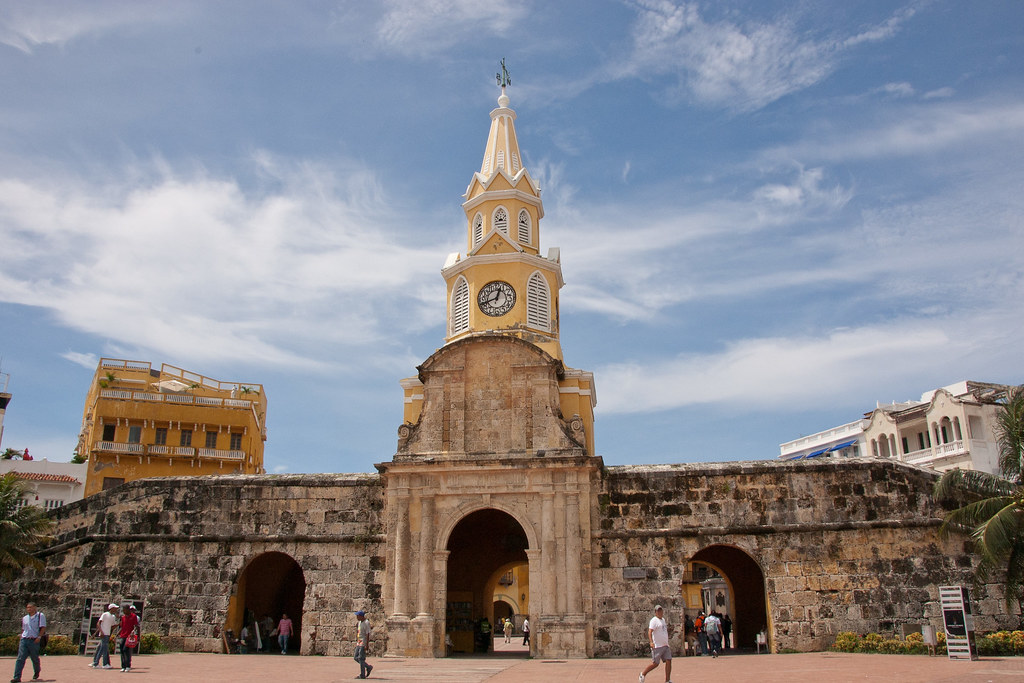
Above: The Clock Gate.

A 20-minute walk from downtown is the Castillo de San Felipe de Barajas, the greatest fortress ever built by the Spaniards in their colonies.

DSC_2691
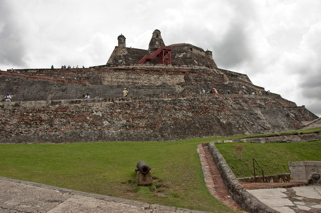
Above: The Castillo de San Felipe de Barajas.

The original fort was constructed between 1639 and 1657 on top of San Lazaro Hill. In 1762 extensive expansion was undertaken, and the result is the current bastion.

DSC_2695
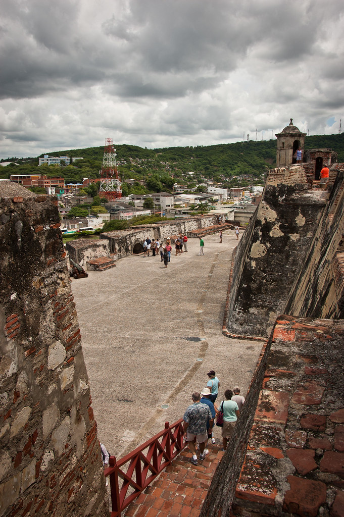
Above: Looking across the fort as tourists explore.

Numerous attempts to storm the fort were mounted, but it was never penetrated.

DSC_2703
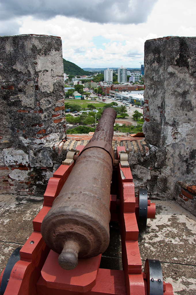
Above: One of the many cannons which sit atop the fortress.

An extensive system of tunnels is connected underground to distribute provisions and facilitate evacuation. The tunnels were all constructed in such a way as to make it possible to hear footsteps of an approaching enemy. I explored some of these tunnels myself:

DSC_2714
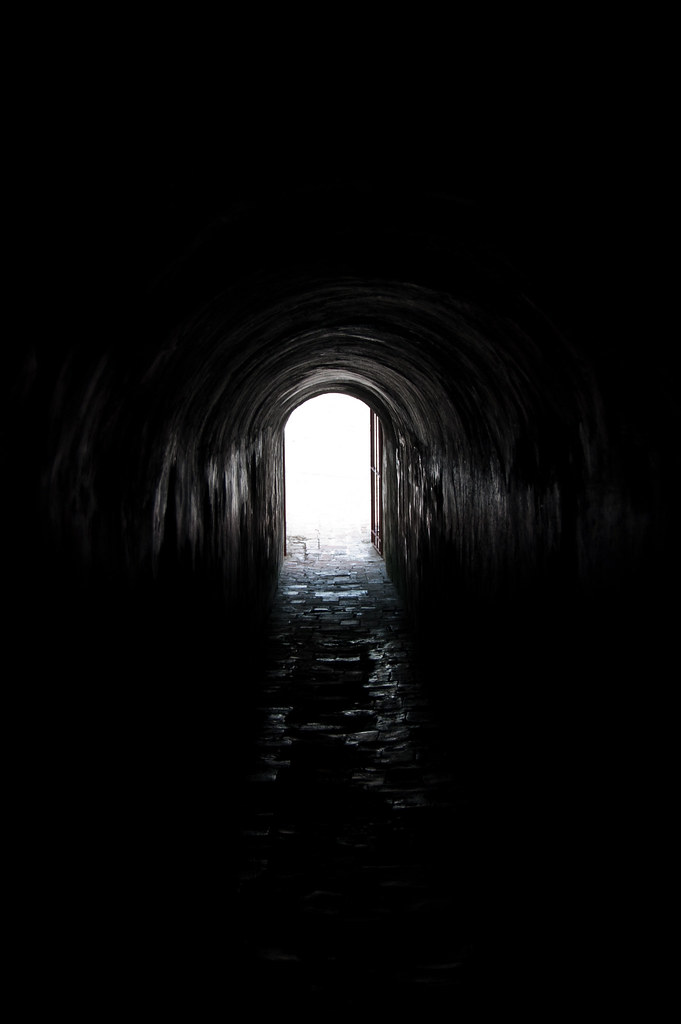
Above: Light at the end of the tunnel!

The fort affords some great views of the city and so I had fun creating some panoramas:

Cartagena_pan1

Cartagena_pan2

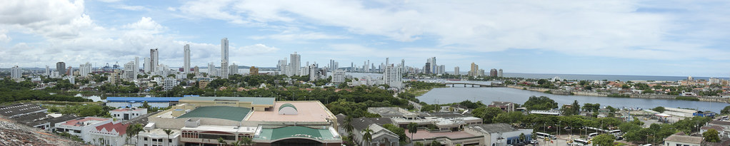
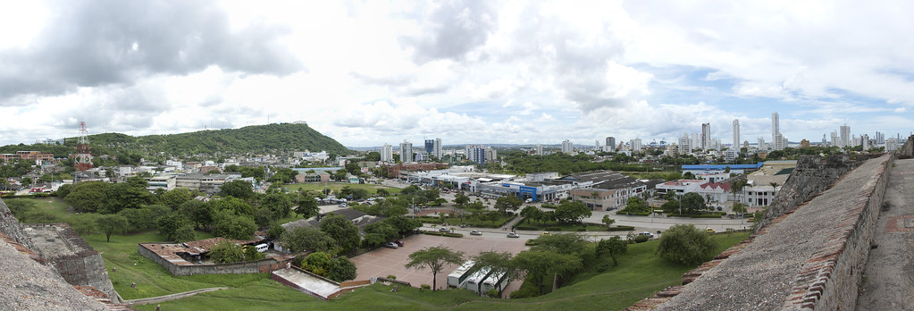
A special prize goes to the person(s) who can spot the three cruise ships (including the Zuiderdam)! A clue: they appear in both photos.

DSC_2706
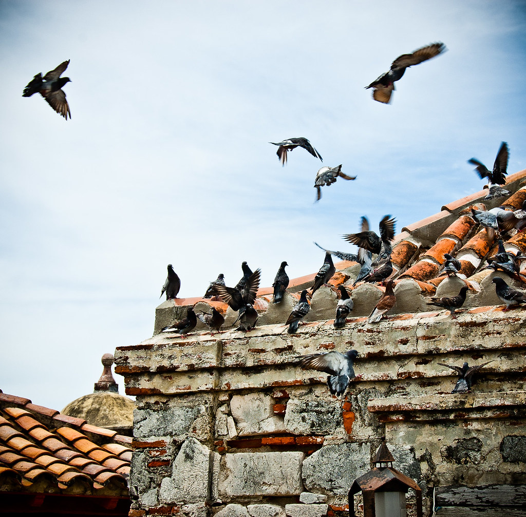
Above: Pigeons pose for this high contrast shot.

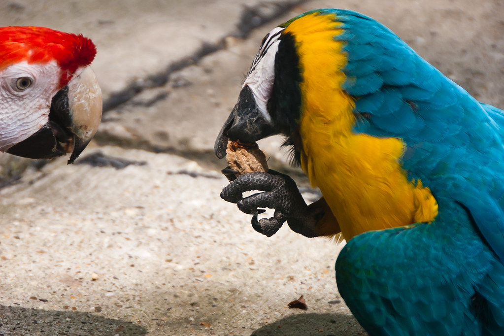
The cruise terminal at which we docked, featured many birds which were free to roam around but liked to stay in the area due to the food that they receive!

DSC_2688

DSC_2840

DSC_2855

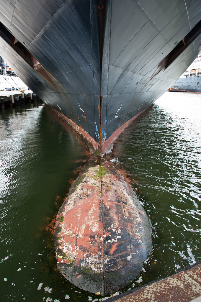
The port also afforded me the rare chance to stand underneath the bow of the Zuiderdam, as the ship came right up to the front of the dock. Quite intimidating!

DSC_2874

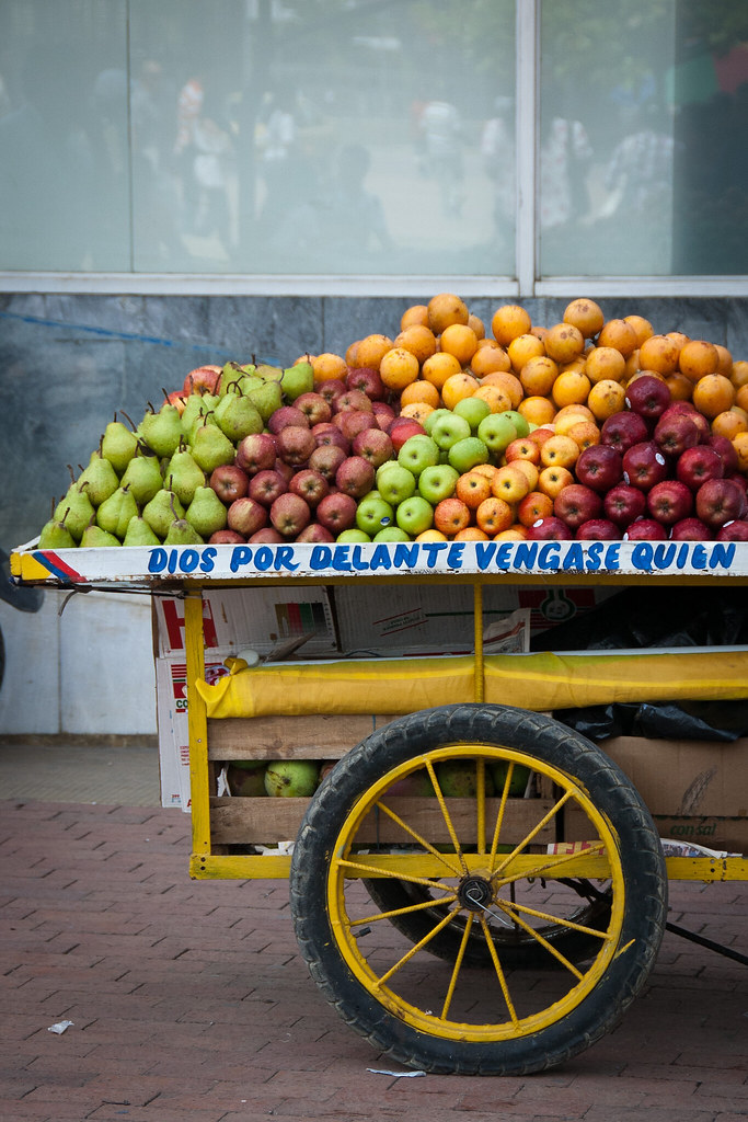
I'll leave you with the classic fruit vendor shot, taken just outside the downtown district of Cartagena. This is the end of our repositioning cruise ports so I'll be showing you around our Caribbean ports of call soon including Aruba, Costa Rica and more of Panama!

DSC_2772

Wednesday 9 November 2011

Panama Canal

Welcome back! In today's post it's the big one - the Panama Canal! We sailed all the way through the Canal from the Pacific to the Atlantic Ocean a month ago, and we are now entering the first set of locks before turning around each Caribbean voyage. I'll take you through the route from Pacific to Atlantic today.

DSC_2472
Above: The first set of locks from the Pacific side - the Miraflores Locks

The Panama Canal is a 48 mile ship canal in Panama that joins the Atlantic Ocean and the Pacific Ocean and is a key route for international maritime trade. Built from 1904 to 1914, the canal was designed to replace the long and treacherous route around the southernmost tip of South America, cutting many journeys by more than half.

DSC_2391
Above: Panama City, located on the Pacific side of the Panama Canal.

The canal consists of artificial lakes, several improved and artificial channels, and three sets of locks. An additional artificial lake, Alajuela Lake, acts as a reservoir for the canal. The canal works entirely by gravity - no pumps are used to fill and empty the locks.

DSC_2435
Above: The Bridge of the Americas (Pacific side) which connects the two American continents.

The first lock system we arrived at was the 1.1 mile long Miraflores lock system, which lifts vessels 16.5 metres above sea-level (see first photo). After the first lock, we entered the artificial Miraflores Lake before heading towards the second of the three locks - the Pedro Miguel Lock. This is the last part of the ascent, with a lift of 9.5 metres to the main level of the canal.

DSC_2535
Above: The Pedro Miguel Lock seen from the Miraflores Lake, with the Centennial Bridge in the distance.

DSC_2552
Above: The view from the back of the Zuiderdam of the Pedro Miguel Lock.

At the locks, small vehicles known as Mules guide the ships through the locks. They do not actually pull ships - the ship sails under its own power but they prevent the ship from scraping against the side of the locks.

DSC_2490
Above: A Mule. Three on each side guided the Zuiderdam through each lock.

The first attempt to construct a canal began in 1880 under French leadership, but was abandoned after 21,900 workers died, largely from disease and landslides. The United States launched a second effort, incurring a further 5,600 deaths but succeeding in opening the canal in 1914.

DSC_2564
Above: Looking back at the Pedro Miguel Lock with the Miraflores Lock in the distance.

DSC_2522
Above: The Holland America photography team was on hand to capture every moment.

After the first two locks, we passed through the Gaillard Cut which slices 7.8 miles through hillside of the continental divide at an altitude of 26 meters, passing under the Centennial Bridge (built to ease traffic on the Bridge of the Americas.

DSC_2594
Above: The cut-away hillside. The tiered design helps to prevent landslides.

As we continued along the Canal, we passed the Chagres River, a natural waterway which merges into Lake Gatun. This is an artificial lake formed by the building of the Gatun Dam, which carries vessels 15 miles towards the final set of locks.

DSC_2609
Above: The Gatun Locks

Finally, the Gatun locks, a three-stage flight of locks 1.2 miles long, drop ships back down 26 metres to sea level. We raced a Celebrity Cruise ship through the lock as all of the locks have two channels which can operate in either direction.

DSC_2620
Above: A Mule descending the Gatun Locks.

You may be interested to know about fees for transiting the Canal. Cruise ships, pay a rate based on the number of passengers that can be accommodated in permanent beds. The most expensive regular toll for canal passage to date was charged on May 16, 2008 to the Disney Magic, which paid US $331,200. The least expensive toll was 36 cents to American adventurer Richard Halliburton, who swam the canal in 1928!

DSC_2664
Above: Mules parked up at the base of the Gatun Locks.

As we passed through the Canal, we saw and heard lots of wildlife including monkeys and crocodiles. I'll try to get some photos of these next time we enter the Canal!

DSC_2661
Above: Looking back at the Gatun Locks from the Atlantic side. You can see the different water levels and if you look closely you can also see cars passing underneath the nearest lock; there is a road bridge beneath the locks which swings open when ships pass though!

The size of the locks determines the maximum size of ships allowed passage. Because of the importance of the canal to international trade, many ships are built to the maximum size allowed. These are known as Panamax vessels.

DSC_2600
Above: Both the Zuiderdam and the Celebrity ship are Panamax Vessels!

Because ships are being built to bigger sizes than the Panamax measurements, a project was started in 2006 for a Third lock lane project which will create larger locks, and deeper and wider channels, allowing bigger ships to transit. I'll show you some pictures of construction in a later post. Thanks for reading - I hope you enjoyed the Panama Canal!