Hello again! Bergen, Norway is probably my favourite Norwegian city; there is so much to see and do but everything is also within easy walking distance!
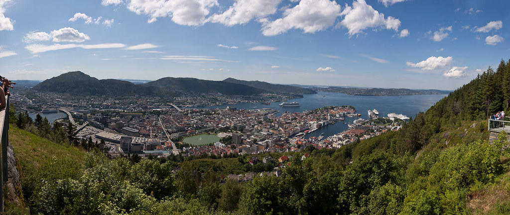
Above: An overview of Bergen from the top of Mount Fløyen.
Bergen is Norway's second largest city and located on the west coast of Norway with a population of 27,000. Trading in Bergen started in the 1020s and the city served as Norway's capital from 1217 to 1299.
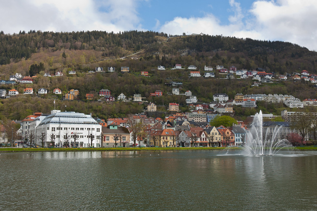
Above: Bergen cityscape with Mount Fløyen in the background.
Undoubtedly, the most famous site in Bergen is Bryggen (Norwegian for the Wharf), a series of Hanseatic commercial buildings lining the eastern side of the fjord. Bryggen has since 1979 been on the UNESCO list for World Cultural Heritage sites.
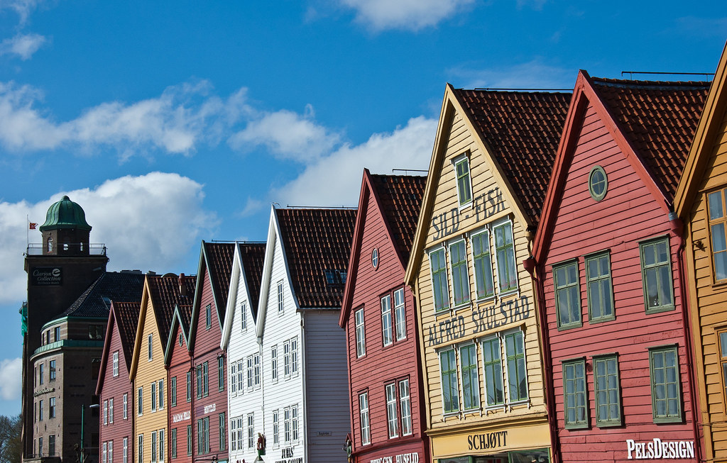
Above: The front facade of Bryggen.
You can wander through the alleyways among the picturesque warehouses lining the street and waterfront which once housed German merchandise belonging to the Hanseatic League. The Hanseatics settled in Bergen around 1350 and had the monopoly on the trade with Northern Norway as well as the political power in the city for about 200 years.
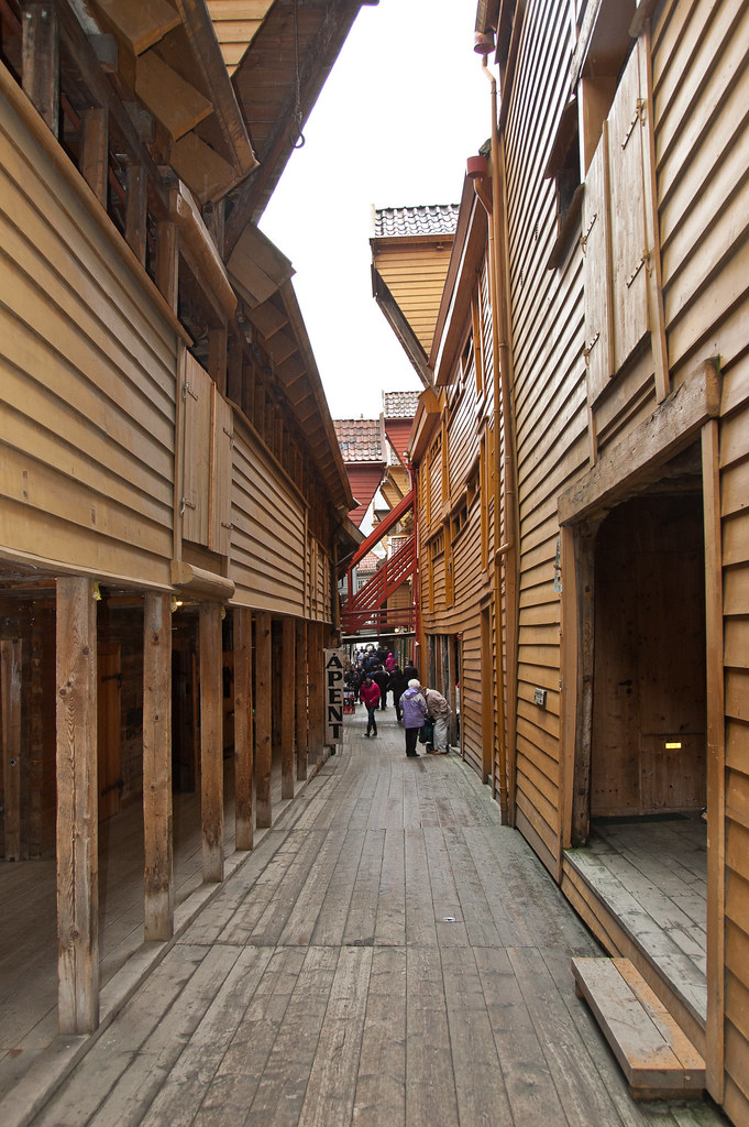
Above: The alleys in Bryggen are very narrow. You can see the winch that would have been used to hoist goods up to the first floor above the shop.
The warehouses were filled with goods, particularly fish from northern Norway, and cereal from Europe. Throughout history, Bergen has experienced many fires, since, traditionally, most houses were made from wood. This was also the case for Bryggen, and as of today, around a quarter of the structures date back to the time after 1702, when the older wharfside warehouses and administrative buildings burned down. The rest predominantly consists of younger structures, although there are some stone cellars that date back to the 15th century.
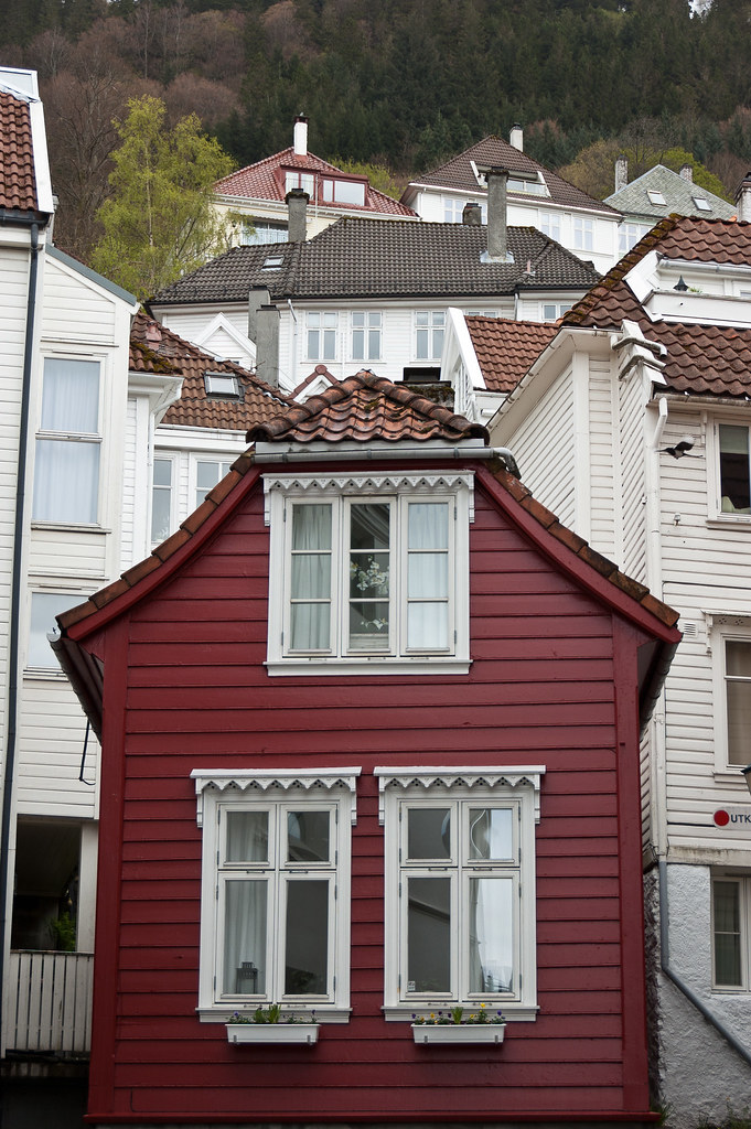
Above: Traditional wooden houses in Bergen.
One of the other main attractions in Bergen is Fløibanen, a funicular which runs up the mountain of Fløyen. Officially opened on 15 January 1918, the funicular affords great views of the city from the top!
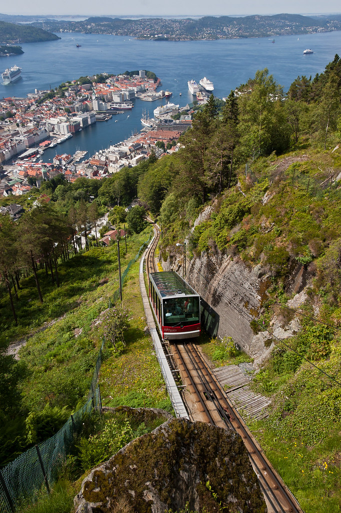
Above: A funicular descends from the top of Mount Fløyen.
One of the tours I went on during my time in Bergen, visited Troldhaugen, the home of Norwegian composer Edvard Grieg and his wife Nina Grieg. The site houses the Edvard Grieg Museum, a concert hall, Grieg’s villa, the hut where he composed music, and his and his wife's gravesite.
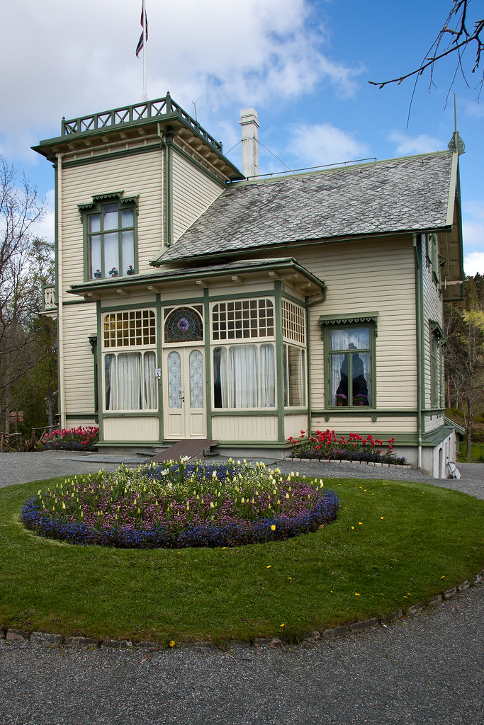
Above: Grieg's villa.
The building was designed by Grieg's cousin, the architect Schak Bull and was finished in 1885. Edvard Grieg himself called the building "my best composition hitherto" and he and his wife, Nina lived in Troldhaugen from April 1885 until his death in 1907.
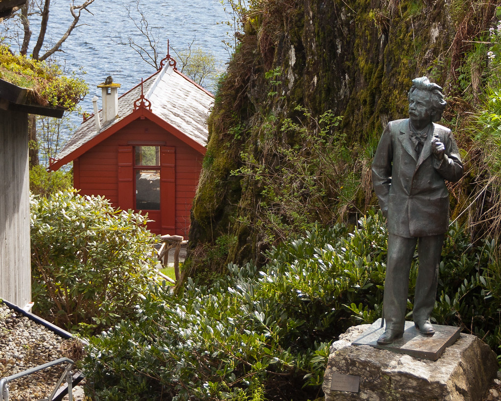
Above: A life-sized statue of Grieg (he was very short), with his composing hut in the background.
Troldhaugen is a typical 19th century residence with panoramic tower and a large veranda with Grieg's small composer's hut overlooking Nordås Lake. Grieg immortalized the name of his home in one of his piano pieces, Wedding-Day at Troldhaugen, Opus 65, No. 6. Grieg and his wife's ashes rest inside a mountain tomb near the house which I visited.
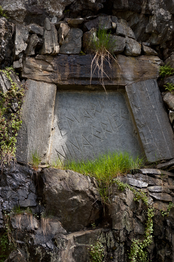
Above: Edvard and Nina Grieg's grave.
At the end of our tour, we also visited a Fantoft Stave Church, rebuilt after a fire completely destroyed the church in 1993 (a Satanist burnt the church down). The new church is an exact copy of the old one, which dated back to 1150. Take special note of the dragonheads and serpents on the roof—designed to frighten away evil spirits.
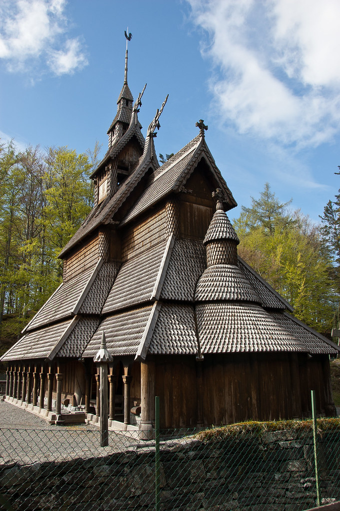
Above: The Fantoft Stave Church.
The church also features a stone cross outside, supposedly the first gathering point for religious services in the early days of Christianity. The interior is very dark and would have been even darker in the past when there were only candles!
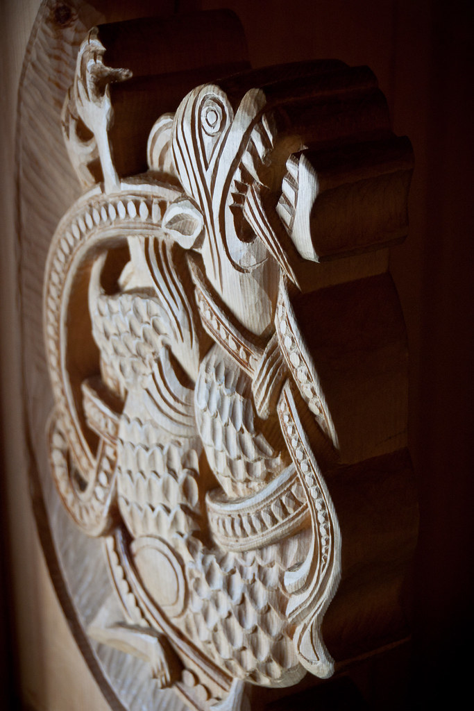
Above: Intricate carvings bookend the pews.
Thanks for reading! My final Norwegian post is coming up soon and I've saved the capital for last: Oslo!
Friday, 21 September 2012
Stavanger, Norway
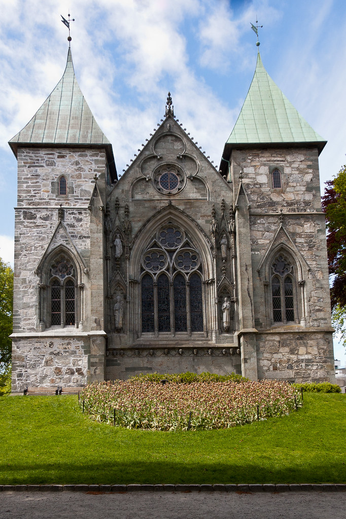
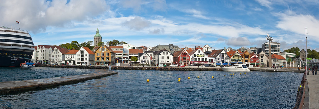
Welcome back! Norway remains one of my favourite countries and Stavanger is one of its most beautiful and vibrant towns. The fourth largest city in Norway, Stavanger counts its official founding year as 1125, the year the cathedral was completed. Stavanger's core is to a large degree 17th and 18th century wooden houses that are considered part of the city's cultural heritage and these are hence protected.
Above: Stavanger Cathedral (1125), the oldest cathedral in Norway.
Above: Wooden houses along the harbour front.
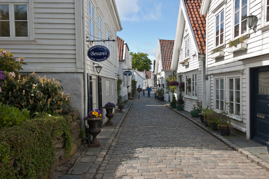
The protection of these houses has caused the town centre and inner city to retain a small-town character, and even after the city's rapid growth in the 1970s onwards, the urbanization of the city centre has been limited and a large share of the population still lives in detached houses.
Above: The houses were originally built for seaman, craftsmen and businessmen. Conservation of Old Stavanger is today considered the city's most important project.
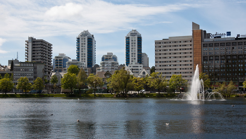
The city's rapid population growth in the late 1900s was primarily a result of Norway's booming offshore oil industry. Norway always had a harsh economy, given its rocky land, cold weather, and sufferings during the Napoleonic and Second World Wars. When Norwegians struck oil on Christmas Eve in 1969, prospects changed. Today the oil industry is a key industry in the Stavanger region and the city is widely referred to as the Oil Capital of Norway.
Above: The more urbanised areas of the city.
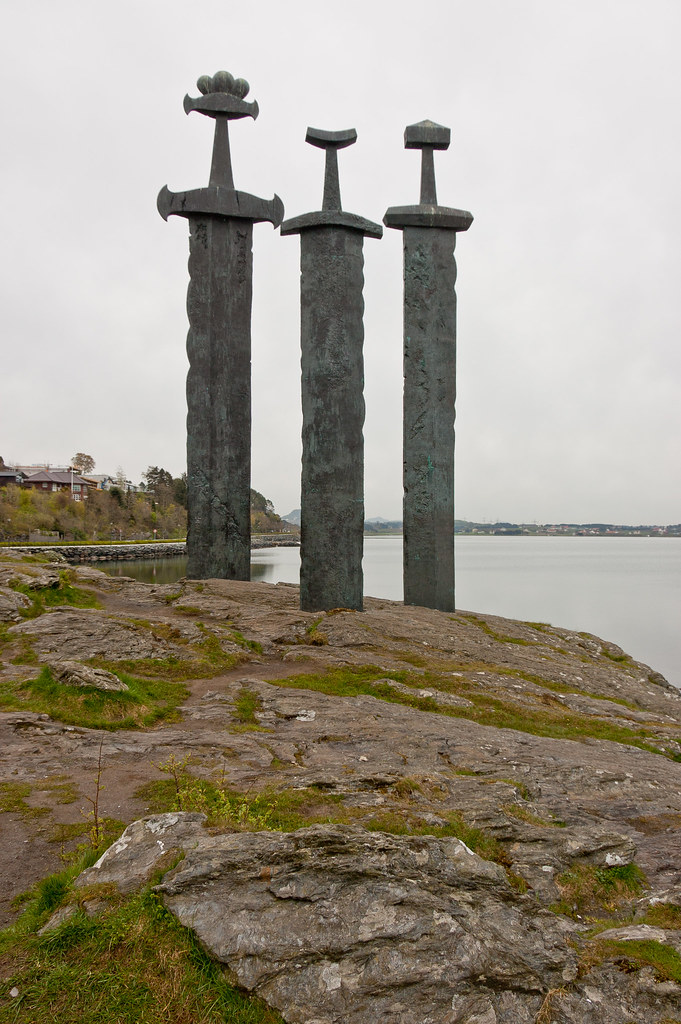
I took a shore excursion on one of my visits to Stavanger which visited several sites and museums. Our first stop was the Sword in the Rock Monument. It is comprised of three Viking swords forced into the ground, stands more than 30 feet tall, and commemorates the place where Viking King Harald Haarfagre (Fairhair) defeated the last of the regional princes in AD 872 and founded the Kingdom of Norway by uniting the 29 small kingdoms under one crown.
Above: The Sword in the Rock Monument.
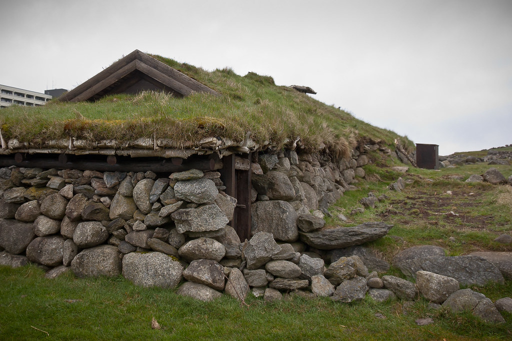
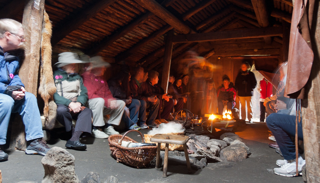
We then travelled on, through agricultural countryside to the Iron Age farm. On this farm are several earth huts, with grass roofs; the living conditions from 1,500 years ago have been recreated. The farm itself is situated in an area with burial mounds from the Bronze Age as well as from the time of the Vikings.
Above: Reconstructed huts which would have housed several families and their animals.
Above: The inside provided warmth and shelter on a cold day!
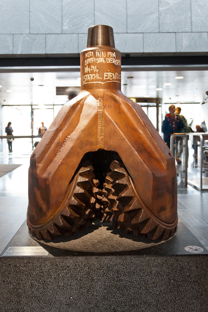
Afterwards, we visited the Archaeological Museum where we learnt about Viking tools, and had the myth about horned helmets dispelled (they never existed!). Our final stop was the Petroleum Museum which has many interactive exhibits, complete with demonstrations of how oil forms. There are exhibitions on land as well as simulated mini-platforms which were pretty cool!
Above: The museum houses the largest drill bit in the world, which weights 1,700kg and measures 90cm in diameter.
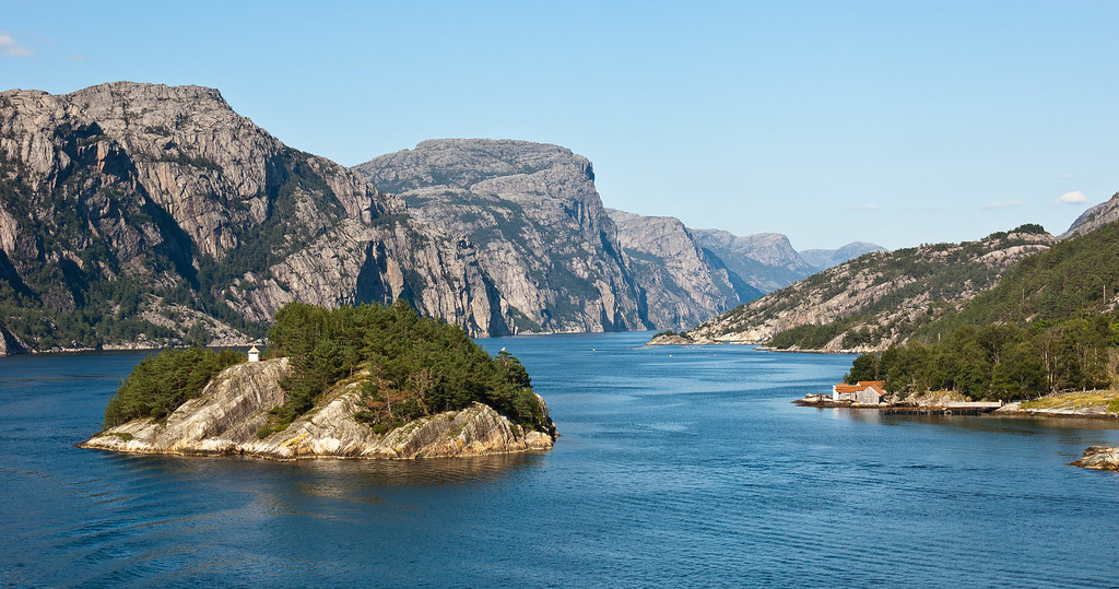
On our sail away from Stavanger, we visited Lysefjord, which is the home of Pulpit Rock - one of Norway's most spectacular natural wonders, jutting more than 1,500 feet above the sea. You can read about my epic climb to Pulpit Rock in a future blog post.
Above: Lysefjord - another beautiful Norwegian fjord.
Thursday, 20 September 2012
Kotor, Montenegro
Before I visited Kotor, I knew next to nothing about the country Montenegro. Now, I would very much like to go back to this amazing place!
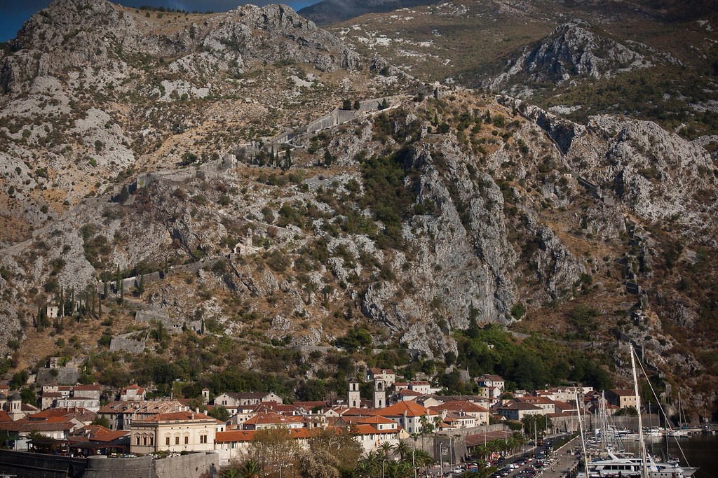
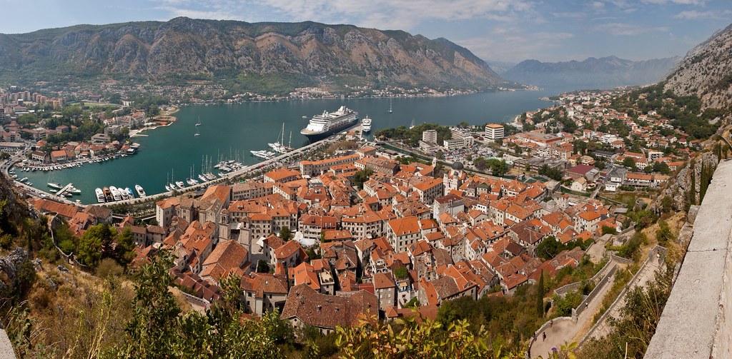
Above: The city of Kotor with the imposing wall stretching around and up the mountain.
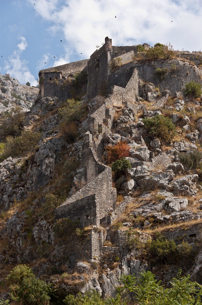
Kotor is a coastal city in Montenegro, located in a secluded part of the Gulf of Kotor. The old Mediterranean port is surrounded by impressive city walls which stretch up 3 miles above the city and were built by the Republic of Venice. Indeed, the Venetian influence remains predominant in the city's architecture.
Above: The city walls!
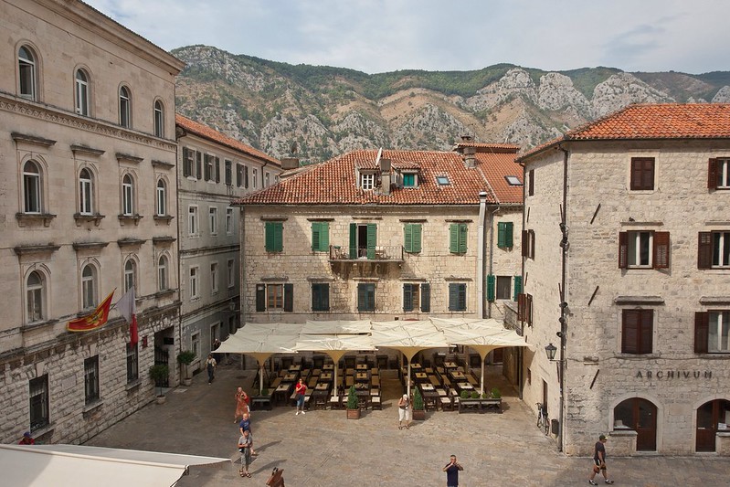
Kotor, first mentioned in 168 BC, was settled during Ancient Roman times, when it was known as Acruvium and was part of the Roman province of Dalmatia. The area has one of the best preserved medieval old towns in the Adriatic and is a UNESCO world heritage site.
Above: A town square, viewed from the Cathedral of Saint Tryphon, built in 1166.
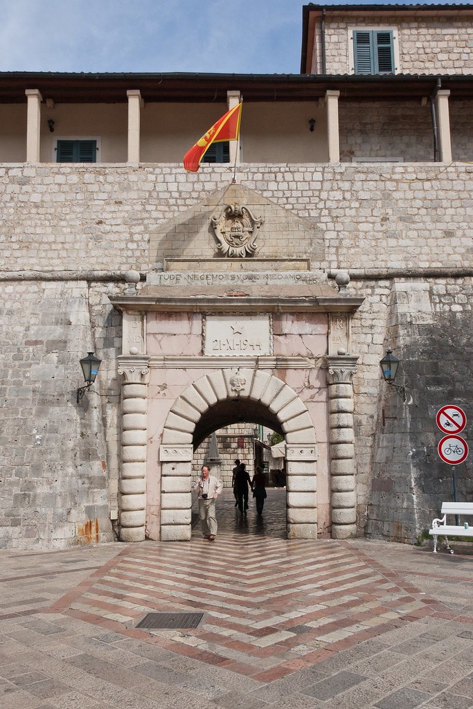
Above: The main city gate, a 30 second walk from our ship!
In recent years, Kotor has seen a steady increase in tourists, many of them coming by cruise ship. Visitors are attracted both by the natural beauty of the Gulf of Kotor and by the old town of Kotor.
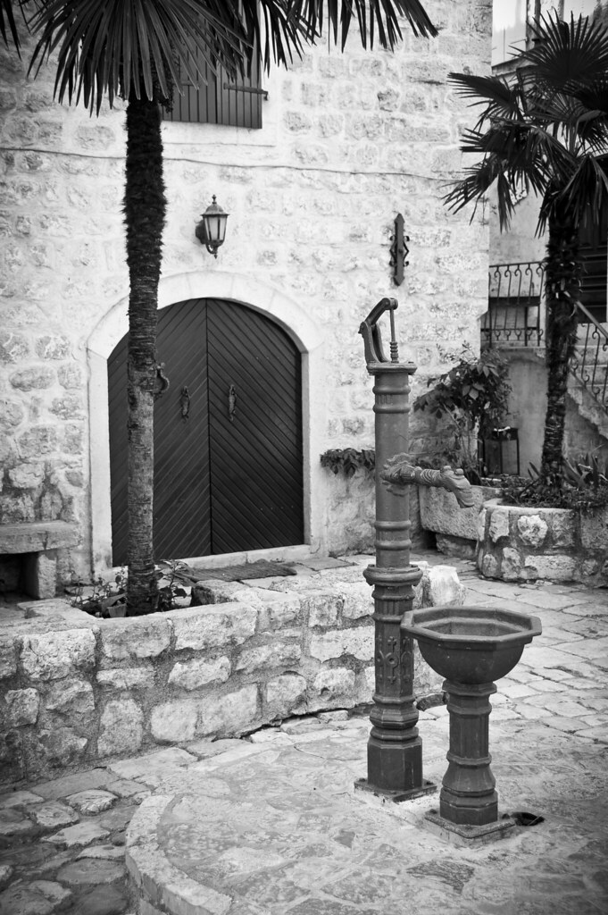
Above: A traditional water pump in one of the town's back streets.
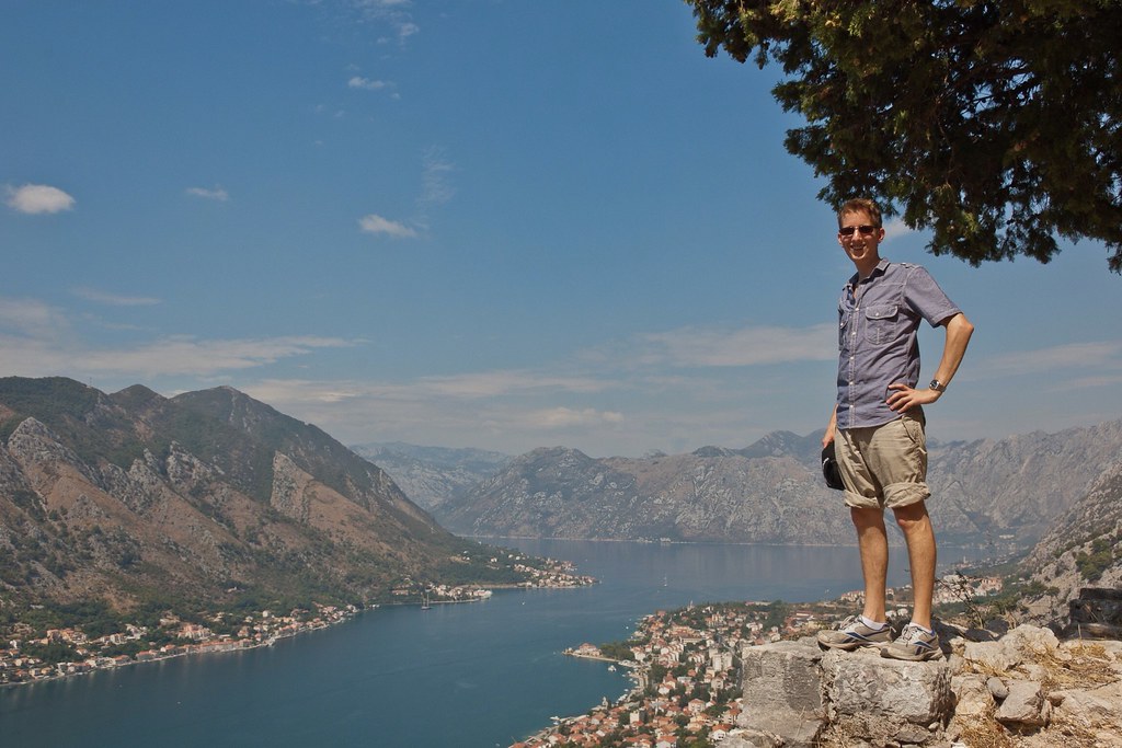
During my one-time visit, I saw the old town and climbed the city walls! It was a very hot day and the walls have not received much TLC in their history; the steps were crumbling away and there are no hand rails!
Above: Posing half-way up the city walls.
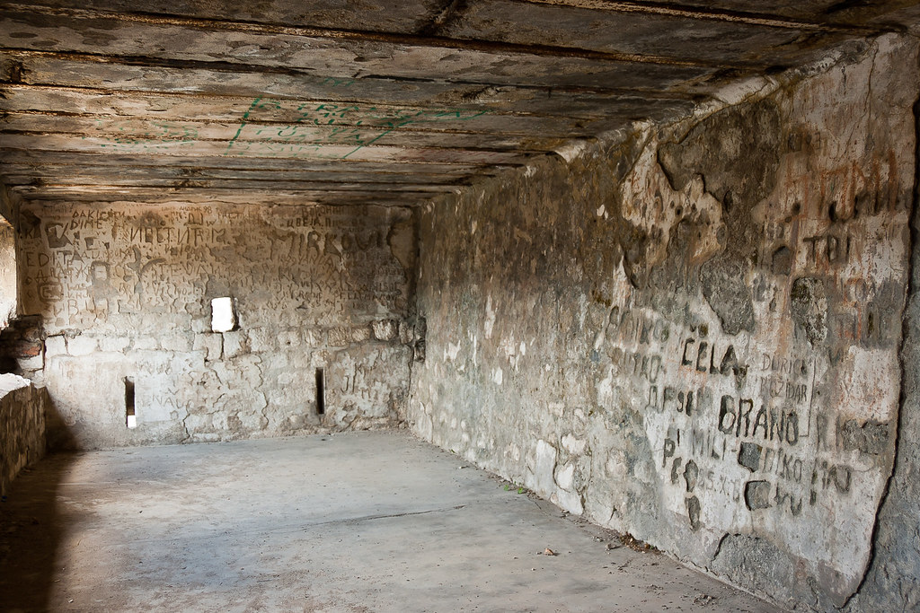
There are more recent artillery outposts and bunkers positioned around the wall and at the top of the climb - a reminder of Montenegro's more recent history.
Above: Military bunker at the summit of the city walls.
After the so called 'people's revolution' in Montenegro in 1988/89 the young socialists came to power. Under their rule Yugoslavia was torn apart in a bloody war. Since the proclamation of Montenegrin independence, all the financial and cultural establishments were drawn to the city of Podgorica (now the capital of Montenegro) resulting in the steady decline of Kotor.
Above: The view of the old town from the steep city walls.
Once I had reached the top of the city walls (which took less time than you might imagine), I explored the ruins and curious mix of architecture at the site. The walls are built onto a tall hill which then drops down to a small valley behind the hill before rising up to a huge mountain range.
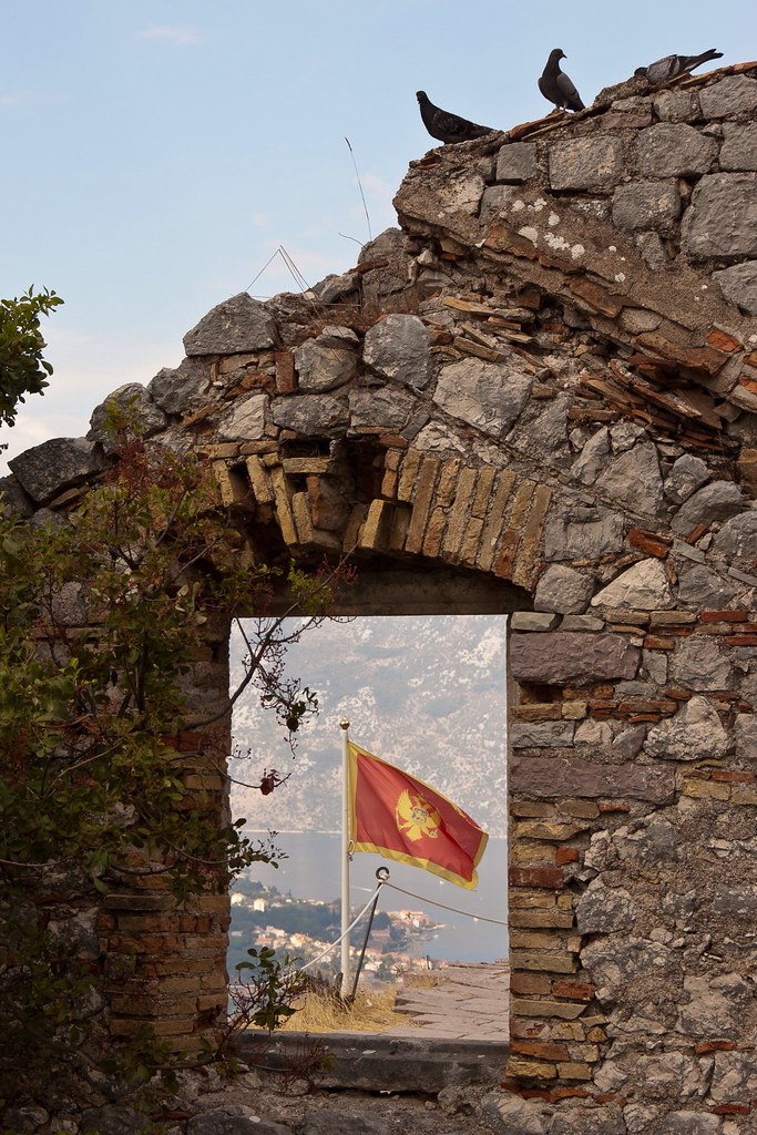
Above: The Montenegrin flag through the window of an old ruin.
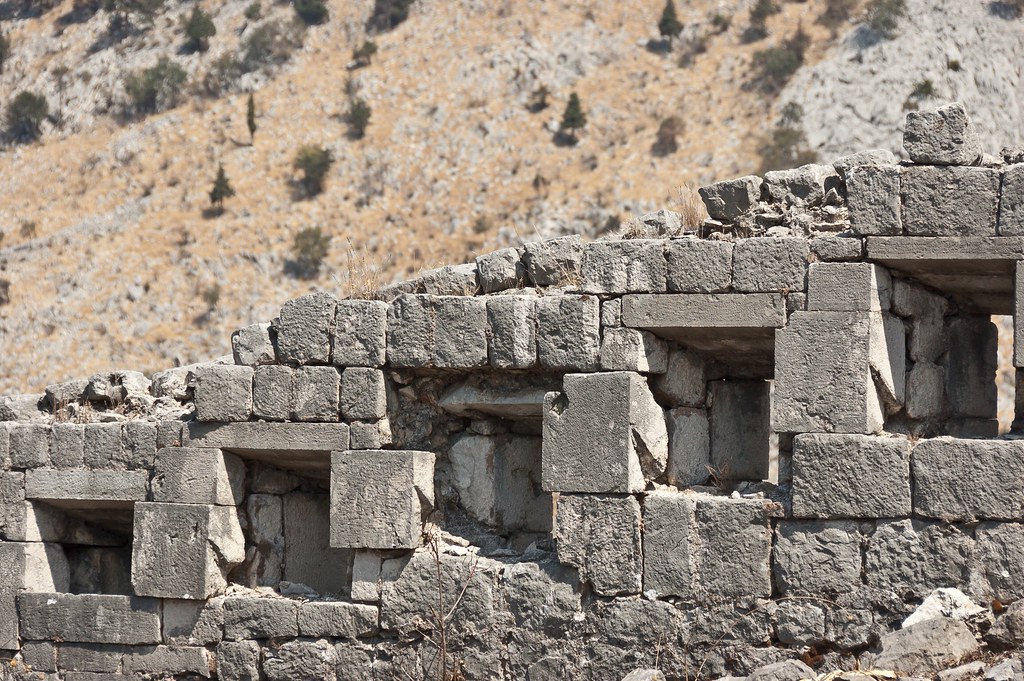
Above: Part of the city wall.
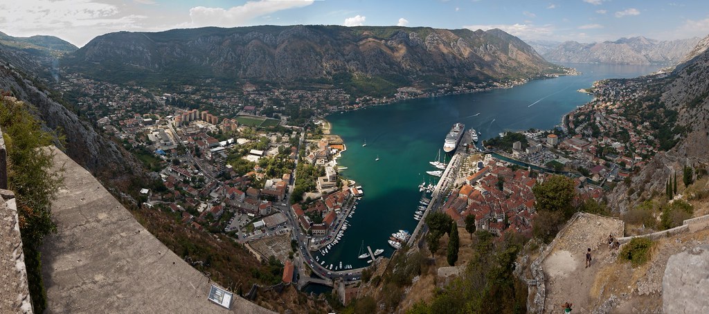
The Bay of Kotor is one of the most indented parts of the Adriatic Sea. Some have called it the southern-most fjord in Europe, but it is a ria, a submerged river canyon. Together with the nearly overhanging limestone cliffs of Orjen and Lovćen, Kotor and its surrounding area form an impressive and picturesque Mediterranean landscape.
Above: The view from the top of the city walls.
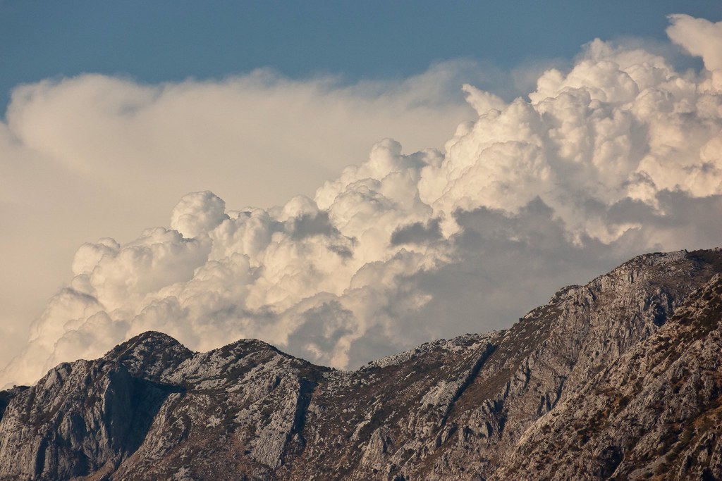
Above: Mountains rise up on either side of the bay.
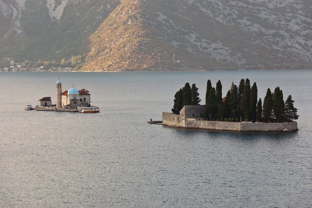
As we sailed away from the town and out of the Bay of Kotor, we passed two small islands, St. George island and Gospa od Škrpjela (Our Lady of the Rock), each with a picturesque chapel. Gospa od Škrpjela is particularly interesting as it is the only artificially built island in the Adriatic; it was built upon a rock after two Venetian sailors from Perast found a picture of the Virgin Mary on it in 1452.
Above: Gospa od Škrpjela, the artificial island is in the background with St. George island in the foreground.
I hope you enjoyed this brief look at Kotor. The town is amazing, and along with its close neighbour, Dubrovnik in Croatia, this is part of the world to which I would like to return!
Kristiansand, Norway
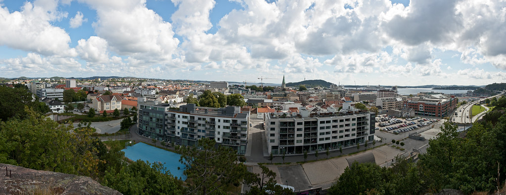
Welcome back! Today I want to show you Kristiansand, Norway; a fairly uninspiring town but with beautiful woodland and coastline surrounding it.
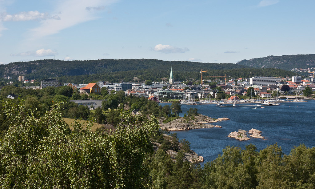
Above: Kristiansand as viewed from Baneheia woodland.
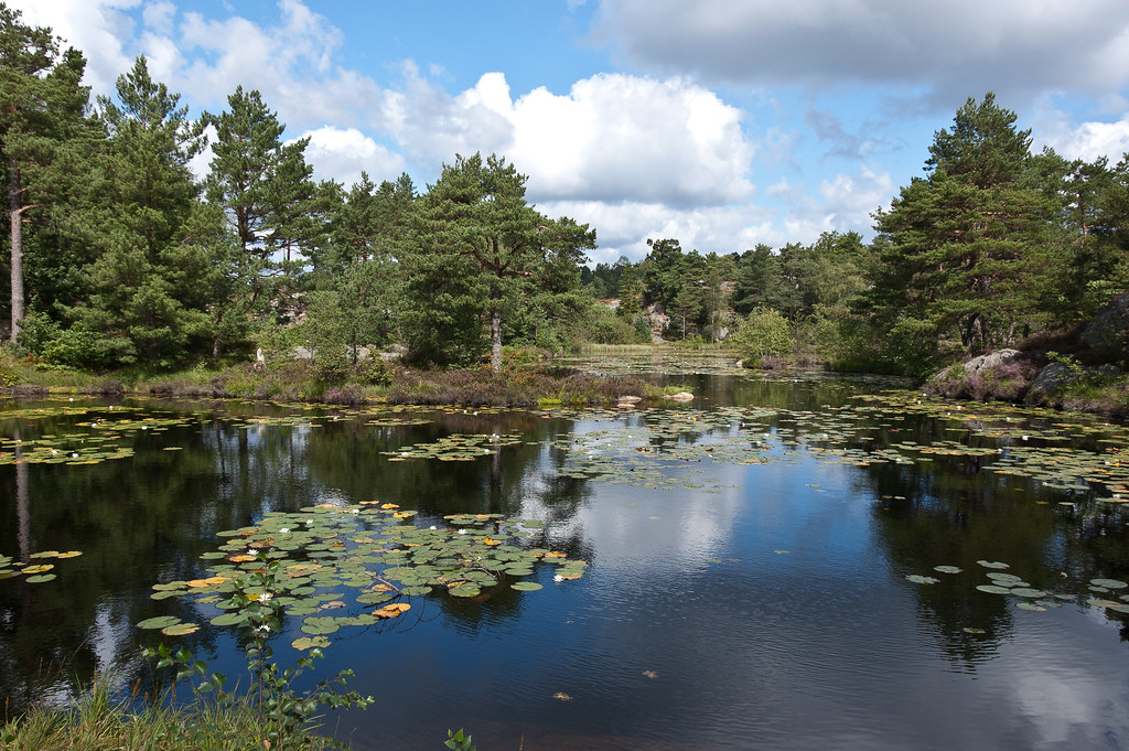
Kristiansand is a city in Southern Norway, the fifth largest in Norway with a population of 82,562 as of 1 April 2011. Surrounding the city are deep woods; Baneheia - an area created in 1860 for recreational use, and Odderøya, a former coastal artillery range, purchased from the military in 2003.
Above: One of the many lakes in the Baneheia woodland.
Both of these areas have ski paths for winter adventurers as well as beautiful forest trails and bridges. It must be wonderful for the residents of Kritiansand to have these woodlands so close to the town.
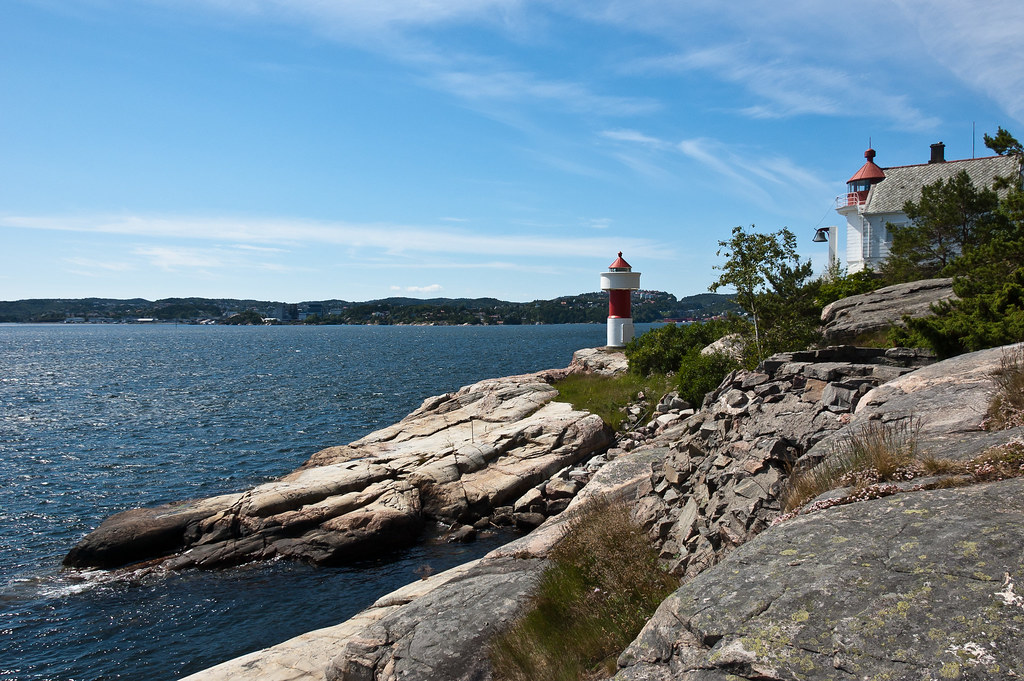
Above: Lighthouses on the former coastal artillery island of Odderøya.
Above: A view of Kristiansand from Odderøya.
On one of my visits to Kristiansand, I took a boat trip along the coastline which is scattered with small islands. The route was very beautiful with quaint coastal communities of traditional mariners’ houses, now converted to holiday homes, lining the shore.
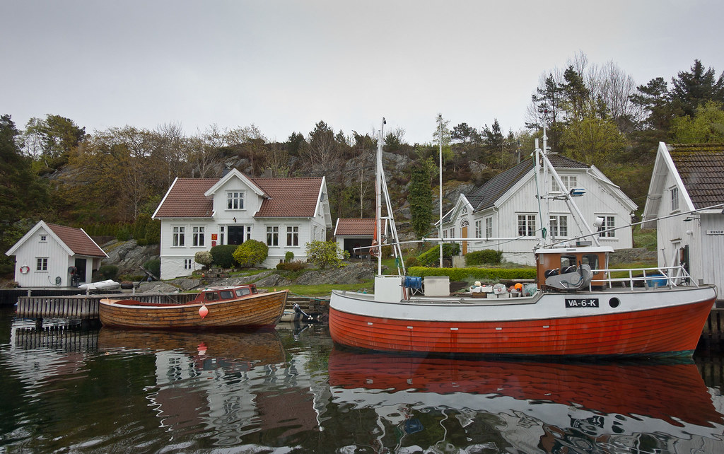
Above: Traditional mariners' houses.
For the second part of our tour we took a coach to the town of Lillesand. Once bustling with maritime activity, Lillesand features 18th- and 19th-century white timber houses.
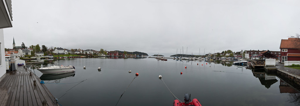
Above: The harbour at Lilesand.
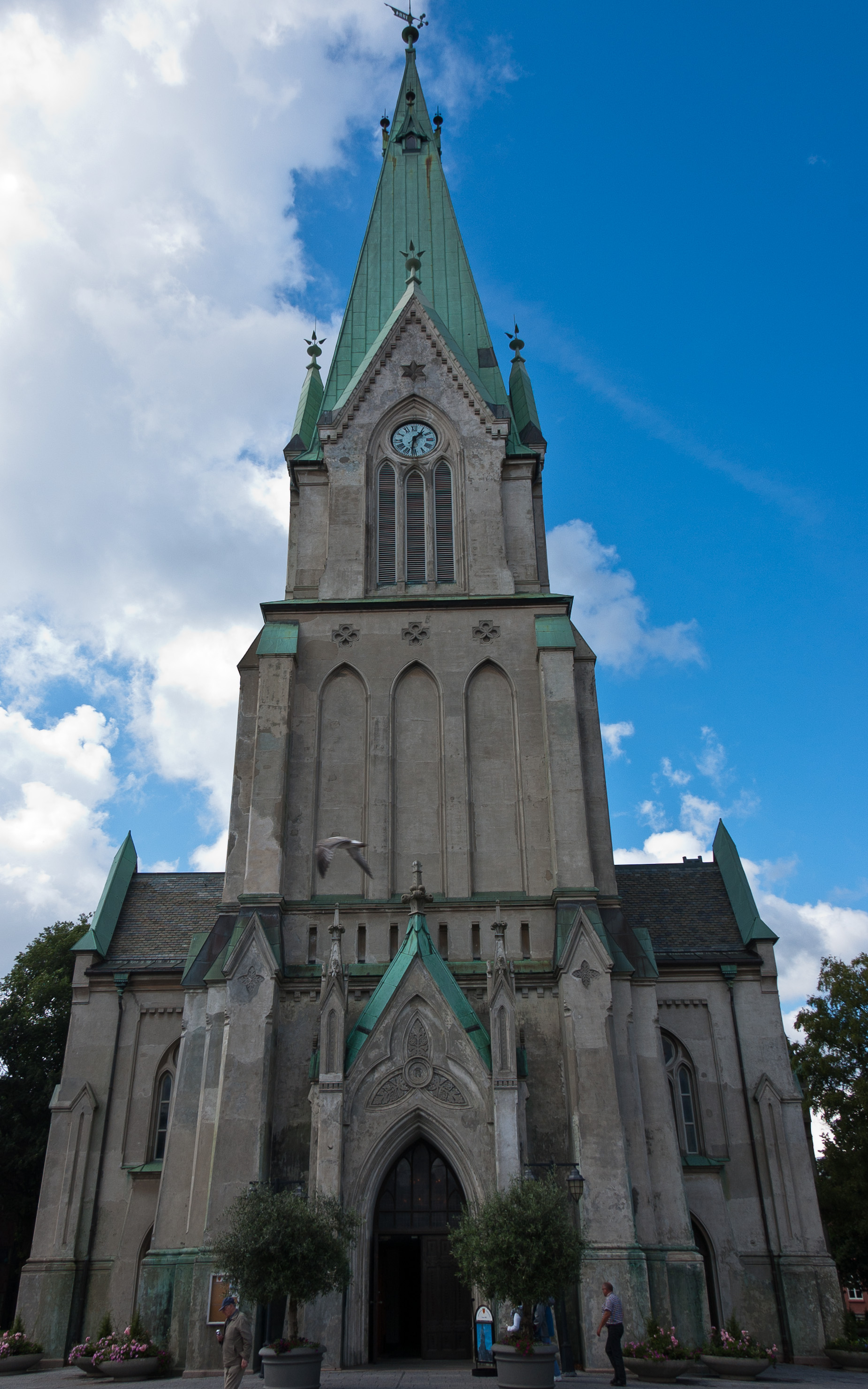
I'll leave you with a picture of the impressively large church in the centre of Kristiansand, constructed in 1885. Thanks for reading!
Eidfjord, Norway
Welcome back to my blog! I'm now back at home and catching up with the backlog of places to tell you about! Today we go back to Norway with Eidfjord!
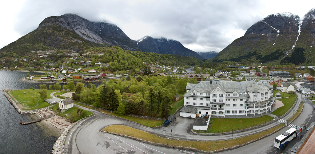
Above: The view of Eidfjord from the ship.
Situated where the Hardangerfjord ends, Eidfjord is at the centre of a region that is sometimes referred to as the orchard of Fjord Norway (Norway’s westernmost region). The mild climate along the 111-mile long Hardangerfjord sees apples, plums, pears and cherries being grown here.
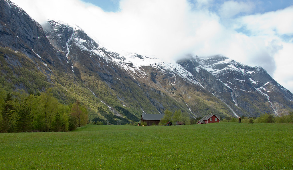
Above: A meadow on top of a nearby hill with a beautiful circular walk.
The blossom season in May and June is unique: The white, pink and red flowers of the fruit trees practically cover the mountain sides – all the way down to the blue fjord.
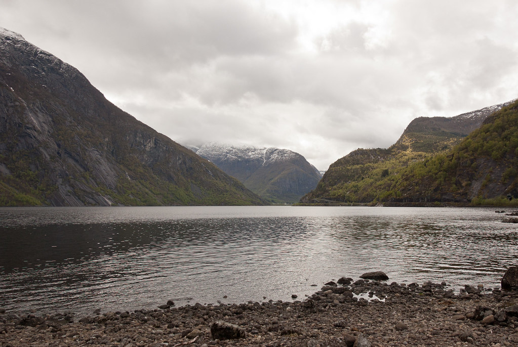
Above: Lake Eidfjordvatnet, a short walk from Eidfjord.
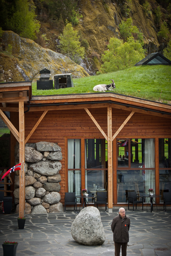
The town itself is fairly small with another settlement further down the valley. A short drive past lake Eidfordvatnet brings you to the Hardangervidda Natursenter (Nature Centre), a building with a turf roof and resident goats!
Above: Goats on the roof of the Nature Centre. There is a fence to stop them falling off and a small shelter in the centre of the roof.
Eidfjord’s 1000 or so inhabitants have at their doorstep one of Europe's best-known National Parks. Covering 2,500 square miles the Hardangervidda is also Europe's largest mountain plateau. One of Norway’s largest glaciers can be found on the plateau, which is entirely above the tree line.
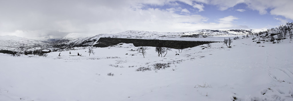
Above: The Hardangervidda as seen in May, with the Sysendam on the right of the picture.
Many hikers like to walk across the plateau in summer and there are small hiking cabins available with supplies and basic living quarters for explorers to spend the night!
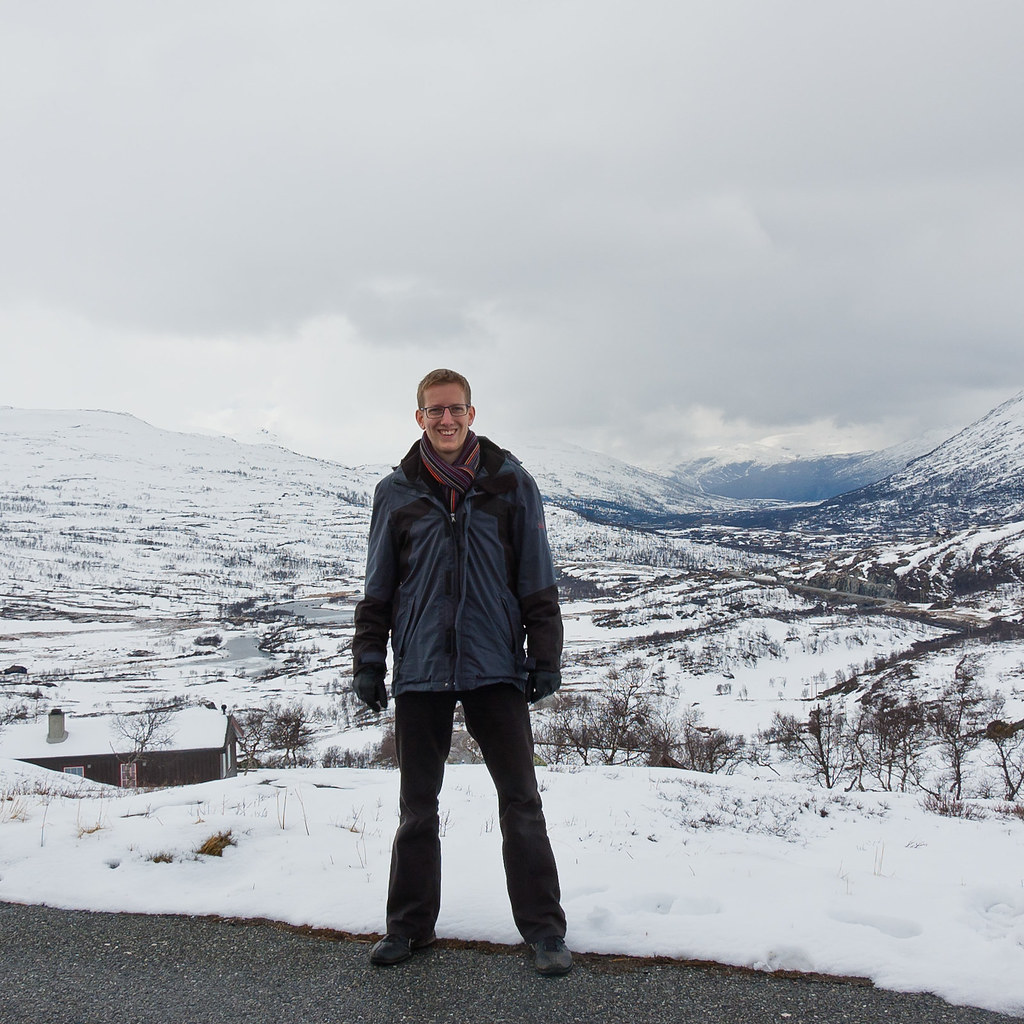
Above: On the Hardangervidda!
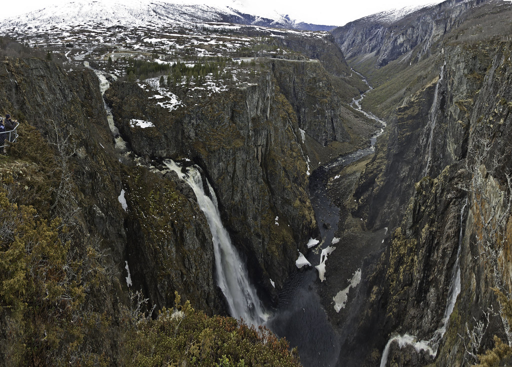
The Vøringsfossen waterfall has for a long time been Norway’s most visited natural attraction with its fall of 600 feet. Bjoreia, the small river that flows into Vøringfossen, has a hydroelectric dam in the Sysendalen valley above the falls, reducing the flow of water (see previous picture). In summer, the flow is increased to 12 m3/s, above its natural rate, not least to benefit the tourist trade.
Above: Vøringsfossen waterfall. On my second visit to the falls with my family, you could not see the falls due to the cloud!
Thanks for reading! More Norway coming soon.
Thursday, 13 September 2012
Dubrovnik, Croatia
Welcome back to my blog! Today, I have a truly amazing place to show you - Dubrovnik, Croatia. A city on the Adriatic Sea, Dubrovnik is one of the area's most prominent tourist destinations and a UNESCO World Heritage Site.
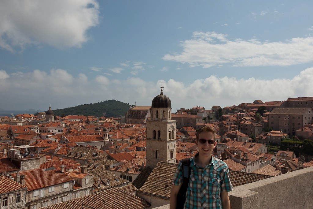
Above: Standing on the city walls of Dubrovnik.
Croatia can be found at the crossroads of Central Europe, the Balkans, and the Mediterranean. Covering just over 20,000 square miles with more than a thousand islands off its Adriatic Sea coast, it has diverse, mostly continental and Mediterranean climates. The country's population is 4.29 million, most of whom are Croats, with the most common religion being Roman Catholicism.
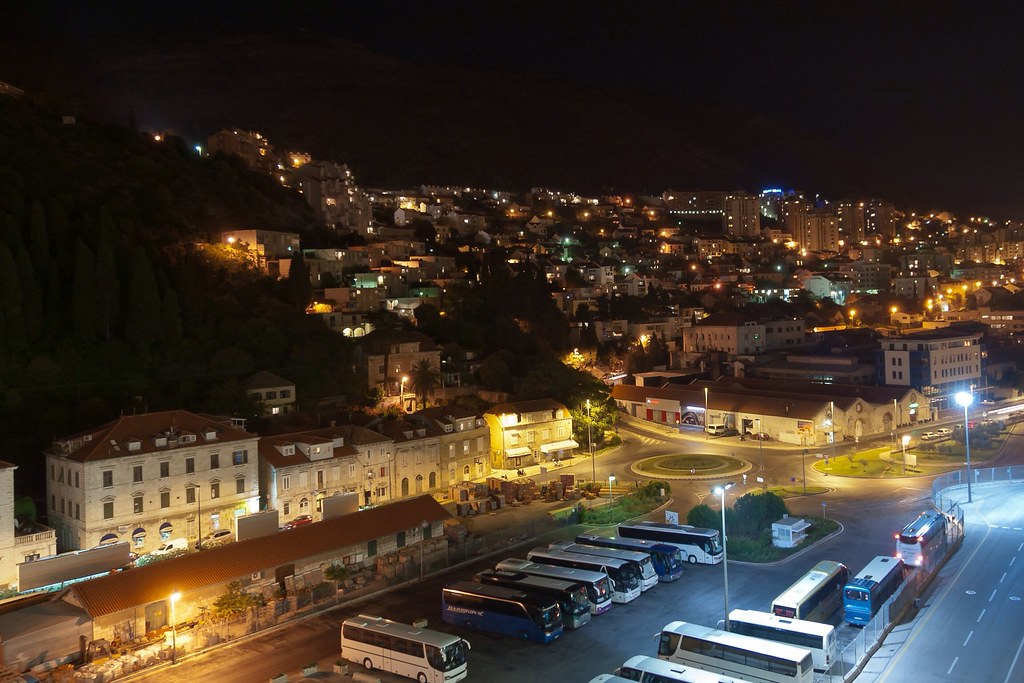
Above: A night time shot from the Ryndam, docked in the next town along from Dubrovnik.
In the early 7th century the Croats arrived in the area of present-day Croatia. Tomislav became the first king by 925 AD, elevating Croatia to the status of a kingdom. The Kingdom of Croatia retained its sovereignty for nearly two centuries, before entering into a personal union with Hungary in 1102.
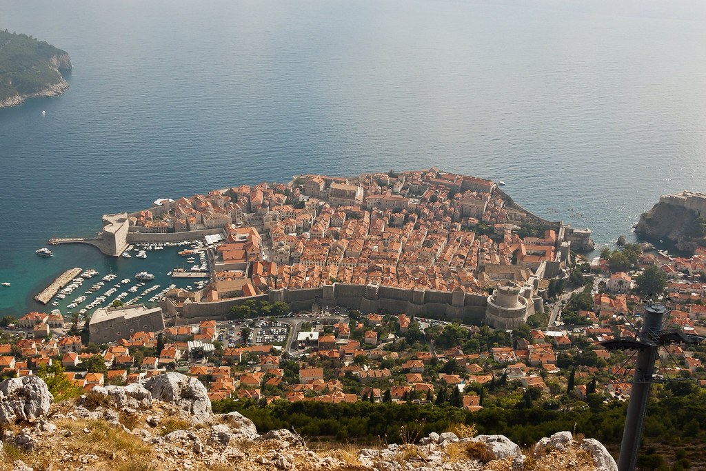
Above: Looking down on Dubrovnik from on high. You can clearly see the city walls.
In 1918, after World War I, Croatia was included in the short-lived State of Slovenes, Croats, and Serbs which seceded from Austria–Hungary and merged into the Kingdom of Yugoslavia. A fascist Croatian puppet state existed during World War II. After the war, Croatia became a founding member and a federal constituent of Second Yugoslavia, a socialist state. In June 1991, Croatia declared independence, which came into effect on 8 October of the same year.
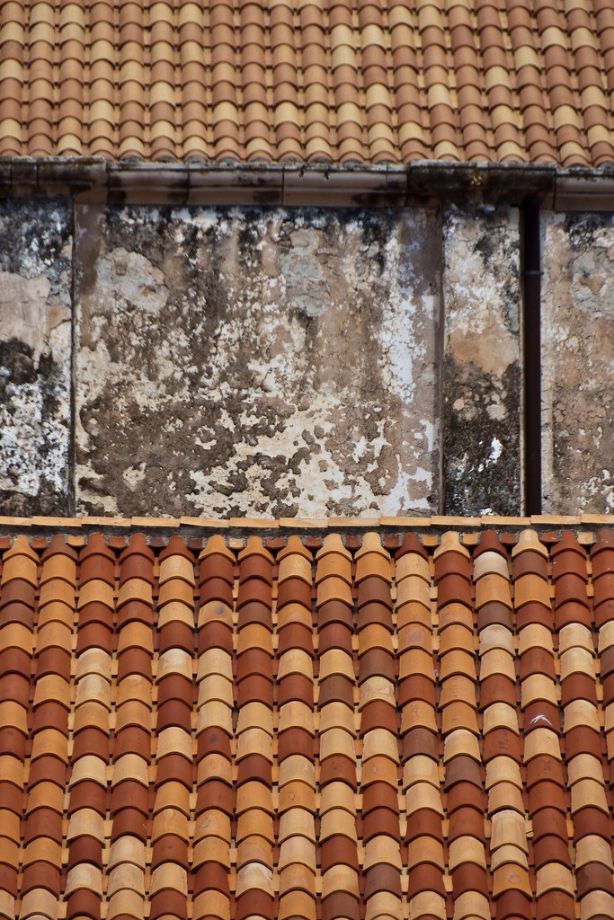
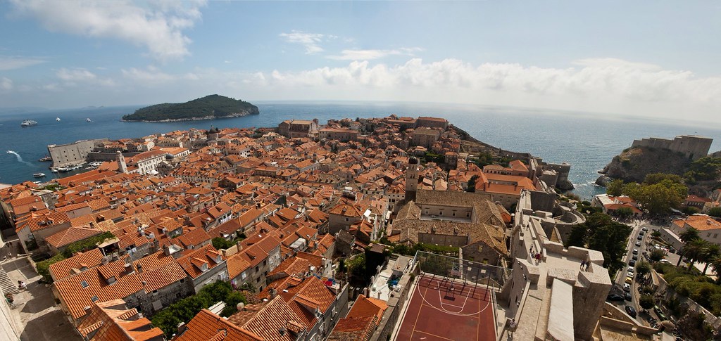
Above: The famous red tiles of Dubrovnik.
In 1991, after the breakup of Yugoslavia, Dubrovnik was besieged by Serb-Montenegrin forces for 7 months and received significant shelling damage. The regime in Montenegro which was installed by and loyal to the Serbian government led by Slobodan Miloševic, declared that Dubrovnik would not be permitted to remain in Croatia because they claimed it was historically part of Montenegro.
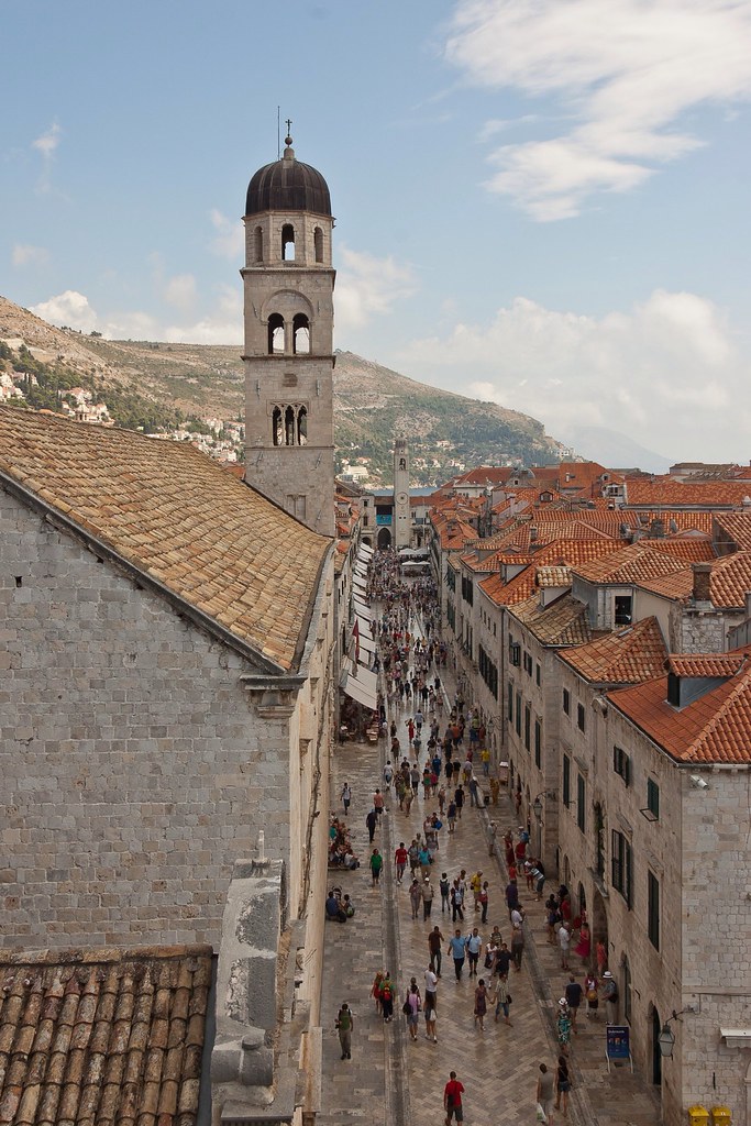
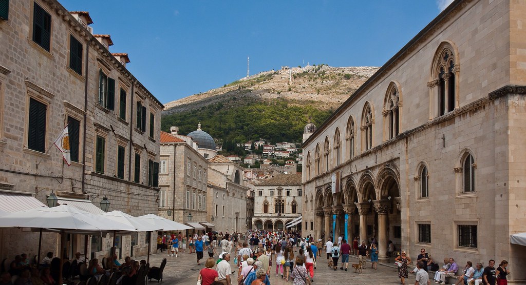
Above: Stradun, Dubrovnik's main street.
The heaviest artillery attack was on December 6 1991 with 19 people killed and 60 wounded. The historic walled city sustained 650 hits by artillery rounds, damaging 56% of its buildings. In May 1992 the Croatian Army lifted the siege and liberated Dubrovnik's surroundings, but the danger of sudden attacks by the Serb-Montenegrin forces lasted for another three years.
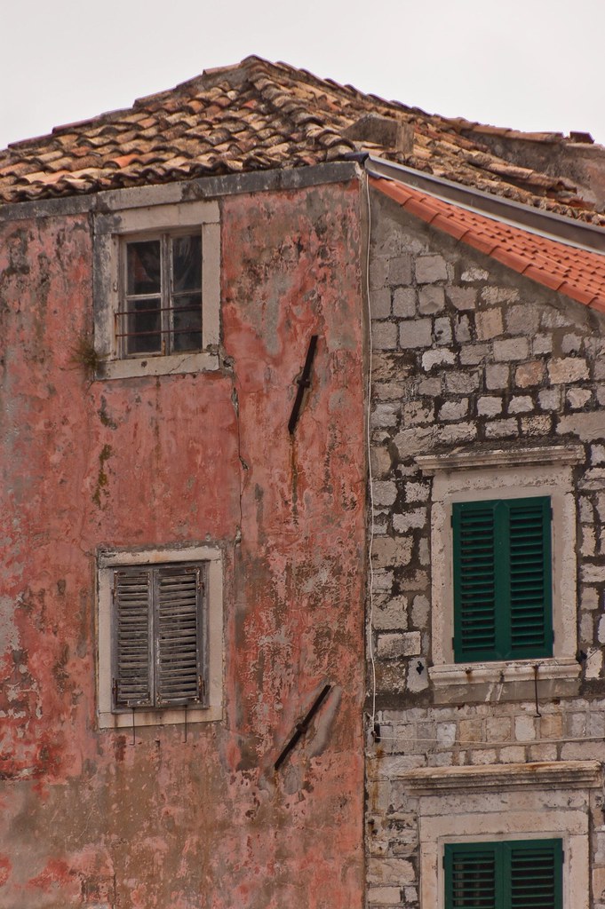
Above: Weathered walls and facades make for interesting photos.
Following the end of the war, damage caused by the shelling of the town was repaired. Adhering to UNESCO guidelines, repairs were performed in the original style. Today, nearly all of the damage has been repaired.
Above: A panoramic shot overlooking the city from the tallest tower of the city wall at Fort Minceta.
The prosperity of the city of Dubrovnik has always been based on maritime trade. In the Middle Ages it became the only eastern Adriatic city-state to rival Venice. Supported by its wealth and skilled diplomacy, the city achieved a high level of development, particularly during the 15th and 16th centuries.
Above: Another street, with the Sponza Palace in the distance (centre) and the Rectors Palace to the right.
Few of Dubrovnik's Renaissance buildings survived a catastrophic earthquake in 1667 which killed 5,000 citizens and levelled most of the public buildings. Fortunately however, enough remain to give an idea of the city's architectural heritage. The finest Renaissance highlight is the Sponza Palace which dates from the 16th century and is currently used to house the National Archives.
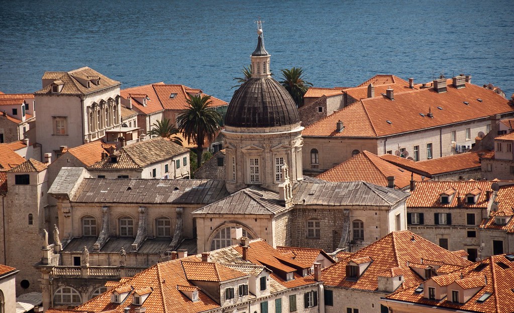
Above: Dubrovnik's baroque Cathedral, built in the 18th century.
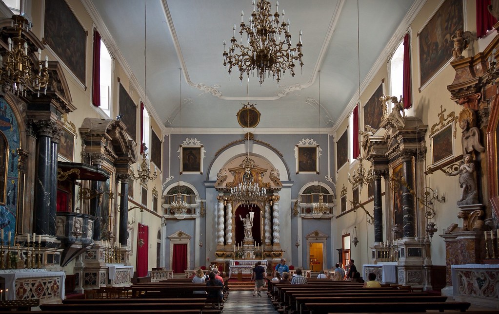
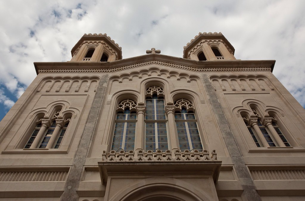
Other structures of interest include the Rectors Palace (a Gothic-Renaissance structure), the Orthodox Church, the Franciscan Monastery (with a library of 30,000 volumes and 1,500 valuable handwritten documents) and the St. Saviour Church (see below).
Above: Inside St. Saviour's Church.
Above: The Orthodox Church of Dubrovnik.
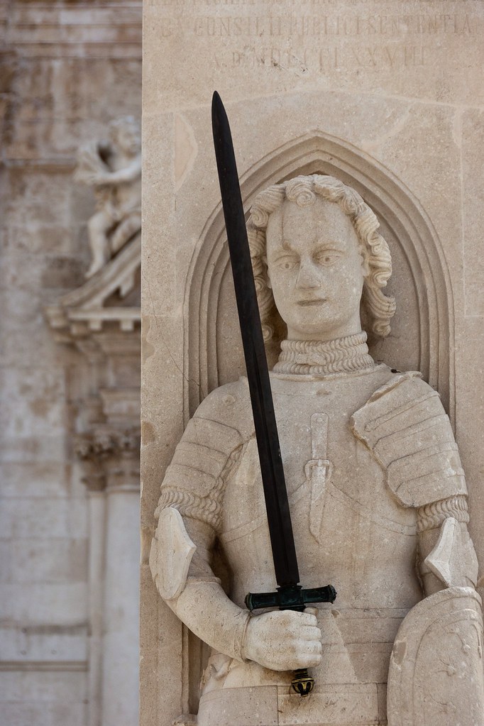
The most famous statue in the city is the Orlando statue which was used as a symbol of a city under protection of the Hungarian-Croatian King. At the time it was common for the distant cities of the Hanseatic League to erect similar stone statues symbolizing the alliance and protection with the Hungarian-Croatian kingdom. Orlando's statue is the work of the local sculptor Antun Dubrovcanin and master sculptor Bonino di Milano from 1418.
Above: The Orlando statue.
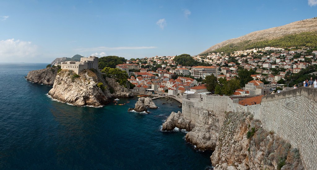
A feature of Dubrovnik is its walls that run almost 2 km around the city. The walls run from four to six metres thick on the landward side but are much thinner on the seaward side. The system of turrets and towers were intended to protect the vulnerable city.
Above: The city walls to the right with Fort Lovrijenac to the left.
As well as exploring the city I also rode the cable car to the top of the surrounding hills. Not only did this afford a great view of the city, but I was also wowed by the huge mountain range behind the cable car station which is not visible from ground level:
Above: The mountain range!
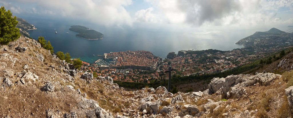
I'll leave you with a final panoramic shot of Dubrovnik and its surroundings, taken from the cable car station. This was one of my favourite Mediterranean ports, and I would highly recommend taking a trip if you can. The town was very busy with tourists but there are always quieter side streets and alleys to explore!
Subscribe to:
Posts (Atom)