CRUISE MAP


View Cruise Destinations in a larger map

Monday, 8 October 2012

Saint Petersburg, Russia - Part One

Welcome back to my blog. One of the highlights of my European cruise was the chance to visit Saint Petersburg in Russia for four days - two overnight stays on each of our Baltic cruises! I visited a lot of beautiful palaces and churches so sit back and enjoy part one of my Russian adventure!

Untitled_HDR2
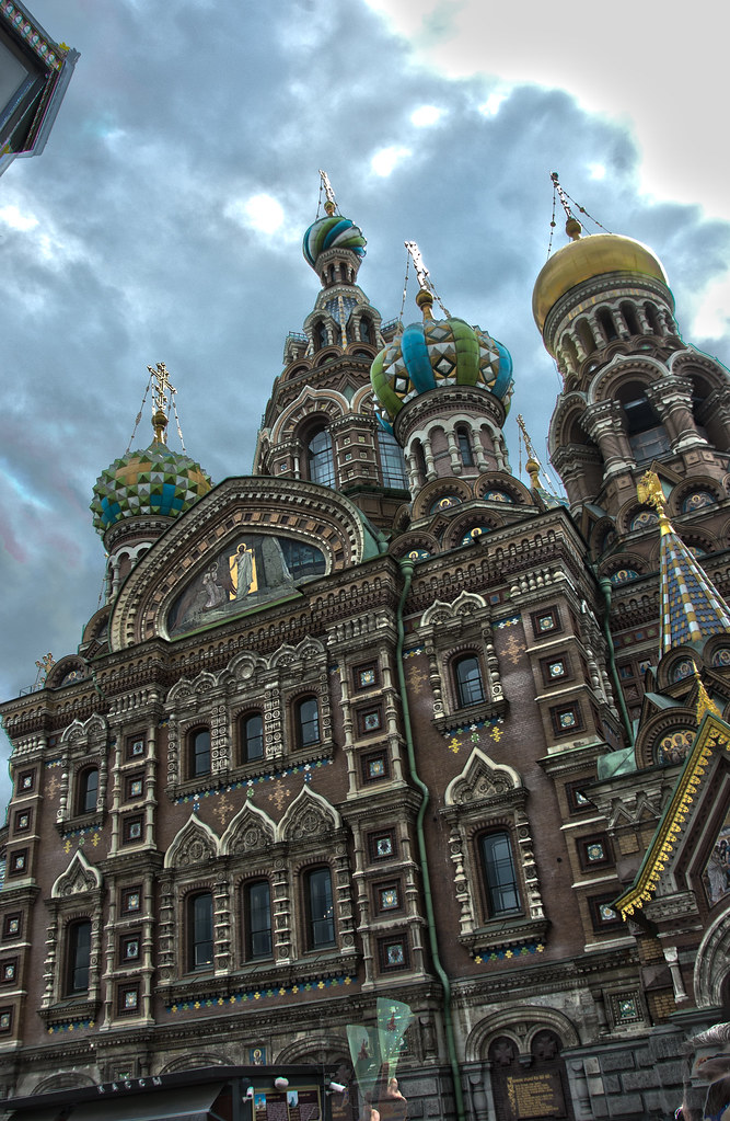
Above: The Church of the Saviour on Spilled Blood - one of the most famous buildings in Saint Petersburg.

Saint Petersburg is located on the Neva River at the head of the Gulf of Finland on the Baltic Sea. It is Russia's second largest city after Moscow with almost 5 million inhabitants. In 1914 the name of the city was changed to Petrograd, in 1924 to Leningrad and in 1991 back to Saint Petersburg. Founded by Tsar Peter the Great on May 27 1703, the city was the Imperial capital of Russia from 1713 to 1728 and from 1732 to 1918, whereupon the central government bodies moved from to Moscow, owing to the advancement of German troops across the West Estonian archipelago.
DSC_9250
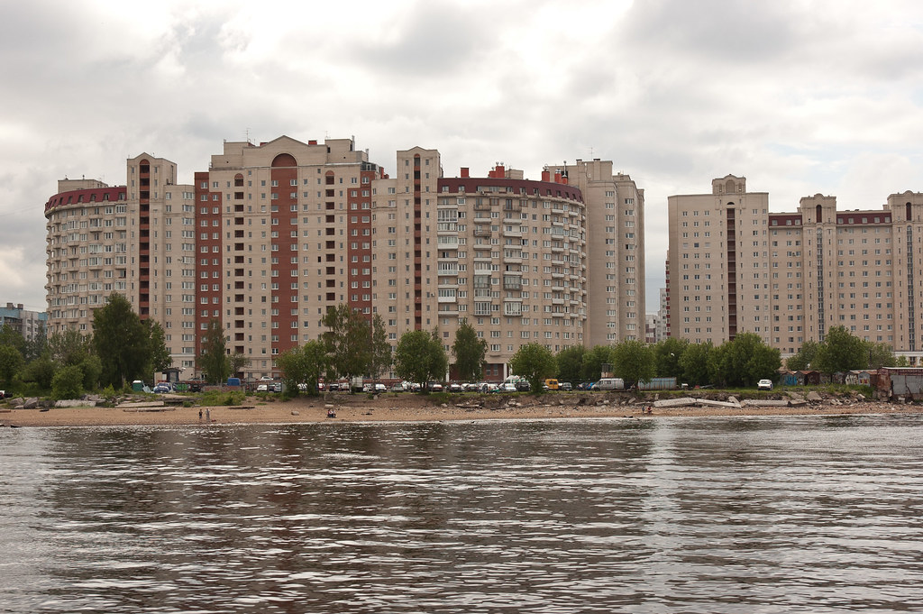
Above: Soviet-era housing dominates the outskirts of the city.

On 7 November 1917, the Bolsheviks, led by Vladimir Lenin, stormed the Winter Palace in an event known thereafter as the Great October Socialist Revolution, which led to the end of the post-Tsarist provisional government, the transfer of all political power to the Soviets, and the rise of the Communist Party.
DSC_9271
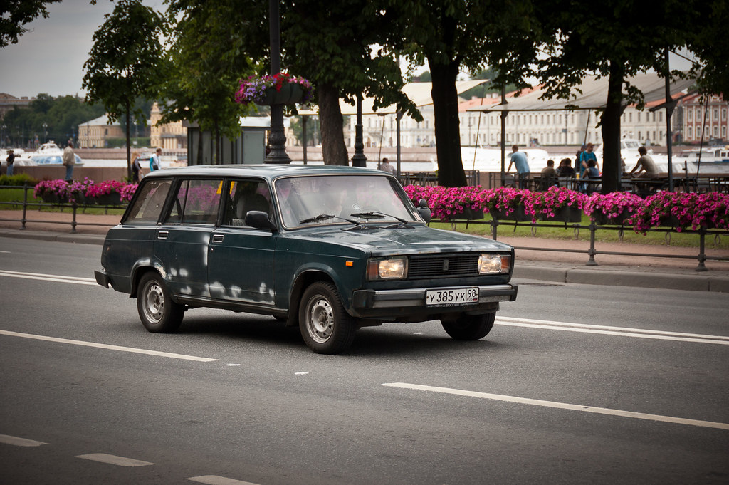
Above: Cars like these were not atypical although we did see many modern vehicles too!

Saint Petersburg is often described as the most Western city of Russia and is a major European cultural centre, with the historic heart of the city a UNESCO World Heritage Site. Unlike in Moscow, in Saint Petersburg the historic architecture of the city centre, mostly consisting of Baroque and neoclassical buildings of the 18th and 19th centuries, has been largely preserved. The oldest of the remaining building is a wooden house built for Peter I in 1703 on the shore of the Neva near Trinity Square.

DSC_9261
Above: The Winter Palace of the Hermitage, one of the largest art museums in the world.

During my time in Russia, I took two fairly comprehensive shore excursions which covered many of the main sites in Saint Petersburg. For passengers, these tours are the only way to leave the ship unless you have an expensive visa, so the coaches were always full and I had a hard job counting groups (which is part of your responsibility as a crew escort!) All of the sites were extremely busy and the guides used audio headsets to communicate with the group - an additional complication as not all passengers are as technologically minded as you or I!
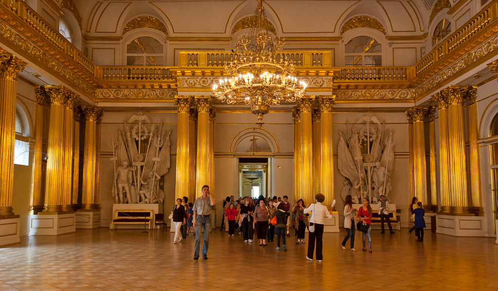
DSC_0321
Above: One of the thrones rooms in the Winter Palace at the Hermitage.

One of the shore excursions I took visited the Hermitage museum, one of the largest and oldest museums in the world. The museum was founded in 1764 by Catherine the Great and has been open to the public since 1852. Its collections, of which only a small part is on permanent display, comprise nearly three million items, including the largest collection of paintings in the world.
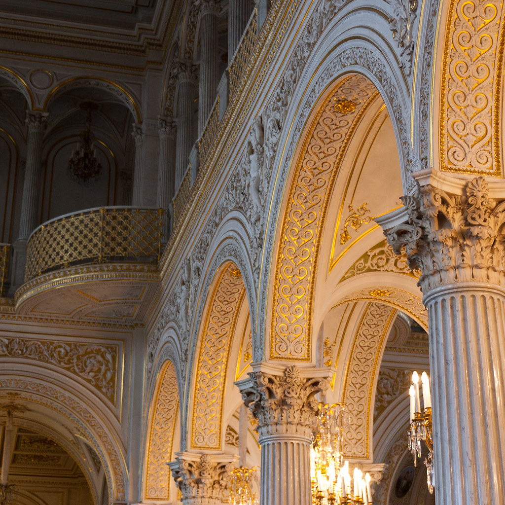
DSC_0343
Above: Another impressive room in the Hermitage.

The collections occupy a large complex of six historic buildings along Palace Embankment, including the Winter Palace, a former residence of Russian emperors. In her lifetime Catherine acquired 4,000 paintings from the old masters, 38,000 books, 10,000 engraved gems, 10,000 drawings, 16,000 coins and medals and a natural history collection filling two galleries.
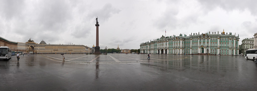
Untitled_Panorama1
Above: Palace Square comprising of the Winter Palace, Alexander Column and General Staff Building.

It is impossible to see everything in this museum but we caught some of the highlights including Van Gough paintings and the 'Golden Room' which houses incredibly rare gold artefacts from ancient history. The museum's buildings are as much of an attraction as the exhibits themselves which included Egyptian antiquities, Classical antiquities, Prehistoric art, Jewellery and decorative art, Italian Renaissance and Spanish fine art, Dutch Golden Age, Flemish Baroque, German, British, Swiss and French fine art as well as Neoclassical, Impressionist, and post-Impressionist art.
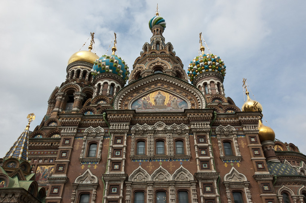
DSC_9361
Above: The rear view of the Church of the Saviour on Spilled Blood.

Along with the Hermitage, the Church on Spilled Blood is one of the most famous attractions in central Saint Petersburg. Construction began in 1883 under Alexander III, as a memorial to his father, Alexander II. On March 13, 1881, as Tsar Alexander's carriage passed along the embankment, a grenade thrown by an anarchist conspirator exploded. The tsar, shaken but unhurt, got out of the carriage and started to remonstrate with the presumed culprit. A second conspirator took the chance to throw another bomb, killing himself and mortally wounding the tsar. The tsar, bleeding heavily, was taken back to the Winter Palace where he died a few hours later.
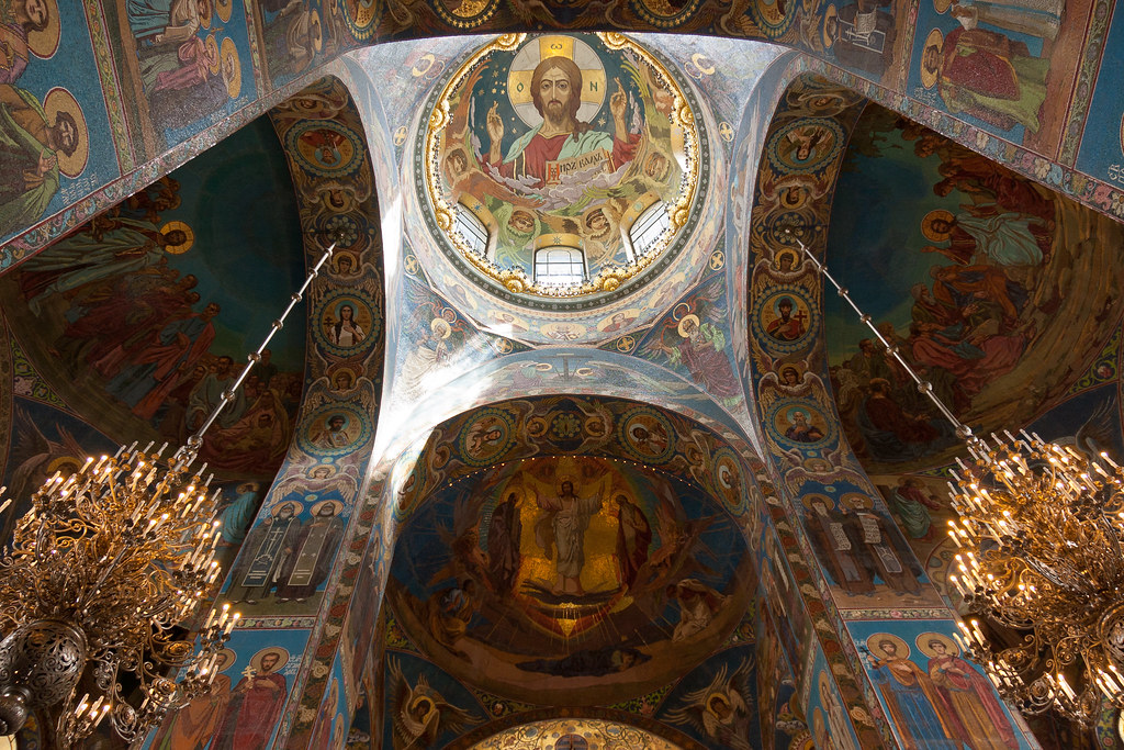
DSC_9323
Above: Inside the Church. Every single surface is covered in astonishing mosaic artwork.

It was decided that the section of the street where the assassination had taken place was to be enclosed within the walls of a church. Inside, an elaborate shrine was constructed on the exact place of Alexander's death, garnished with topaz, lazurite and other semi-precious stones. Amid such rich decoration, the simple cobblestones on which the tsar's blood was spilled and which are exposed in the floor of the shrine provide a striking contrast.
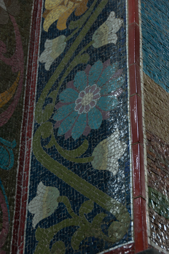
DSC_9331
Above: You can see the mosaic texture more clearly here.

Architecturally, the Cathedral differs from St. Petersburg's other structures. The city's architecture is predominantly Baroque and Neoclassical, but the Saviour on Blood harks back to medieval Russian architecture in the spirit of romantic nationalism. The Church contains over 7500 square metres of mosaics—according to its restorers, more than any other church in the world.

DSC_9325
Above: More incredible artwork.

Thanks for reading and I'll be back soon with part two featuring two of the most incredible palaces I have seen - Catherine's Palace and Peterhof.


Thursday, 4 October 2012

Oslo, Norway

Welcome back to my blog! Today is my last post from beautiful Norway and I have saved the capital for last - it's Oslo!

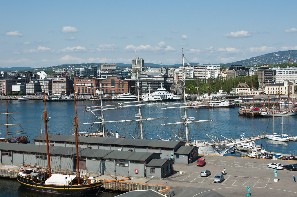
DSC_7991
Above: Oslo Harbour.

Oslo was founded around 1048 by King Harald III, and after being destroyed by a fire in 1624, the city was moved closer to Akershus Castle (next to where our ship docked) during the reign of King Christian IV. The city is the economic and governmental centre of Norway and is also a hub of Norwegian trade, banking, industry and shipping. It has an estimated population of about 1 million people.

DSC_7938
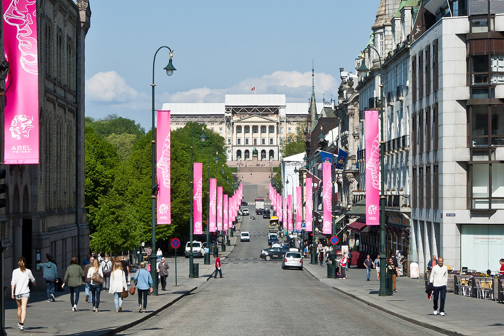
Above: Looking towards the Royal Palace (Slottet) which was built in the early 1800s and is the official residence of the present Norwegian Monarch with 173 rooms.

Oslo is built in a horseshoe shape on the shores of the Oslofjord and limited in most directions by hills and forests. As a result, any point within the city is relatively close to the forest which has resulted in a city very much shaped and influenced by nature.

DSC_7949
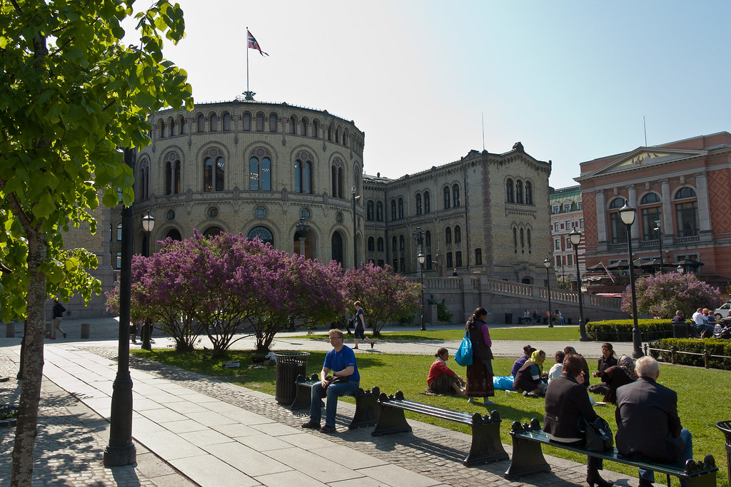
Above: The Storting, Norway's national parliament which lies at the opposite end of the street to the Royal Palace.

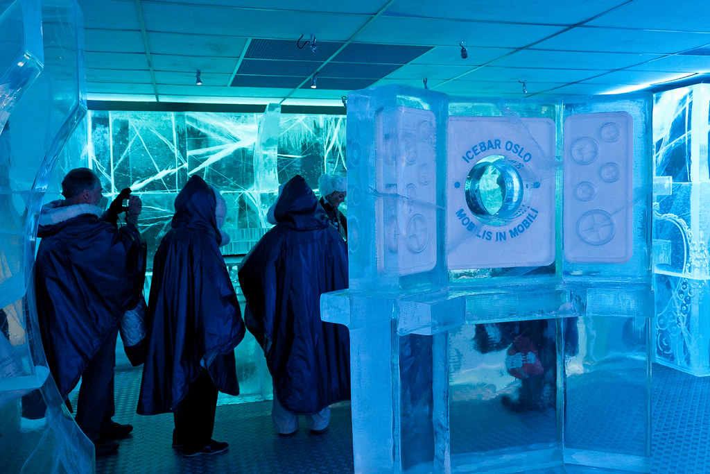
I did a walking tour of the city, and we had the opportunity to visit Oslo's Ice Bar which is the only permanent bar in Norway made entirely of ice. The bar is kept at minus five centigrade at all times and everything is made out of crystal clear ice, harvested from the frozen Torne River in Northern Sweden. Even the glasses are made of ice and once we were equipped with fur-lined cloaks, we entered the bar for a drink!

DSC_7950
Above: Oslo's Ice Bar.

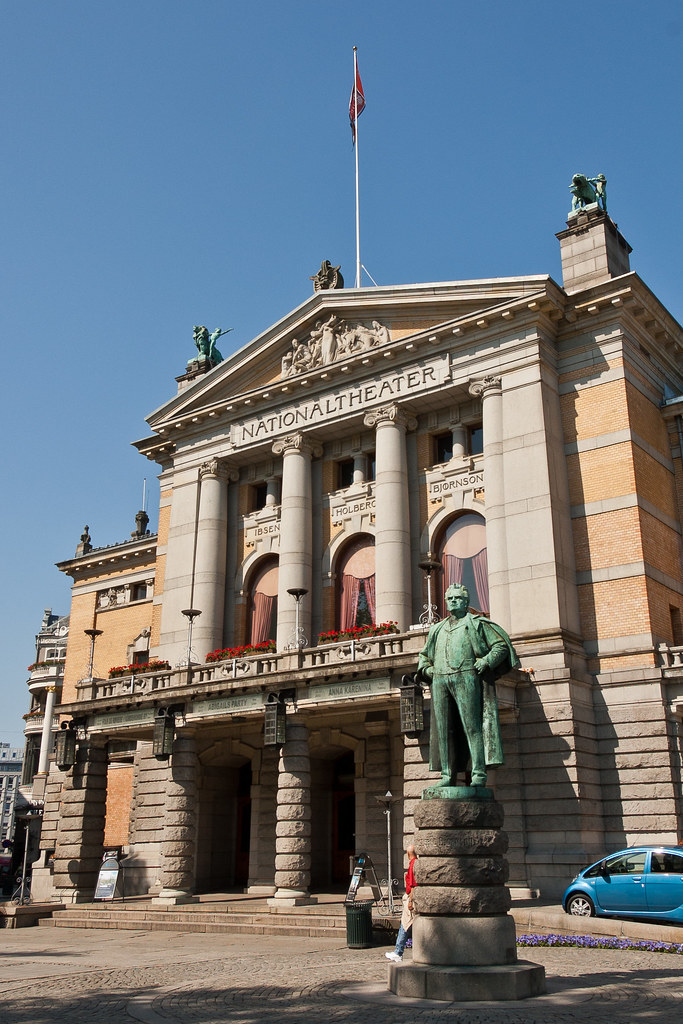
Oslo houses over 20 theatres, such as the Norwegian Theatre and the National Theatre located at Karl Johan Street. The National Theatre is the largest theatre in Norway and is situated between the royal palace and the parliament building. The names of Ludvig Holberg, Henrik Ibsen and Bjørnstjerne Bjørnson are engraved on the façade of the building over the main entrance.

DSC_7955
Above: The National Theatre.

Oslo has been in the news recently for the wrong reasons, and you have probably heard of Anders Behring Breivik and the atrocities he committed on 22 July 2011. Oslo was hit by a bomb blast that ripped through the city central government district, killing at least eight people prior to a shooting spree on the island of Utøya on which killed 69 youths.

DSC_7970
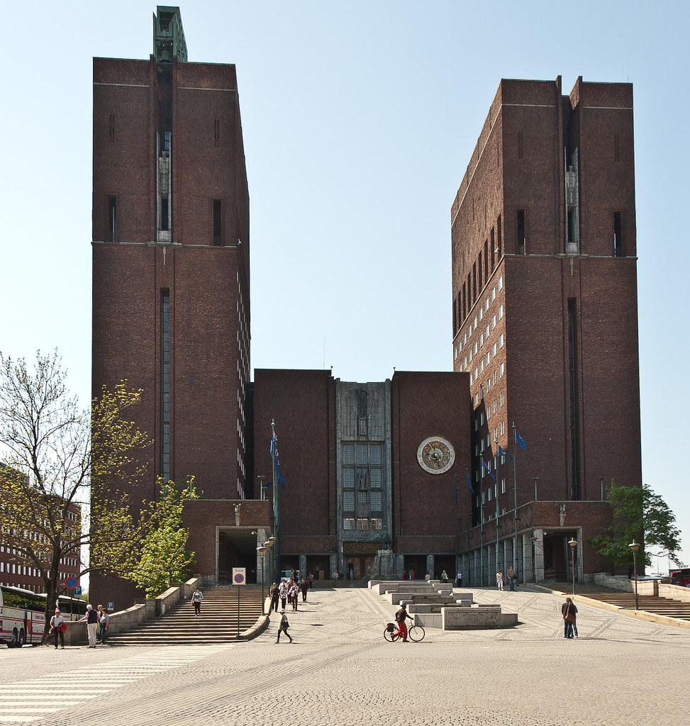
Above: The City Hall.

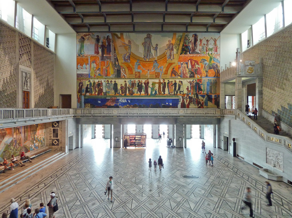
To end on a more upbeat note, you have probably also heard of the Nobel Peace Prize (!) and the ceremonial presentation of the prize takes place every year in the City Hall (above) on 10th December. The construction started in 1931, but was paused by the outbreak of World War II, before the official inauguration in 1950. Designed by Arnstein Arneberg and Magnus Poulsson, the Hall houses the city council, city administration, and art studios and also features a 49-bell carillon on the roof of the eastern tower which plays every hour.

P1040704
Above: The main space inside the City Hall, where the Nobel Peace Prize is awarded.

Thanks for reading and I hope you enjoyed my blogs about Norway - it is probably my favourite country that I have visited so far and I hope I've given you a glimpse of its diversity and beauty.

Wednesday, 3 October 2012

Pulpit Rock, Norway

Welcome back! You may have seen some of my Pulpit Rock pictures on Facebook, but I wanted to give you a bit of the background and story of our epic hike through Norway's stunning scenery. Enjoy!

Untitled
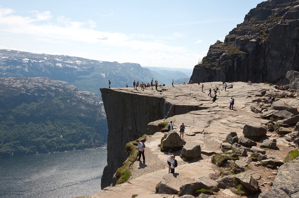
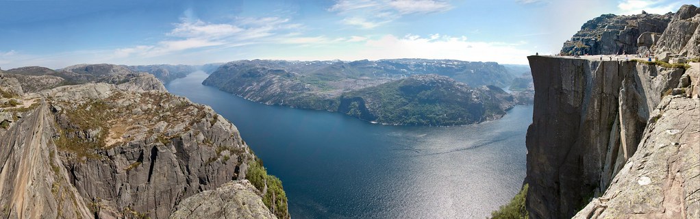
Above: Pulpit Rock

Whilst researching things to see and do in Stavanger, I came across Pulpit Rock which is located about 25km from the town. Other crew members from the ship had the same idea, and after a boat ride, followed by a bus ride, we were ready to start out hike! With the ship's all-aboard time in the back of our minds (we had to be back by 5pm) the hike took on an extra dimension - a race against the clock!

Untitled
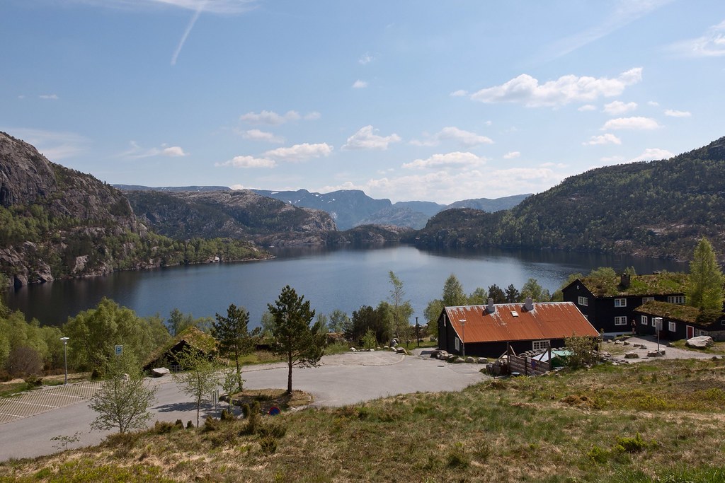
Above: The 'base camp', Preikestolen Fjellstue.

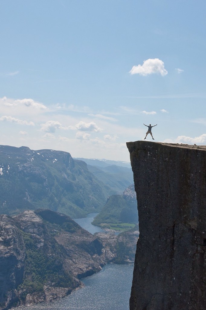
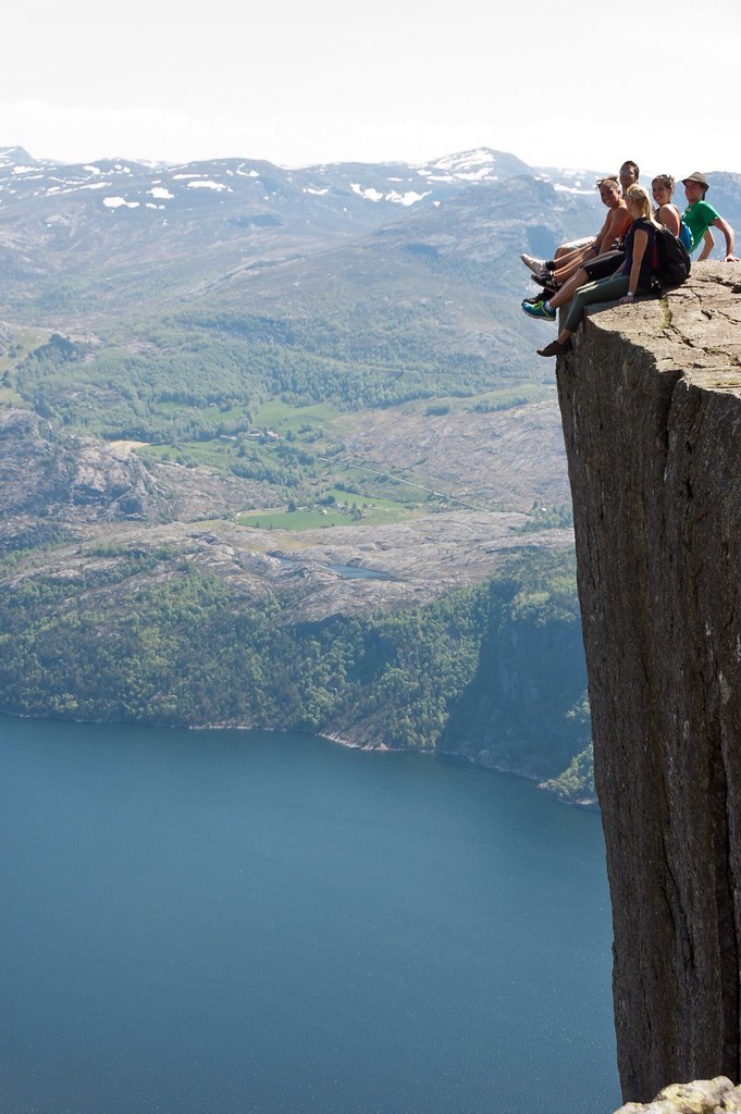
Before I tell you a bit more about the hike, let me give you some background information. Preikestolen, also known by the English translations of Preacher's Pulpit or Pulpit Rock, is a massive cliff 604 metres (1982 feet) above Lysefjorden. The top of the cliff is approximately 25 by 25 metres (82 by 82 feet), almost flat, and is one of the most visited tourist attractions in Norway (about 200,000 people hike to the rock every year).

Untitled
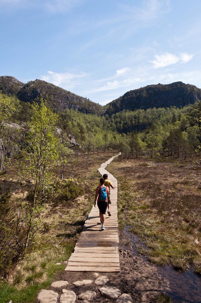
Above: The path leading from the base camp (hidden behind trees on the right).

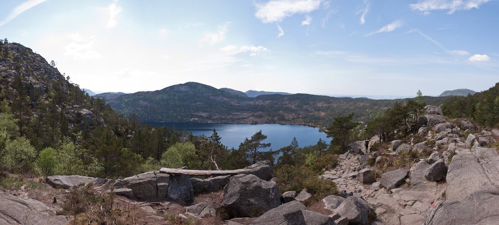
Our bus dropped us off at Preikestolen Fjellstue, where the road ends. A trail then extends from there up to the rock through a variety of mountain landscapes. Some parts of the walk are very easy such as this wooden pathway through marshland:

Untitled
Above: Following the leader.

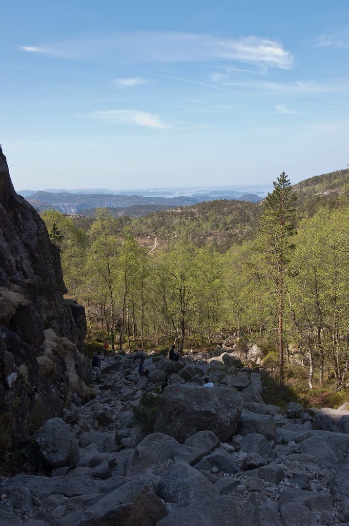
However, most of the journey was over rougher terrain, and in some cases we found ourselves scrambling over boulders with only a red daub of paint to guide us.

Untitled
Above: The boulder field which proved one of the toughest parts of the hike!

The hike starts at an elevation of approximately 270 metres (886 feet) above sea level, and climbs to 604 metres (1982 feet). Even though the difference in elevation is only 334 metres (1096 feet) and the walk is not particularly long (3.8 km each way), the path climbs and descends various ridges which makes the journey much more strenuous!

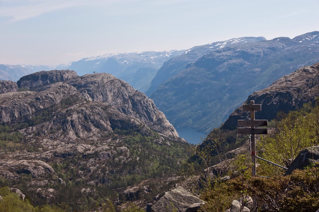
Untitled
Above: A rare signpost!

We managed the walk up in about an hour. Some people take as many as three but we didn't have time for a leisurely stroll! As we reached the top, it was an exhilarating moment to take in the view and the rock itself.

Untitled
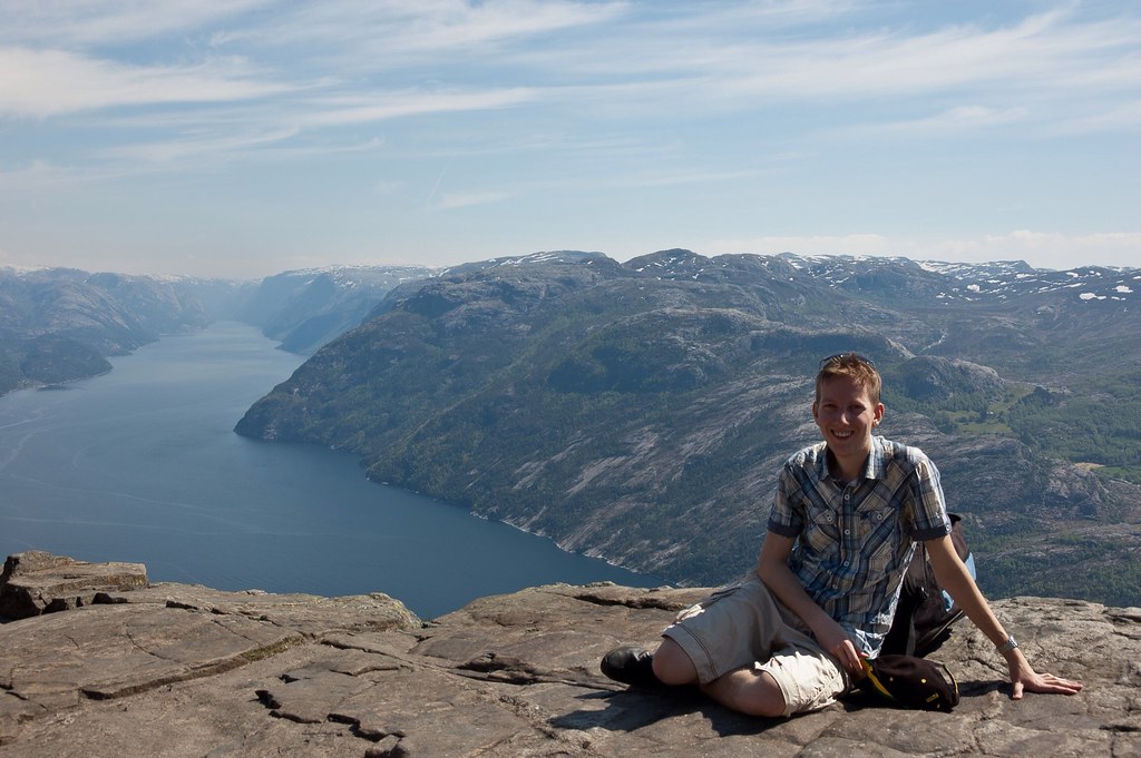
Above: The view!

Despite the popularity of the rock, to this day no safety railing has been constructed on the edge of the cliff so as not to harm the natural beauty of the cliff. Despite the insecure gorge, there have been no accidents at the site, but there have been suicides and suicide attempts.

Untitled
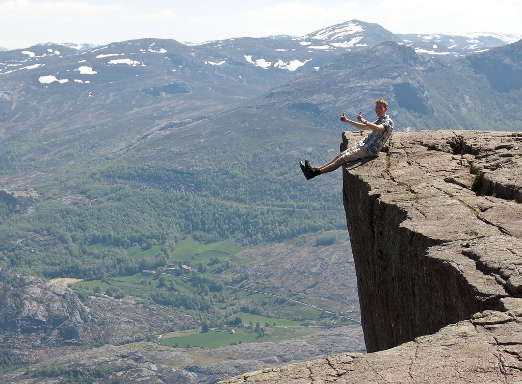
Above: The key here was not to think about the fact that you are dangling over a 604 metre cliff.

The cliff was formed during the Ice age, about approximately 10,000 years ago, when the edges of the glacier reached the cliff. The water from the glacier froze in the crevices of the mountain and eventually broke off large, angular blocks, which were later carried away with the glacier. This is the cause of the angular shape of the plateau.

Untitled
Above: This looks more precarious than it is - the plateau is actually quite wide and I was a safe distance from the edge!

Along the plateau itself there continues to be a deep crack. The cracks show that the plateau will at some point fall down, but all the geological investigations have revealed that this event will not happen in the foreseeable future, and the geologists have thus confirmed the safety of the plateau.

Untitled
Above: Another view from the edge.

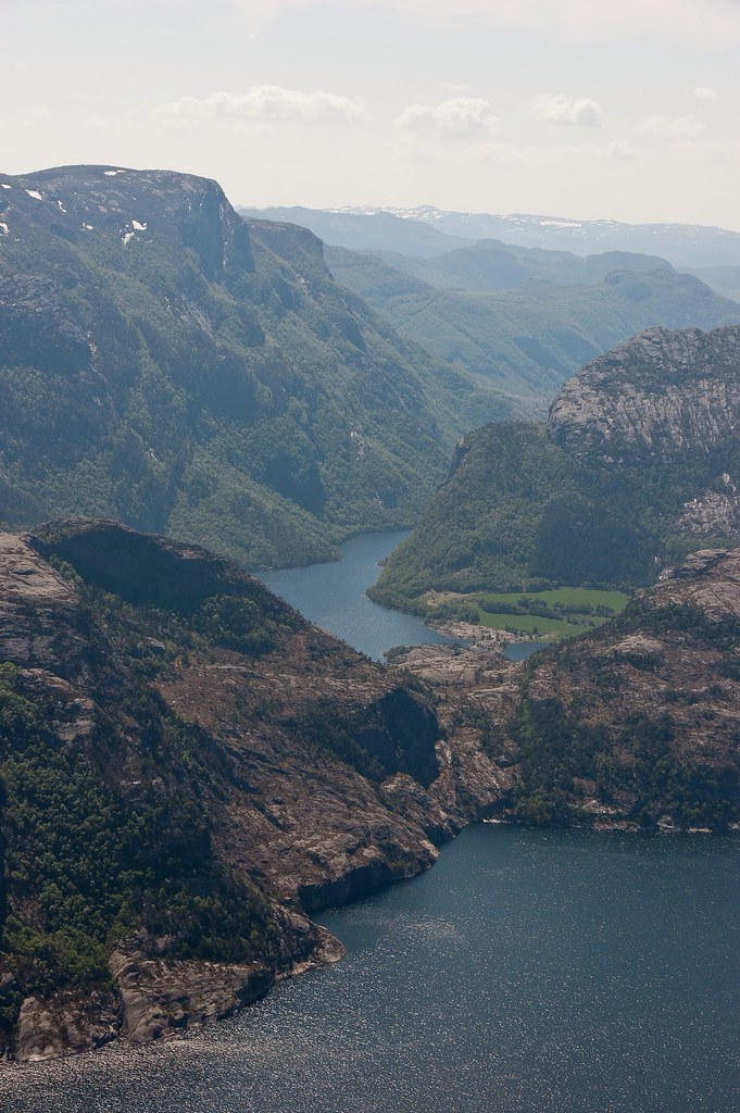
The views from the rock were incredible, and it is very difficult, if not impossible to capture it on camera. The day we visited, the rock was quite busy but many people were fairly quiet, seemingly in awe of their surroundings.

Untitled
Above: Fellow crew-members pose for a picture.

After a light lunch on the rock, we began the descent down which took a little less time than the ascent. On our way down, we stopped at a mountain lake and some of the more adventurous among us took a dip! Part of the excitement of the day was the race against the clock to get back to the ship (the buses and ferries only ran at certain times) but you'll be pleased to hear that we made it!

Untitled
Above: One more shot from the top.

Thanks for reading!

Friday, 21 September 2012

Bergen, Norway

Hello again! Bergen, Norway is probably my favourite Norwegian city; there is so much to see and do but everything is also within easy walking distance!

bergen
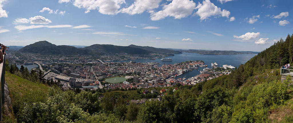
Above: An overview of Bergen from the top of Mount Fløyen.

Bergen is Norway's second largest city and located on the west coast of Norway with a population of 27,000. Trading in Bergen started in the 1020s and the city served as Norway's capital from 1217 to 1299.

DSC_7527
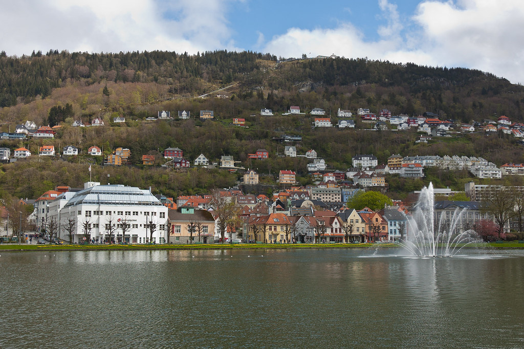
Above: Bergen cityscape with Mount Fløyen in the background.

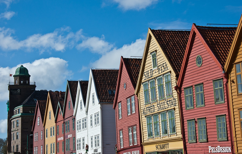
Undoubtedly, the most famous site in Bergen is Bryggen (Norwegian for the Wharf), a series of Hanseatic commercial buildings lining the eastern side of the fjord. Bryggen has since 1979 been on the UNESCO list for World Cultural Heritage sites.

DSC_7632
Above: The front facade of Bryggen.

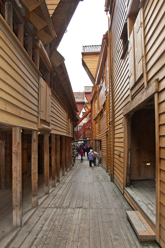
You can wander through the alleyways among the picturesque warehouses lining the street and waterfront which once housed German merchandise belonging to the Hanseatic League. The Hanseatics settled in Bergen around 1350 and had the monopoly on the trade with Northern Norway as well as the political power in the city for about 200 years.

DSC_7506
Above: The alleys in Bryggen are very narrow. You can see the winch that would have been used to hoist goods up to the first floor above the shop.

The warehouses were filled with goods, particularly fish from northern Norway, and cereal from Europe. Throughout history, Bergen has experienced many fires, since, traditionally, most houses were made from wood. This was also the case for Bryggen, and as of today, around a quarter of the structures date back to the time after 1702, when the older wharfside warehouses and administrative buildings burned down. The rest predominantly consists of younger structures, although there are some stone cellars that date back to the 15th century.

DSC_7520
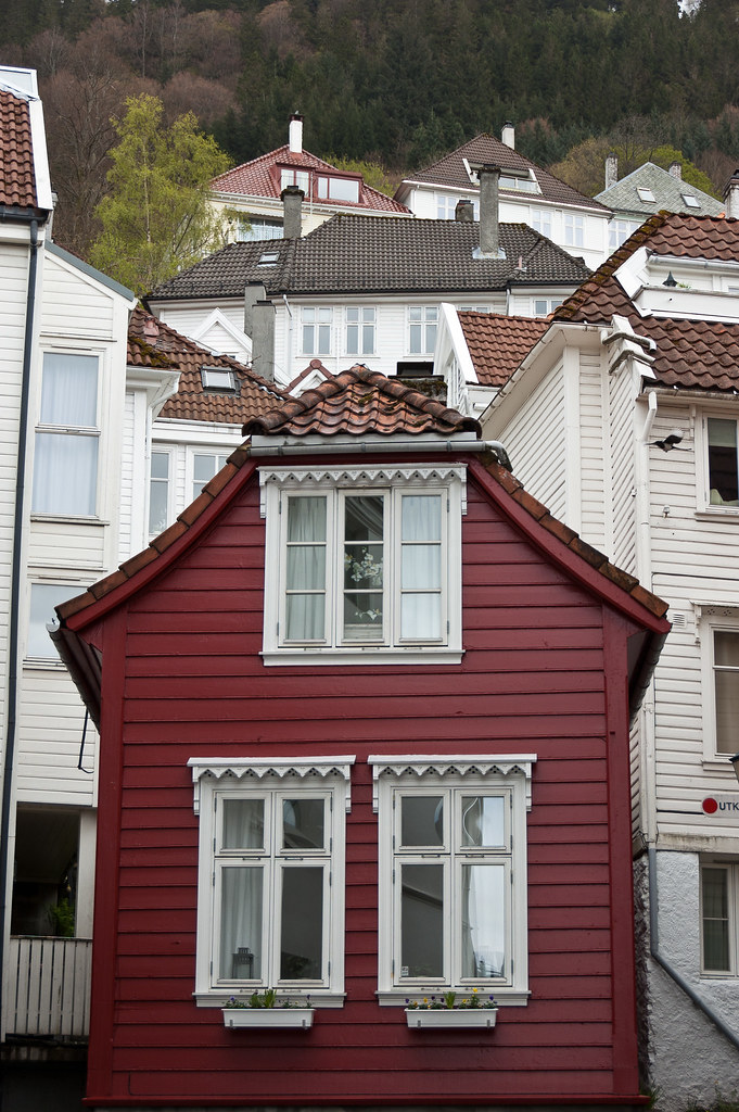
Above: Traditional wooden houses in Bergen.

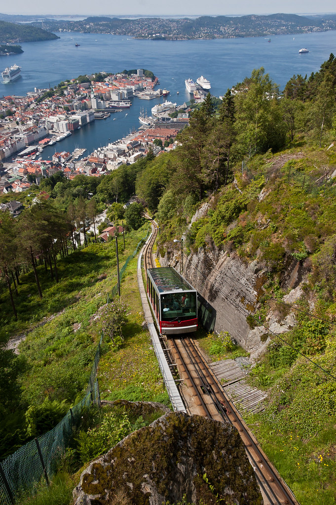
One of the other main attractions in Bergen is Fløibanen, a funicular which runs up the mountain of Fløyen. Officially opened on 15 January 1918, the funicular affords great views of the city from the top!

DSC_0083
Above: A funicular descends from the top of Mount Fløyen.

One of the tours I went on during my time in Bergen, visited Troldhaugen, the home of Norwegian composer Edvard Grieg and his wife Nina Grieg. The site houses the Edvard Grieg Museum, a concert hall, Grieg’s villa, the hut where he composed music, and his and his wife's gravesite.

DSC_7580
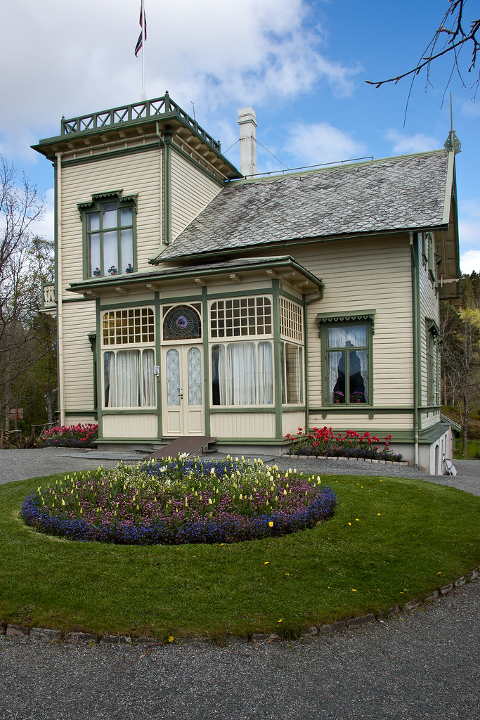
Above: Grieg's villa.

The building was designed by Grieg's cousin, the architect Schak Bull and was finished in 1885. Edvard Grieg himself called the building "my best composition hitherto" and he and his wife, Nina lived in Troldhaugen from April 1885 until his death in 1907.

DSC_7565
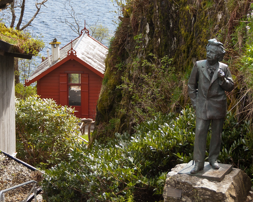
Above: A life-sized statue of Grieg (he was very short), with his composing hut in the background.

Troldhaugen is a typical 19th century residence with panoramic tower and a large veranda with Grieg's small composer's hut overlooking Nordås Lake. Grieg immortalized the name of his home in one of his piano pieces, Wedding-Day at Troldhaugen, Opus 65, No. 6. Grieg and his wife's ashes rest inside a mountain tomb near the house which I visited.

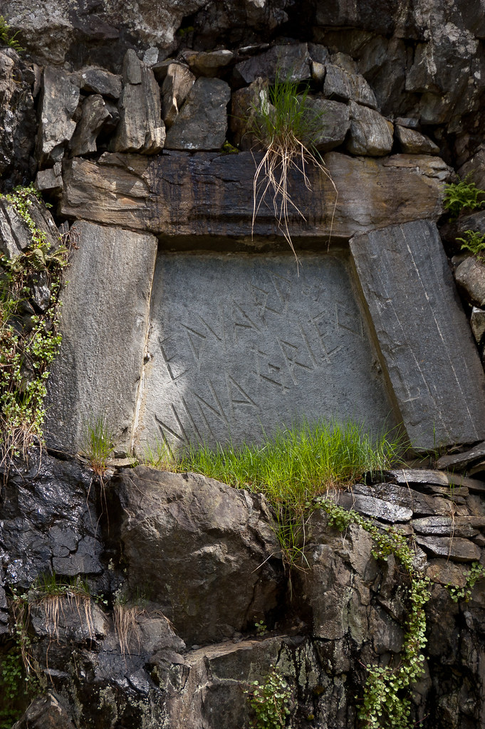
DSC_7591
Above: Edvard and Nina Grieg's grave.

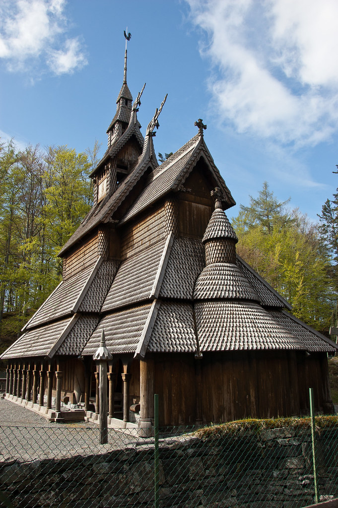
At the end of our tour, we also visited a Fantoft Stave Church, rebuilt after a fire completely destroyed the church in 1993 (a Satanist burnt the church down). The new church is an exact copy of the old one, which dated back to 1150. Take special note of the dragonheads and serpents on the roof—designed to frighten away evil spirits.

DSC_7623
Above: The Fantoft Stave Church.

The church also features a stone cross outside, supposedly the first gathering point for religious services in the early days of Christianity. The interior is very dark and would have been even darker in the past when there were only candles!

DSC_7612
Above: Intricate carvings bookend the pews.

Thanks for reading! My final Norwegian post is coming up soon and I've saved the capital for last: Oslo!