
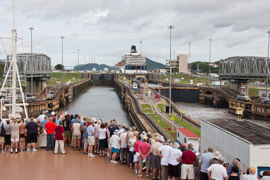
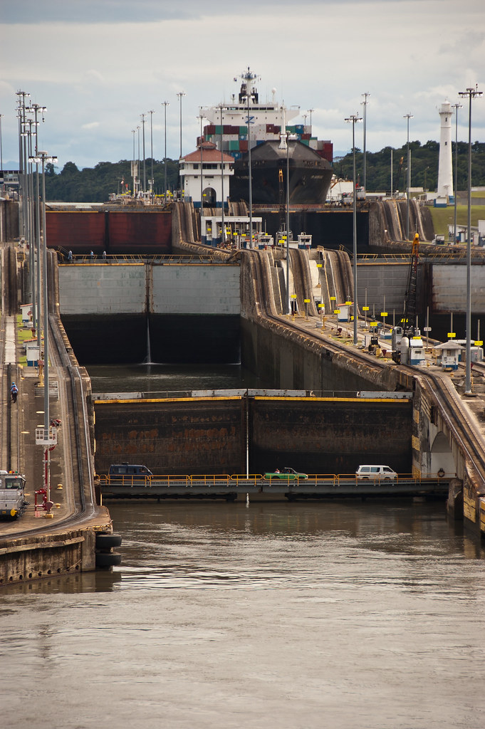
Above: The first set of locks from the Pacific side - the Miraflores Locks
The Panama Canal is a 48 mile ship canal in Panama that joins the Atlantic Ocean and the Pacific Ocean and is a key route for international maritime trade. Built from 1904 to 1914, the canal was designed to replace the long and treacherous route around the southernmost tip of South America, cutting many journeys by more than half.
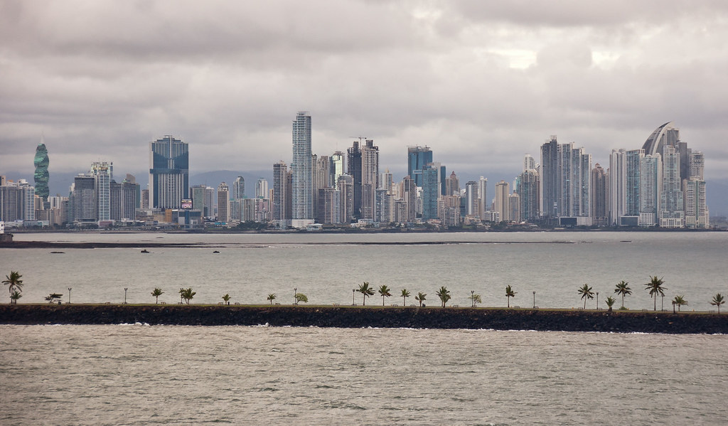
Above: Panama City, located on the Pacific side of the Panama Canal.
The canal consists of artificial lakes, several improved and artificial channels, and three sets of locks. An additional artificial lake, Alajuela Lake, acts as a reservoir for the canal. The canal works entirely by gravity - no pumps are used to fill and empty the locks.
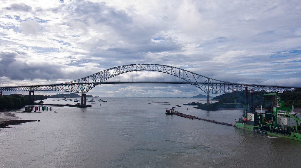
Above: The Bridge of the Americas (Pacific side) which connects the two American continents.
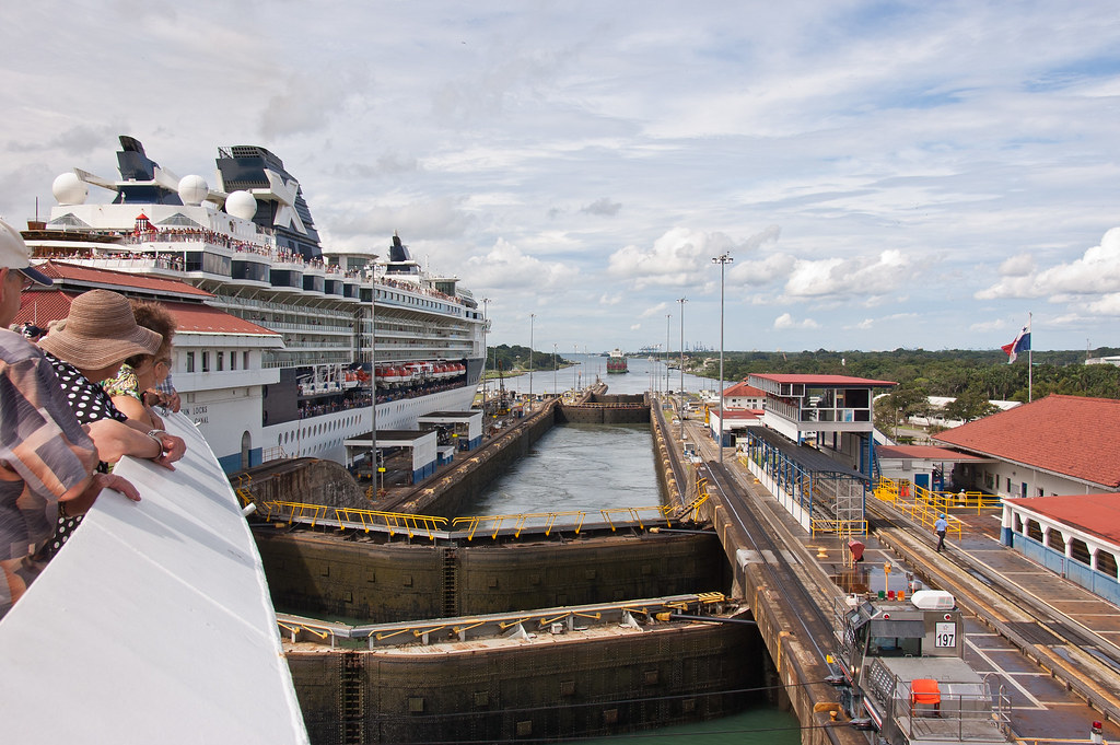
The first lock system we arrived at was the 1.1 mile long Miraflores lock system, which lifts vessels 16.5 metres above sea-level (see first photo). After the first lock, we entered the artificial Miraflores Lake before heading towards the second of the three locks - the Pedro Miguel Lock. This is the last part of the ascent, with a lift of 9.5 metres to the main level of the canal.
Above: The Pedro Miguel Lock seen from the Miraflores Lake, with the Centennial Bridge in the distance.
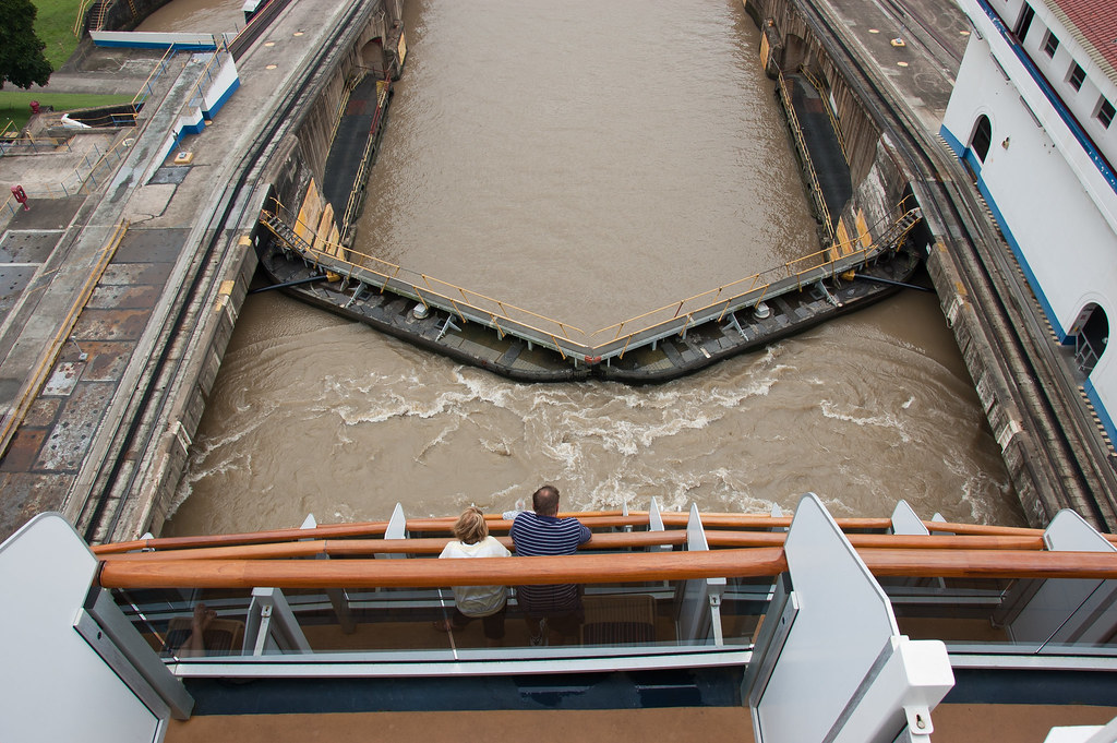
Above: The view from the back of the Zuiderdam of the Pedro Miguel Lock.
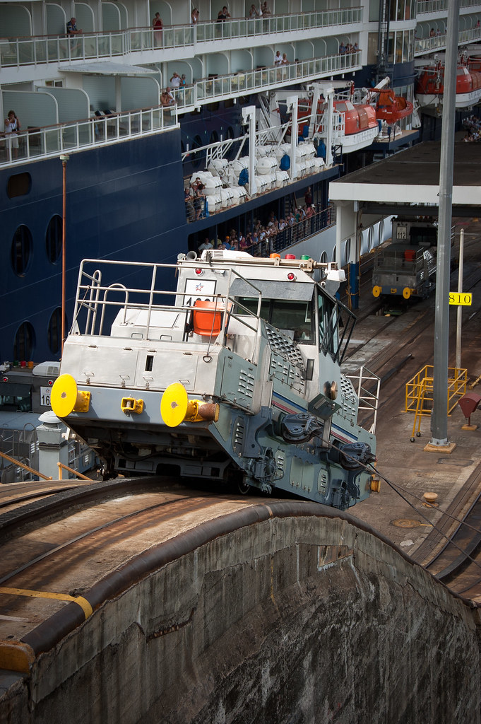
At the locks, small vehicles known as Mules guide the ships through the locks. They do not actually pull ships - the ship sails under its own power but they prevent the ship from scraping against the side of the locks.
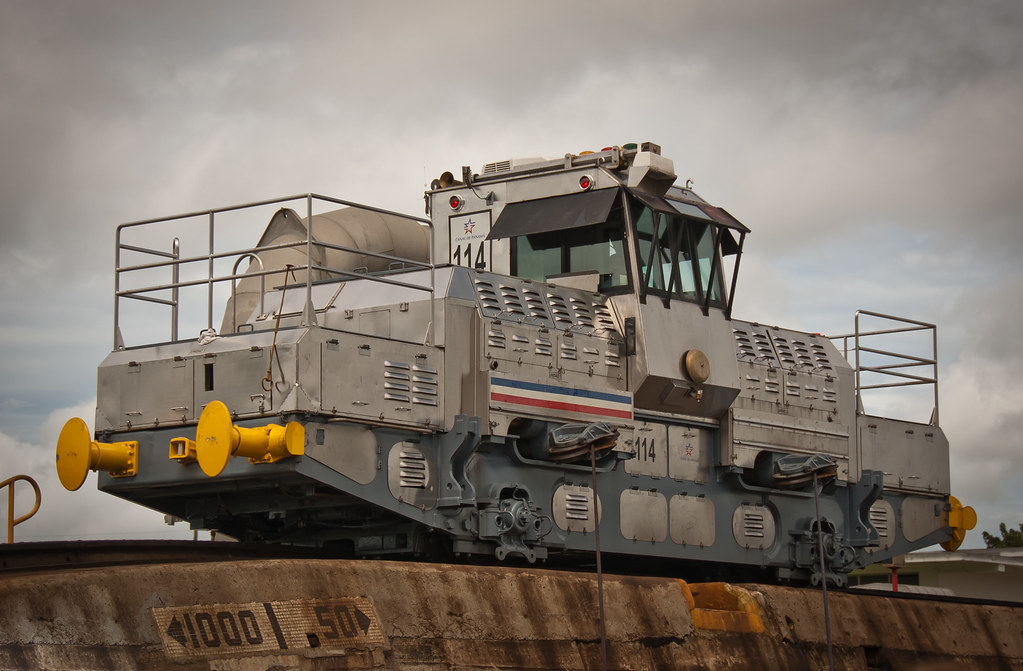
Above: A Mule. Three on each side guided the Zuiderdam through each lock.
The first attempt to construct a canal began in 1880 under French leadership, but was abandoned after 21,900 workers died, largely from disease and landslides. The United States launched a second effort, incurring a further 5,600 deaths but succeeding in opening the canal in 1914.
Above: Looking back at the Pedro Miguel Lock with the Miraflores Lock in the distance.
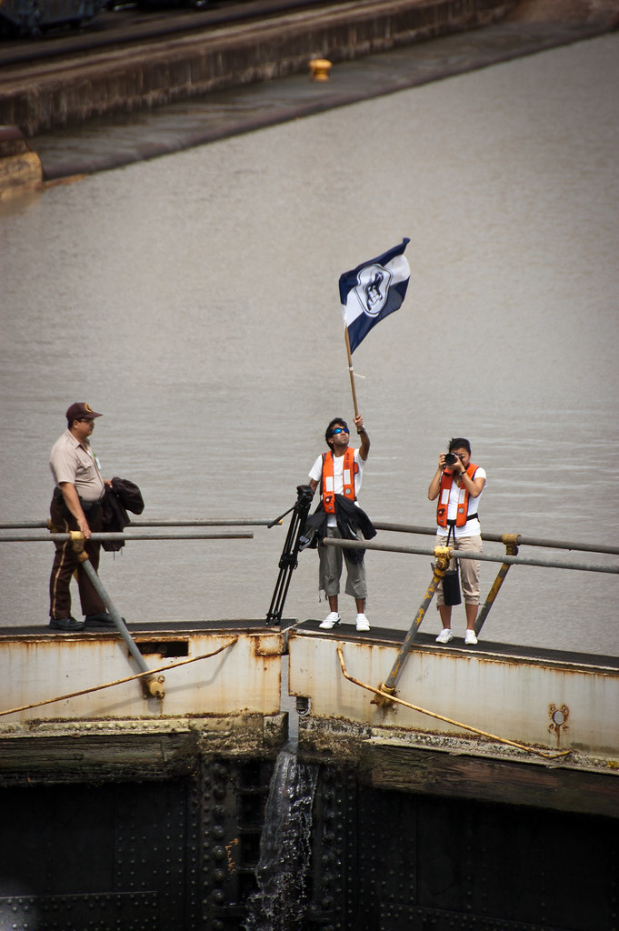
Above: The Holland America photography team was on hand to capture every moment.
After the first two locks, we passed through the Gaillard Cut which slices 7.8 miles through hillside of the continental divide at an altitude of 26 meters, passing under the Centennial Bridge (built to ease traffic on the Bridge of the Americas.
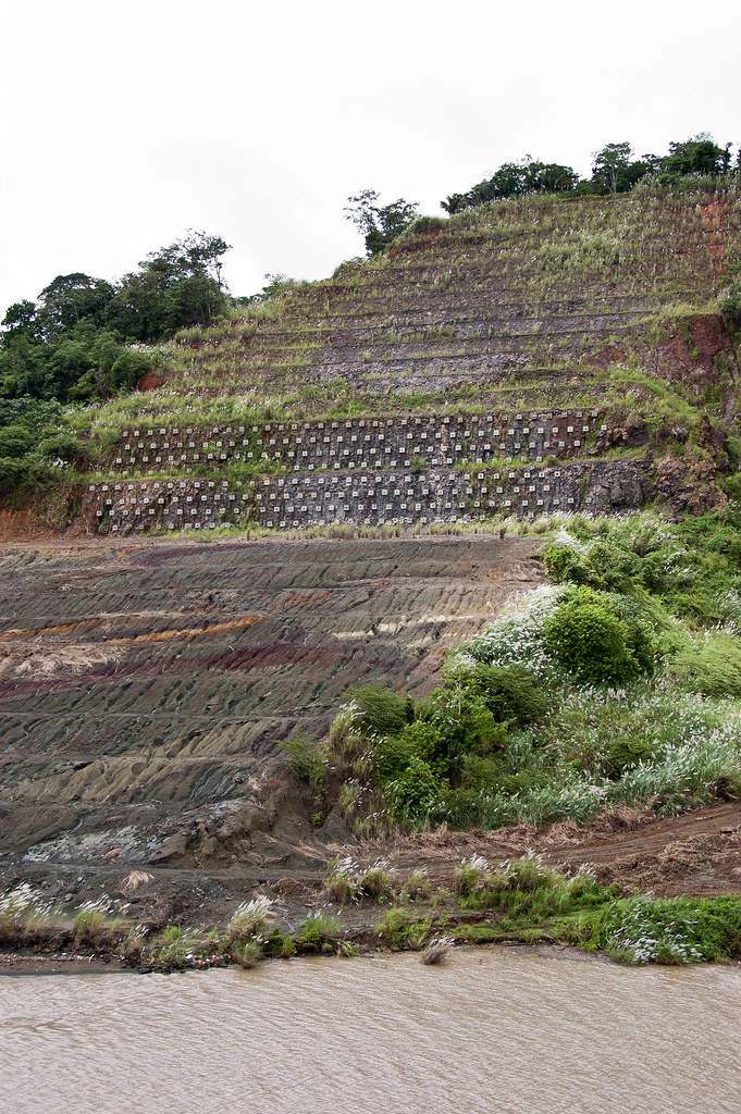
Above: The cut-away hillside. The tiered design helps to prevent landslides.
As we continued along the Canal, we passed the Chagres River, a natural waterway which merges into Lake Gatun. This is an artificial lake formed by the building of the Gatun Dam, which carries vessels 15 miles towards the final set of locks.
Above: The Gatun Locks
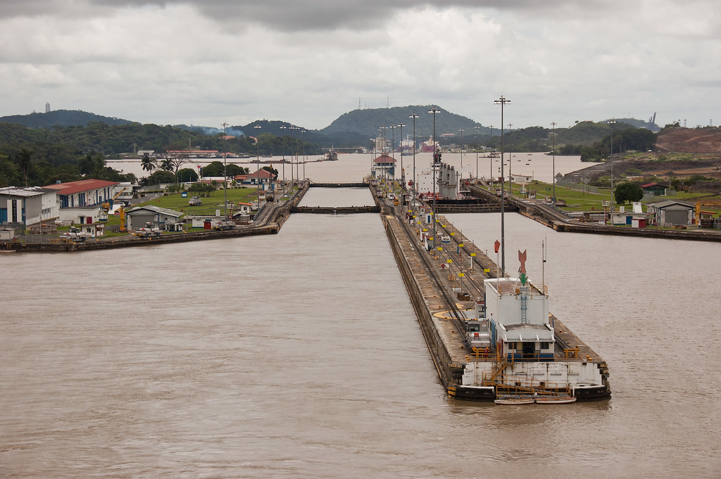
Finally, the Gatun locks, a three-stage flight of locks 1.2 miles long, drop ships back down 26 metres to sea level. We raced a Celebrity Cruise ship through the lock as all of the locks have two channels which can operate in either direction.
Above: A Mule descending the Gatun Locks.
You may be interested to know about fees for transiting the Canal. Cruise ships, pay a rate based on the number of passengers that can be accommodated in permanent beds. The most expensive regular toll for canal passage to date was charged on May 16, 2008 to the Disney Magic, which paid US $331,200. The least expensive toll was 36 cents to American adventurer Richard Halliburton, who swam the canal in 1928!
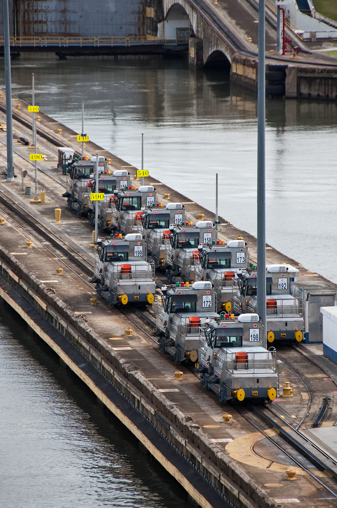
Above: Mules parked up at the base of the Gatun Locks.
As we passed through the Canal, we saw and heard lots of wildlife including monkeys and crocodiles. I'll try to get some photos of these next time we enter the Canal!
Above: Looking back at the Gatun Locks from the Atlantic side. You can see the different water levels and if you look closely you can also see cars passing underneath the nearest lock; there is a road bridge beneath the locks which swings open when ships pass though!
The size of the locks determines the maximum size of ships allowed passage. Because of the importance of the canal to international trade, many ships are built to the maximum size allowed. These are known as Panamax vessels.
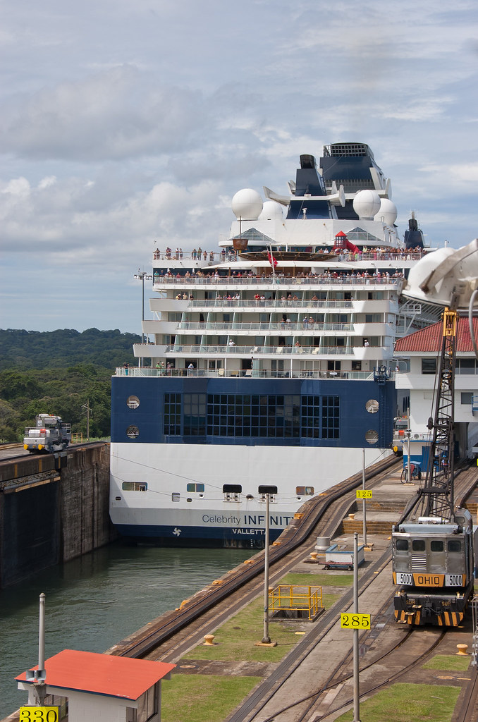
Above: Both the Zuiderdam and the Celebrity ship are Panamax Vessels!
Because ships are being built to bigger sizes than the Panamax measurements, a project was started in 2006 for a Third lock lane project which will create larger locks, and deeper and wider channels, allowing bigger ships to transit. I'll show you some pictures of construction in a later post. Thanks for reading - I hope you enjoyed the Panama Canal!
No comments:
Post a Comment