CRUISE MAP


View Cruise Destinations in a larger map

Friday, 30 March 2012

Sint Maarten and St Vincent

Hello again! Today I'm going to show you two islands (technically three - more later): Sint Maarten and St Vincent!

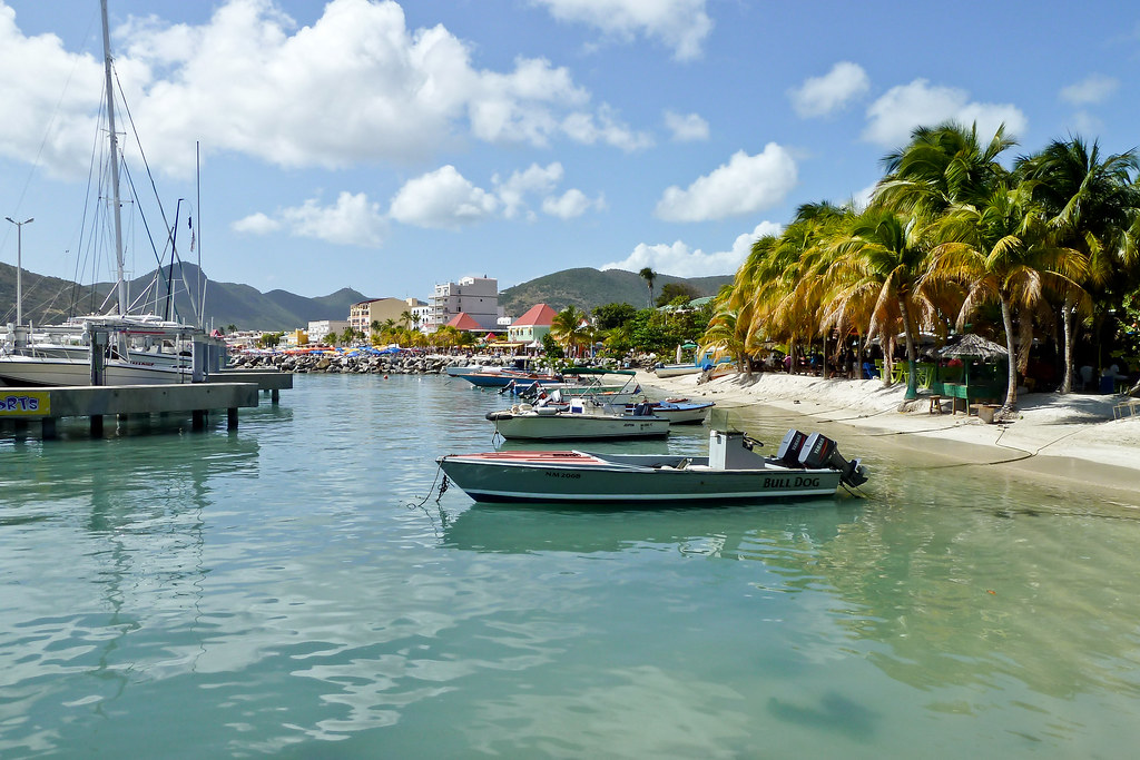
P1040367
Above: The beach and downtown area of Sint Maarten.

Sint Maarten is a constituent country of the Kingdom of the Netherlands, rather like Curaçao - an island I visited on the Zuiderdam. It encompasses the southern half of the Caribbean island of Saint Martin (the northern half of the island is the French overseas collectivity of Saint-Martin).
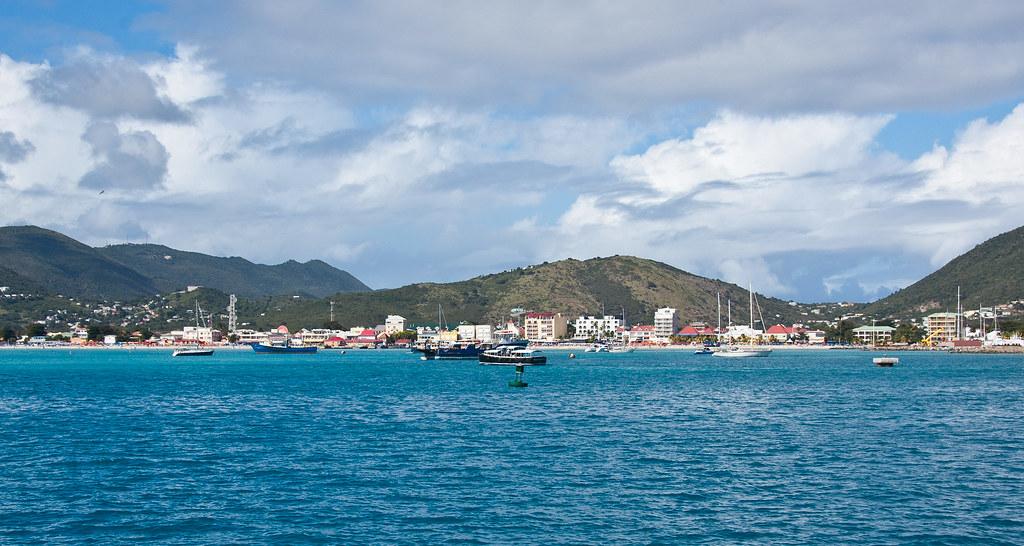
DSC_5825
Above: The coastline of Sint Maarten.

The capital of the country is Philipsburg, where our ship docked along with many others! The island is particularly famous for Maho Beach, a beach at the edge of the airport where planes pass by very low to land on the short runway - Google it!
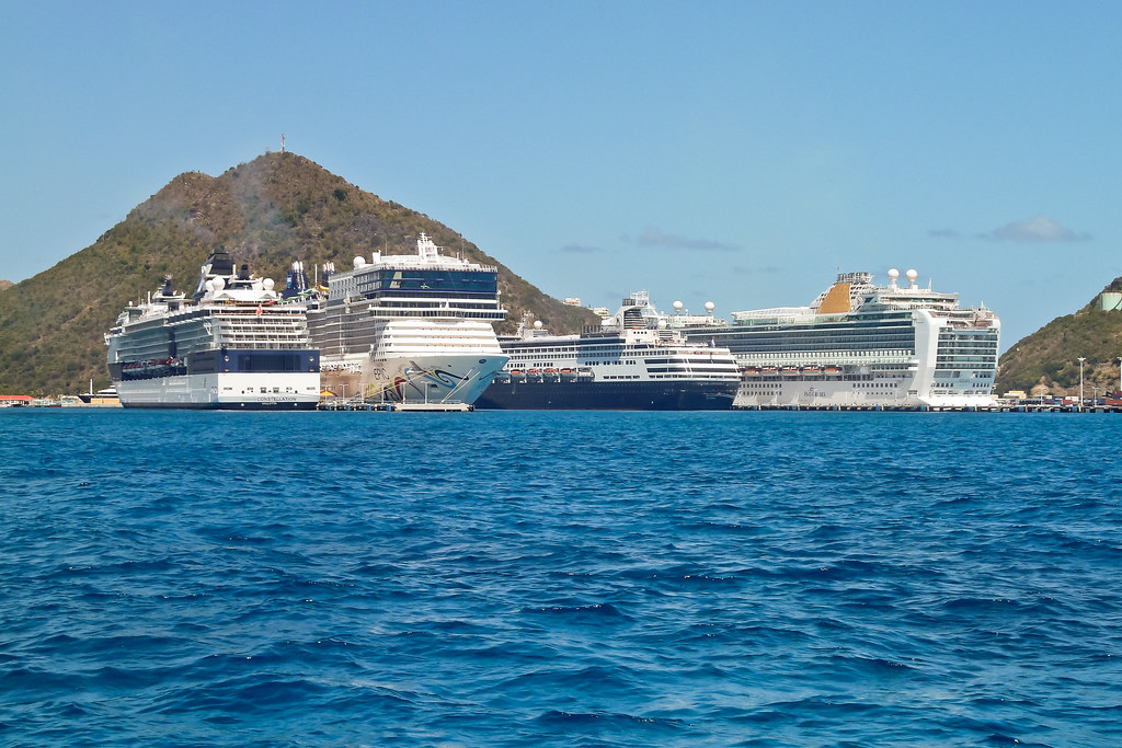
P1040350
Above: Some of the ships docked with us (second from right) including the Norwegian Epic (second from left), the third biggest cruise ship in the world.

Whilst at Sint Maarten, I did not tour the island or learn much about its history. However, I did get to race on the Stars & Stripes 87, the 12 Meter challenge boat sailed by Dennis Conner in his America’s Cup victory of 1987.
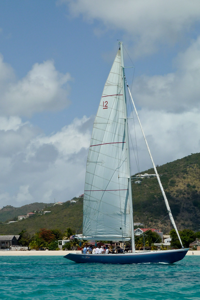
P1040346
Above: The Stars & Stripes 87 Yacht.

Stars & Stripes 87 was the final 12 Meter to win the America's Cup, and as such she represented the zenith in 12 Meter design. On the day of the race, we came second out of three and I also managed to break the yacht - snapping a plastic bearing off the primary grinder!
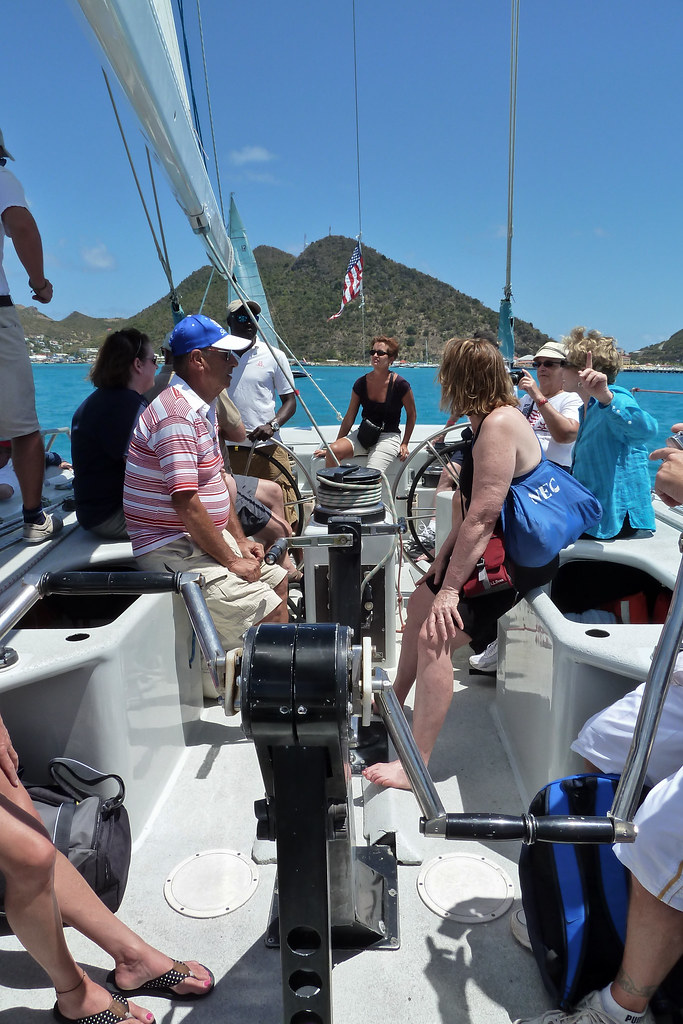
P1040349
Above: The crew of cruise ship passengers who were coached to race the yacht!

ST VINCENT

Saint Vincent is a volcanic island in the Caribbean. It is the largest island of the chain called Saint Vincent and the Grenadines and is composed of partially submerged volcanic mountains.

Untitled_Panorama1
Above: A panorama of Kingston, the main town in St Vincent (click for bigger pic).

The territory was disputed between France and the United Kingdom in the 18th century, before being ceded to the British in 1783. It gained independence on October 27, 1979.
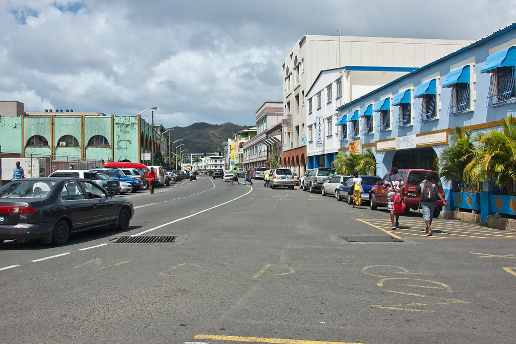
DSC_5505
Above: Downtown Kingston, St Vincent.

St Vincent is one of the major filming locations for the first Pirates of the Caribbean film ('Curse of the Black Pearl') but sadly I did not see any of the film locations whilst there.
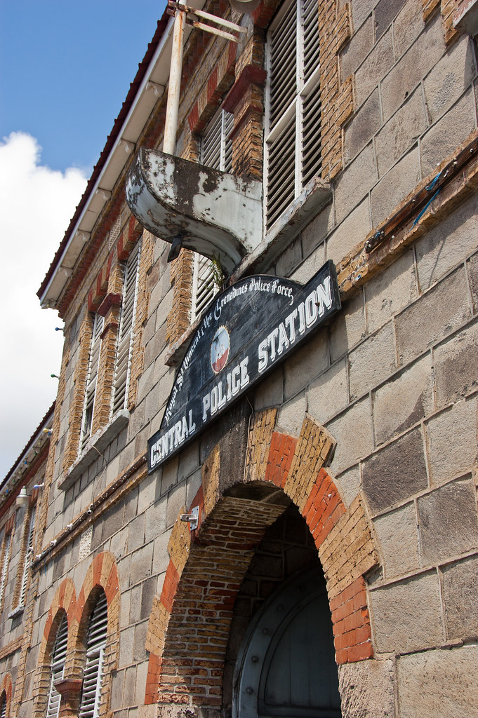
DSC_5517
Above: Kingston's Police Station.

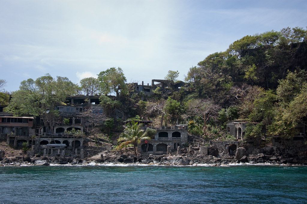
One of the shore excursions I took part in was a sailing trip to Bequia. With a total population of only 4,300 and a size of seven square miles, the island is still the largest of the Grenadines. The first site we visited were the cave dwellings where we snorkelled in the bay.
DSC_6447
Above: The cave dwellings of Bequia

19 families have built homes in this cave-man like community, the first couple arriving in the 1960s. Twice each year on the solstice the moon can be seen setting through the moonhole. Today, only a few houses are inhabited year round and some are rented out to vacationers looking for a very different kind of experience.
DSC_6458
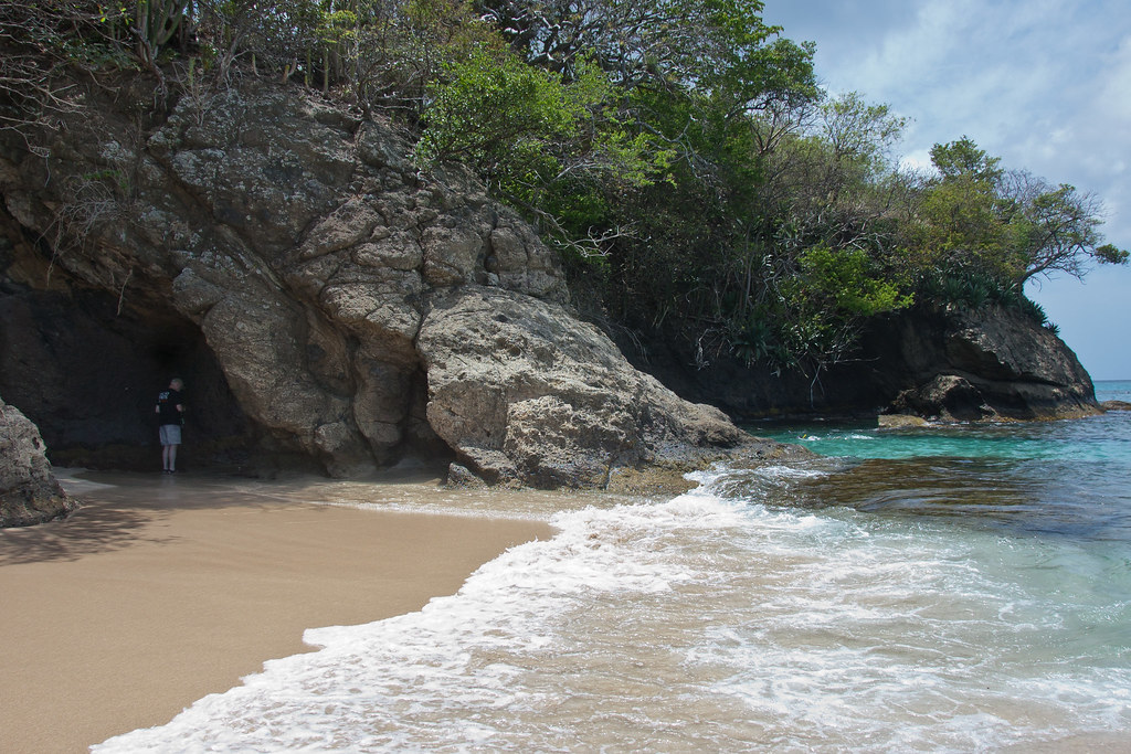
Above: Princess Margaret Beach.

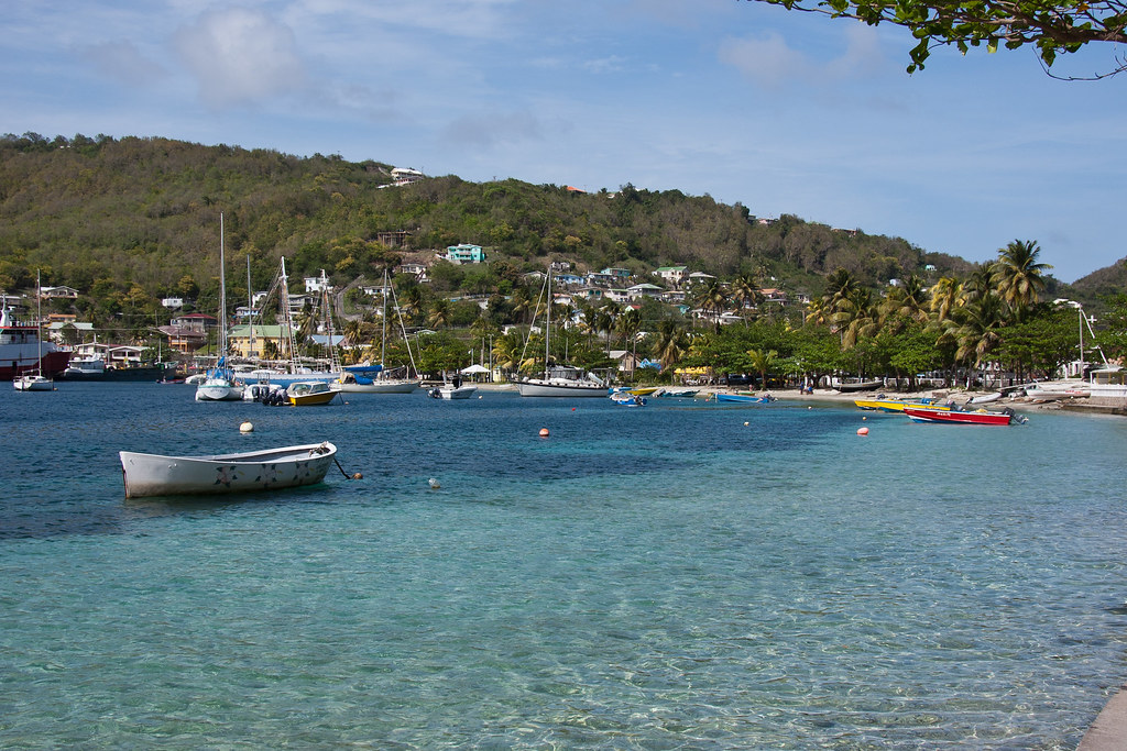
We then visited a beach named after Princess Margaret, who had a home on nearby Mustique, visited Bequia and had a beach named in her honour. Finally we stopped off in Port Elizabeth, the main population centre on the island.
DSC_6493
Above: Port Elizabeth.

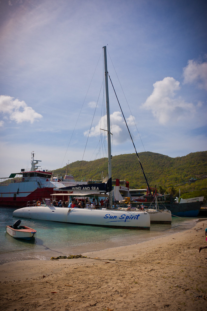
I hope you enjoyed this whistle-stop tour of Sint Maarten and St Vincent & the Grenadines. I'll leave you with a shot of our catamaran that took us on the tour around beautiful Bequia:
DSC_6501_1

Nassau - Bahamas

Welcome back. Today I'll be showing you Nassau which is the capital, largest city, and commercial centre of the Commonwealth of the Bahamas (over 70% of the Bahamian population live here).

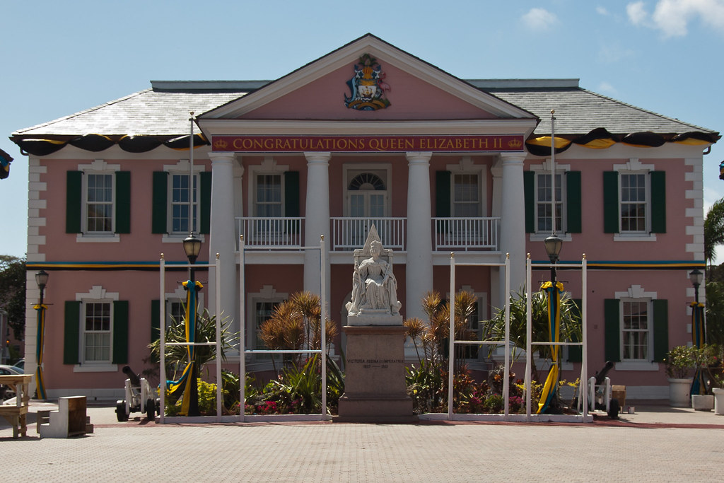
DSC_6240
Above: Parliament Building - the decorations were in preparation for Prince Harry who was arriving a day after us!

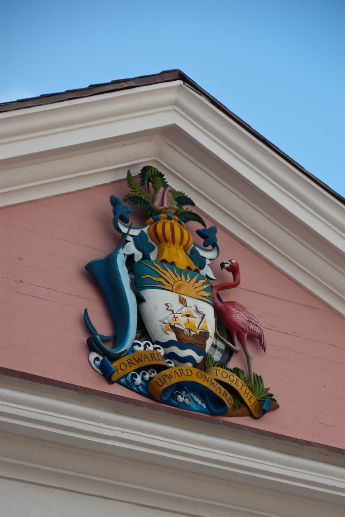
DSC_4972
Above: The crest close-up.

The city is located on the island of New Providence, which functions much like a business district. Nassau is the site of the House of Assembly and various judicial departments and was considered historically to be a stronghold of pirates.

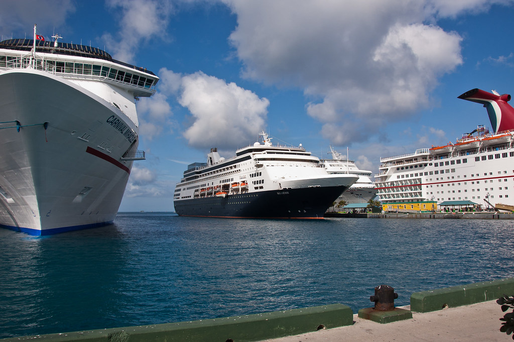
DSC_4960
Above: Cruise ships docked at Nassau Harbour.

Nassau has an attractive harbour, a colourful blend of old world and colonial architecture, and a busy port. The tropical climate and natural beauty of the Bahamas, combined with the city's proximity to the USA, have made Nassau a popular tourist destination.

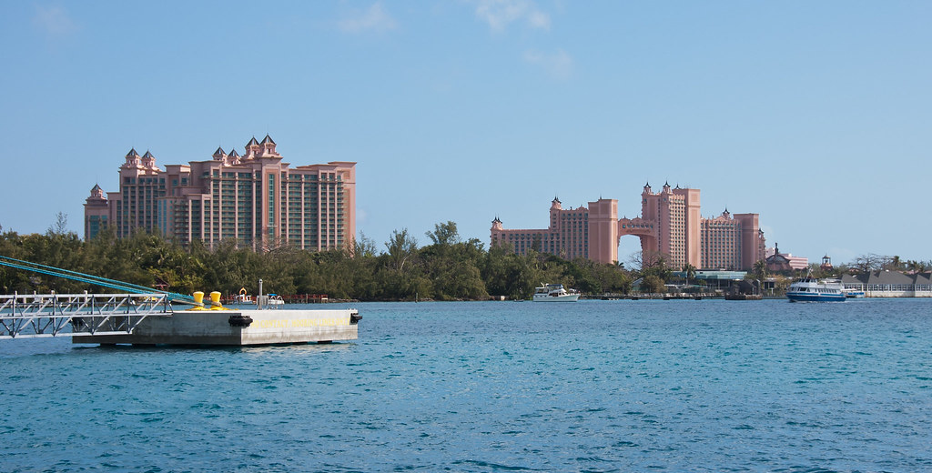
DSC_4959
Above: The Atlantis resort on nearby Paradise Island accounts for more tourist arrivals to the city than any other hotel property.

Nassau was formerly known as Charles Town; it was burned to the ground by the Spanish in 1684, but later rebuilt and renamed Nassau in 1695 in honour of the Dutch Stadtholder and later also King of England, Scotland and Ireland, William III from the Dutch House of Orange-Nassau.

DSC_4974
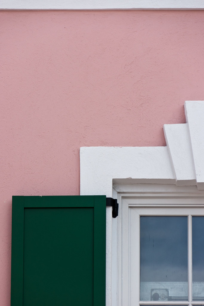
Above: Most of the parliament buildings are painted pink!

By 1713, the sparsely settled Bahamas had become a pirate haven for pirate chieftains Thomas Barrow and Benjamin Hornigold. They proclaimed Nassau a pirate republic, establishing themselves as governors, and were joined by Blackbeard, along with women pirates such as Anne Bonny and Mary Read.

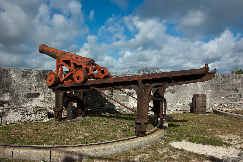
DSC_6193
Above: One of the manoeuvrable cannons at Fort Fincastle.

In 1718, the British sought to regain control of the islands and appointed Captain Woodes Rogers as Royal governor. Rogers cleaned up Nassau, even going as far as using his own money to try to overcome problems.

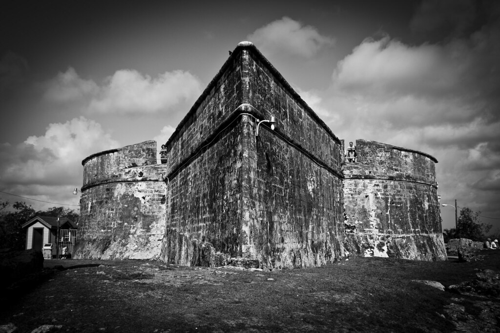
DSC_6203
Above: The outside of Fort Fincastle which is shaped like a boat.

One of the most visited attractions in Nassau is the Queen's Staircase. The steps were carved out of solid limestone by slaves sometime between 1793 and 1794; a century later the staircase was renamed to honour the 65 year reign of Queen Victoria as well as her role in helping bring about the abolition of slavery in the Bahamas.

DSC_6204
Above: The Queen's Staircase

In 1973, The Bahamas became fully independent, but retained membership in the Commonwealth of Nations.

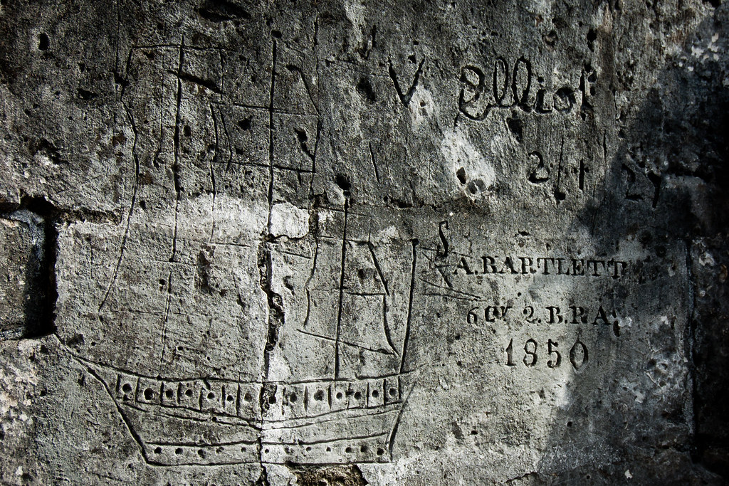
DSC_6213
Above: Carvings at Fort Charlotte, built by the British Lord Dunmore who governed the colony from 1787 to 1796.

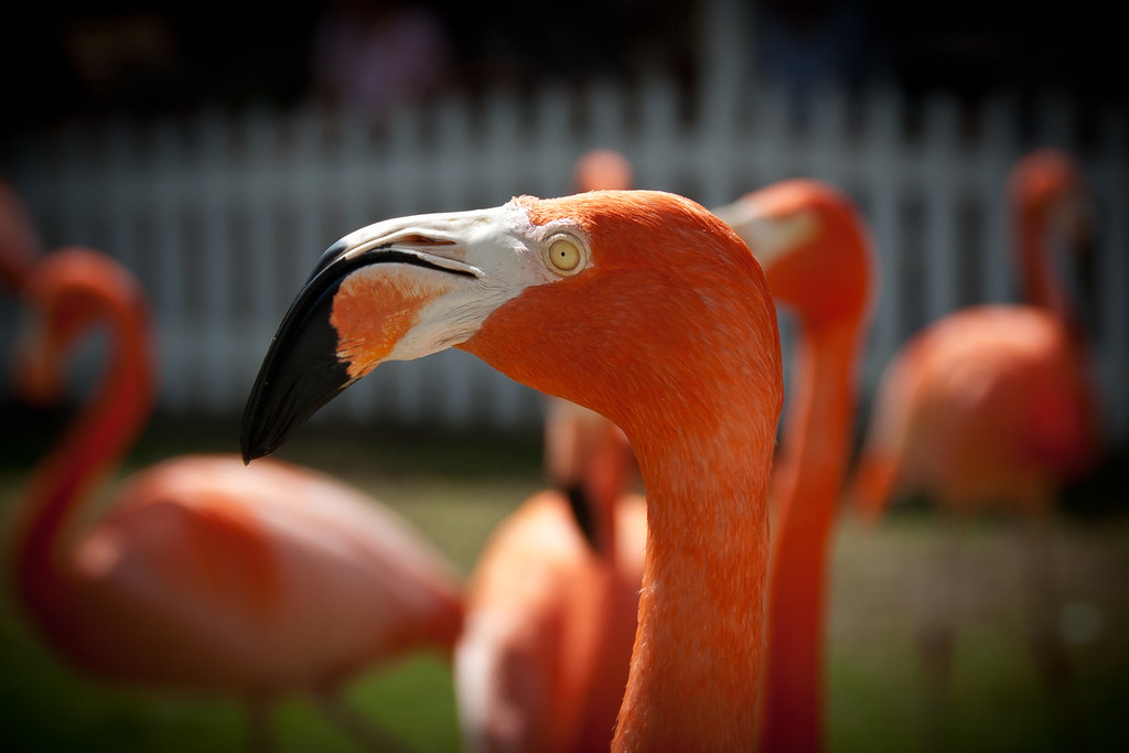
One of the quirkier attractions in Nassau are the marching flamingos which were featured in National Geographic way back in the 1950s (presumably not the same birds...). I'll leave you with a picture of the show they put on for us:

DSC_6228

Tuesday, 20 March 2012

Old San Juan - Puerto Rico

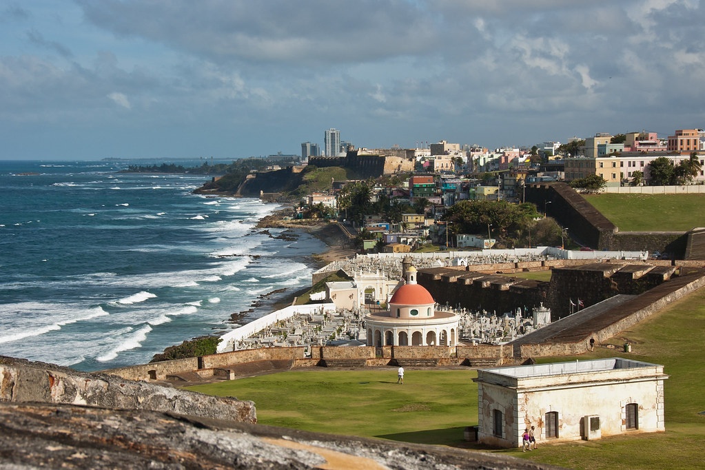
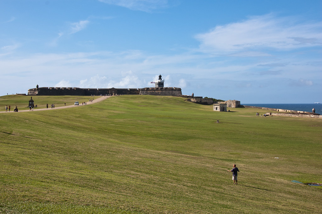
Hello again. One of my favourite ports on this contract has been San Juan, the capital of Puerto Rico, an unincorporated territory of the United States. Founded by Spanish colonists in 1521, it was used by merchant and military ships travelling from Spain as the first stopover in the Americas.

DSC_5074
Above: The Atlantic side of San Juan, taken from Fort San Felipe del Morro.

During the Spanish colonial times most of the urban population resided in what is now known as Old San Juan. This sector is located on the western half of a small island called the Isleta de San Juan, which is connected to the mainland by bridges.

Untitled_Panorama1
Above: A panorama of downtown Old San Juan, taken from Fort San Cristóbal.

Our ship docked at Old San Juan, which is the busiest port in the Caribbean.
DSC_4989
Above: A slightly older ship docked at the harbour!

Because of its strategic location between Europe and the Americas, Puerto Rico became known as the gateway or entrance to this new world. The nation that could control this 'front door' to the Caribbean, could shelter its merchant vessels in the harbour, behind strong fortifications and send its warships out to control access to the Caribbean Sea and the rest of the New World.

DSC_5011
Above: Fort San Cristóbal, which featured in the latest Pirates movie ('On Stranger Tides').

Spain got to Puerto Rico first, then fought for 400 years to keep it. Because of the rich cargoes, San Juan became a target of the foreign powers of the time but the Spanish were successful in defending it right up until the end of the 19th century, when the U.S. Navy captured it.

DSC_5058
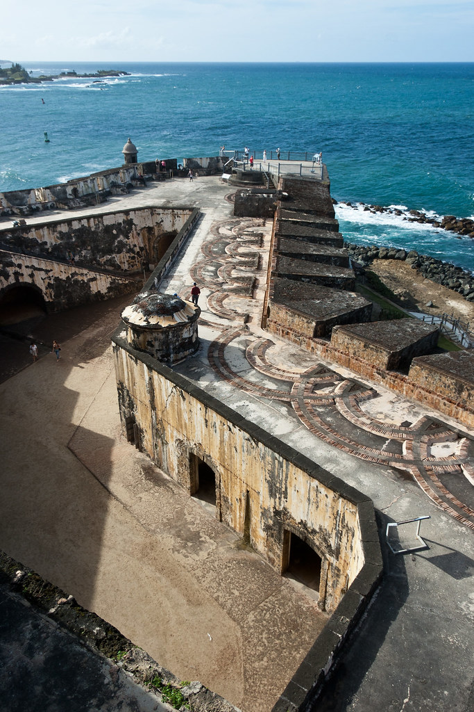
Above: Fort San Felipe del Morro.

I visited both of the city's former defensive forts, which are connected via underground passages!

DSC_5077
Above: The corner of Fort San Felipe del Morro. It formed a strong barrier to the harbour entrance.

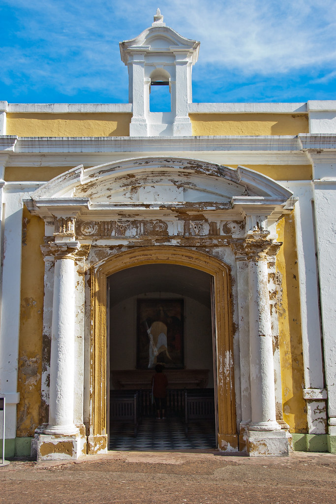
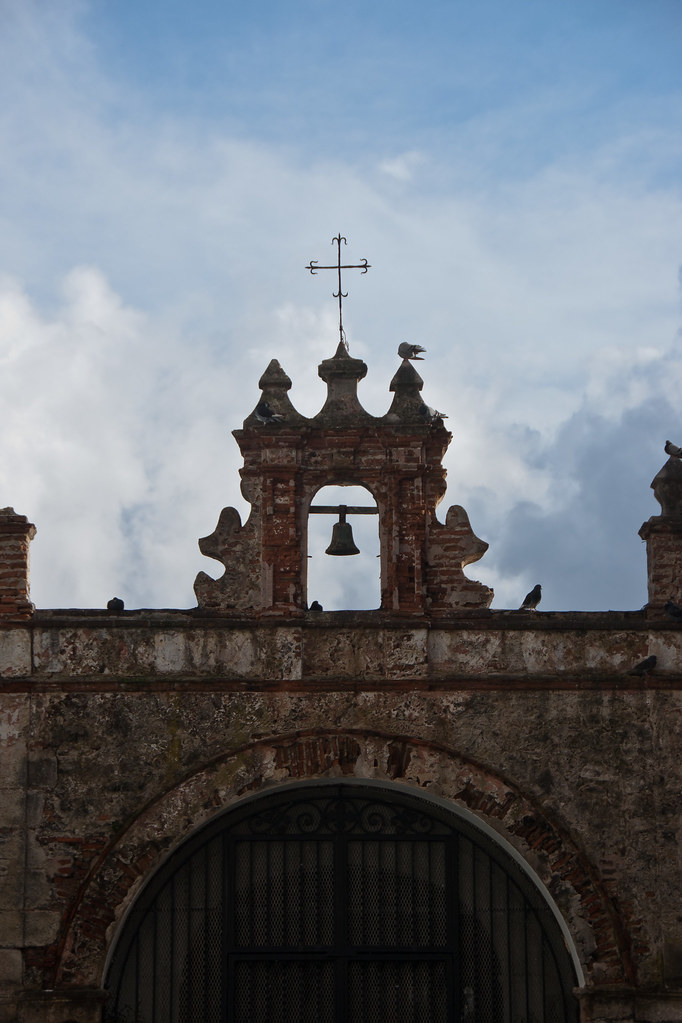
DSC_5064
Above: The Chapel at Fort San Felipe del Morro.

The main central part of the city is characterized by narrow streets made of blue cobblestone and picturesque colonial buildings, some of which date back to the 16th and 17th century.

DSC_4998
Above: One of the many colonial buildings in Old San Juan.

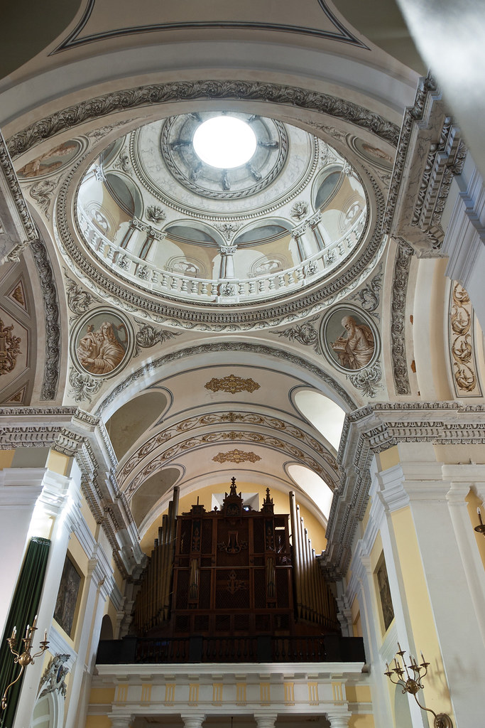
DSC_5096
Above: The inside of San Juan Cathedral.

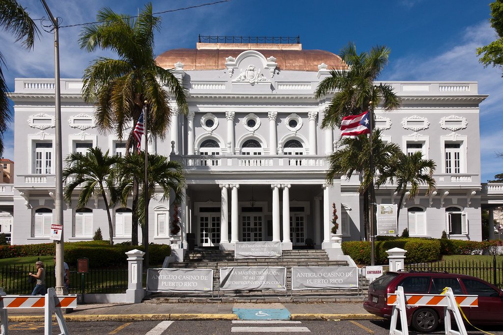
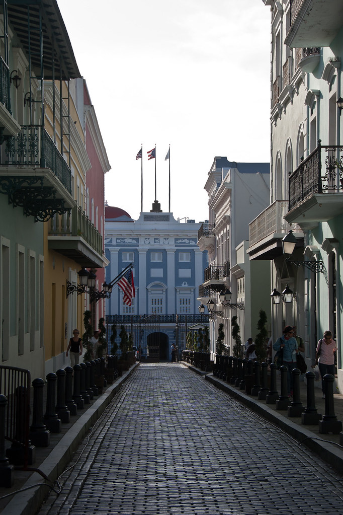
DSC_5102
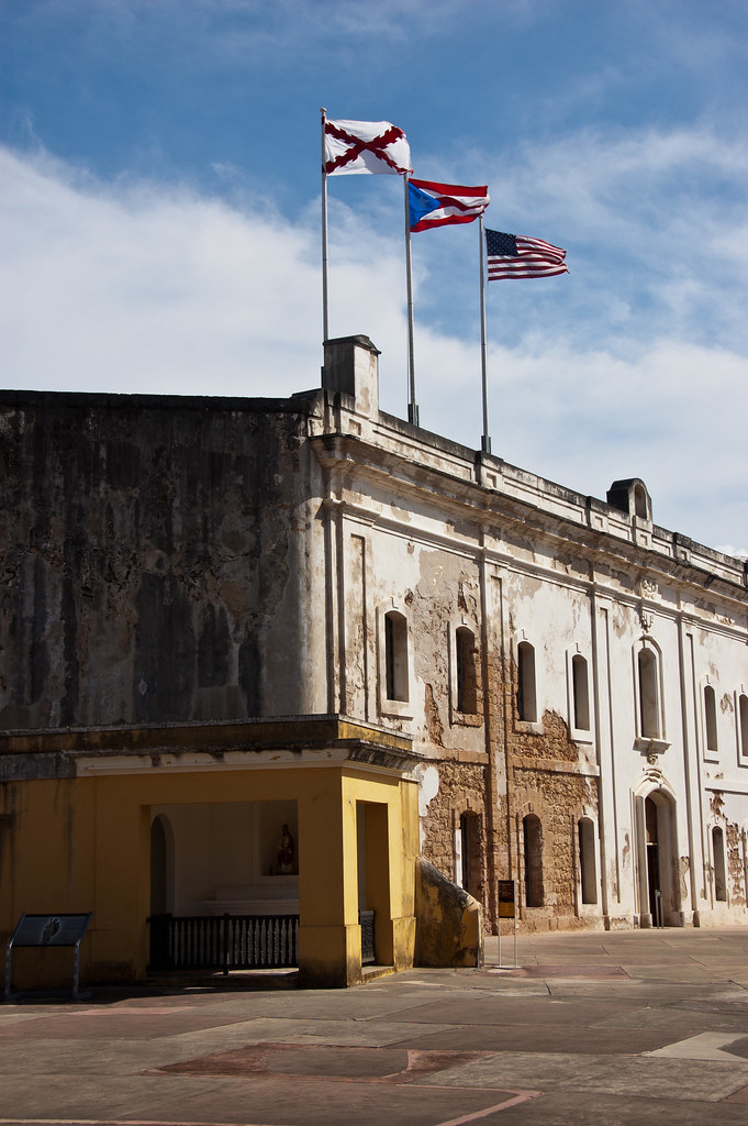
Above: Government buildings flying the U.S. Flag and the Puerto Rico Flag.

DSC_5103
Above: More colonial architecture.

I'll leave you with an arty shot of a red wall! Old San Juan is a beautiful place, and reminded of Europe - where I am going next!

DSC_5107

Dominica

Welcome back to my blog! Today, I will show you some highlights of Dominica, one of the most beautiful islands I have visited.

DSC_5166
Above: One of the many waterfalls in Dominica, Trafalgar Falls.

Dominica is an island nation with an estimated population of 72,500 and a size of 290 square miles. Nicknamed the "Nature Isle of the Caribbean" for its unspoiled natural beauty, it is the youngest island in the Lesser Antilles, still being formed by geothermal-volcanic activity, as evidenced by the world's second-largest boiling lake. The island features lush mountainous rainforests, home of many rare plant, animal, and bird species.

DSC_5129
Above: A flower at Dominica's Botanical Gardens.

Our ship docked at the capital, Rosseau, a small and compact urban settlement, located within the Saint George parish and surrounded by the Caribbean Sea, the Roseau River and Morne Bruce.

Untitled_Panorama1
Above: Downtown Rosseau.

Christopher Columbus named the island after the day of the week on which he spotted it, a Sunday, November 3, 1493. In the hundred years after Columbus's landing, Dominica remained isolated, and even more Caribs settled there after being driven from surrounding islands as European powers entered the region.

DSC_5228
Above: Houses in Rosseau. Dominica is the second poorest country in the Caribbean, after Haiti.

France formally ceded possession of Dominica to the United Kingdom in 1763. The United Kingdom then set up a government and made the island a colony in 1805. In 1978, Dominica became an independent nation.

Untitled_Panorama1_1
Above: A panorama of downtown Rosseau.

During my tour of Dominica, we visited some waterfalls including Trafalgar falls (see picture above). We also saw the Emerald Falls which is famed for its sparkling water! The island boasts 365 rivers and is very mountainous.

DSC_5200
Above: Emerald Falls.

Dominica is especially vulnerable to hurricanes. At the botanical gardens a school bus has been left in its crushed state, caused by a hurricane decades ago:

DSC_5130

Scenes from the second Pirates of the Caribbean film ('Dead Man's Chest') were shot in Dominica. There was anger in the region upon the film's release as the local Caribs were portrayed as savage cannibals in the movie. The Caribs are the native group from which the Caribbean takes its name and Dominica is one of the last places that a Carib population can be found in the world.

DSC_5211
Above: A view of the Atlantic coast, where much of the second Pirates movie was shot.

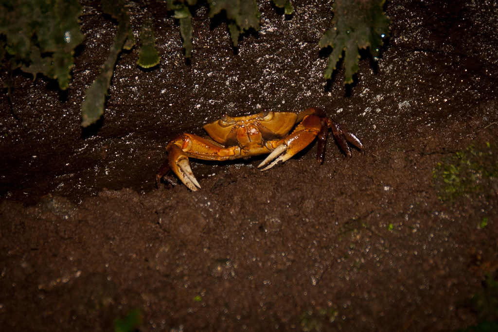
I'll leave you today with a curious shot of a tree crab, one of many exotic animals that can be found in Dominica!

DSC_5155

Sunday, 11 March 2012

Grenada

Today I will show you Grenada, an island country and Commonwealth Realm consisting of the island of Grenada and six smaller islands. Its size is 133 square miles, with an estimated population of 110,000. Our ship docked at St. George's - the capital - and I took part in a seven hour tour of the island!

Untitled_Panorama3
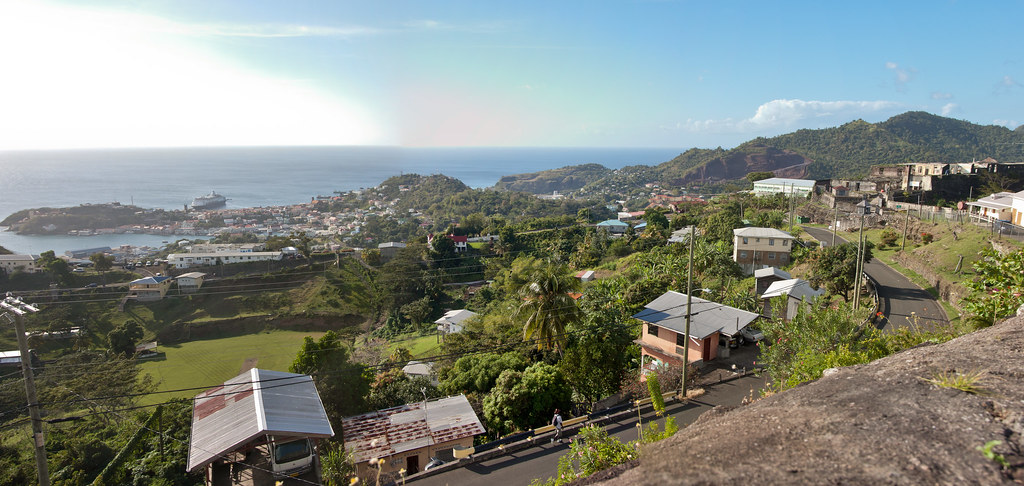
Above: The view from Fort Frederick on a ridge 800 feet above sea level, looking at downtown St. George's with the Maasdam docked centre.

The island was first settled by the French in 1649 and from that time until 1763 it was a French colony. Grenada was formally ceded to Britain by the Treaty of Paris in 1763 and then gained its independence in 1974.

DSC_6188
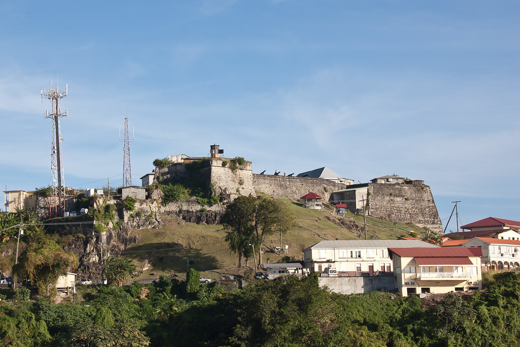
Above: One of the Forts at St. George's.

In 1983, the moderate government was over-thrown by a strongly pro-communist coup, which saw the prime minister executed. On October 25 combined forces from the United States and from the Regional Security System based in Barbados invaded Grenada. President Reagan was worried that Cuba – under the direction of the Soviet Union – would use Grenada as a refuelling stop for Cuban and Soviet airplanes loaded with weapons destined for Central American communist insurgents. The invasion was highly criticised by head of state HM Queen Elizabeth II and the governments of Britain, Trinidad and Tobago and Canada but it succeeded in re-establishing democracy on the island.

Untitled_Panorama2
Above: The view of St. George's from the ship.

Grenada is also known as the "Island of Spice" due to the production of nutmeg and mace crops of which Grenada is one of the world's largest exporters. Nutmeg was introduced to Grenada in 1843 when a merchant ship called in on its way to England from the East Indies. Grenada's nutmeg industry now supplies nearly forty percent of the world's annual crop.

DSC_6061
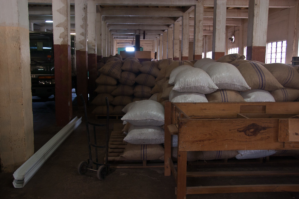
Above: Bags of nutmeg at a local factory we visited.

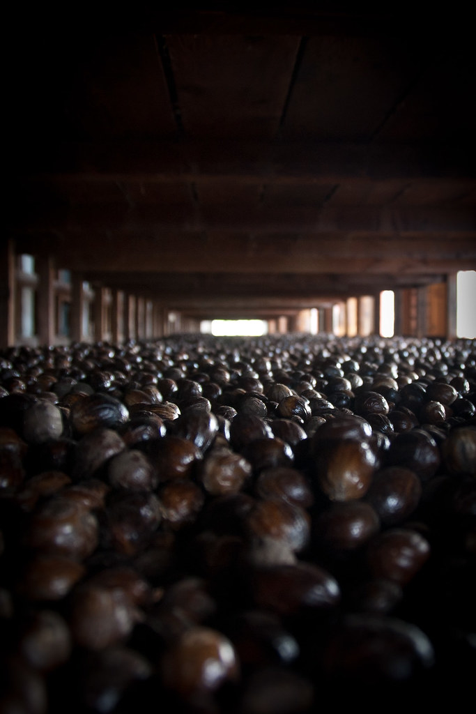
We visited a nutmeg factory which was housed in an old wooden building from the 1950s. They had a whole floor of drying racks for the nutmeg:

DSC_6076

The island of Grenada is of volcanic origin with extremely rich soil. Grenada’s interior is very mountainous with Mount St. Catherine being the highest at 840m.

DSC_6123
Above: Grand Etang is a cobalt-blue crater lake situated a breathtaking 1900 feet above sea level in an extinct volcano

Several small rivers with beautiful waterfalls flow into the sea from these mountains. The climate is tropical: hot and humid in the rainy season and cooled by the trade winds in the dry season. Grenada, being on the Southern edge of the hurricane belt, has suffered only three hurricanes in fifty years.

DSC_6125
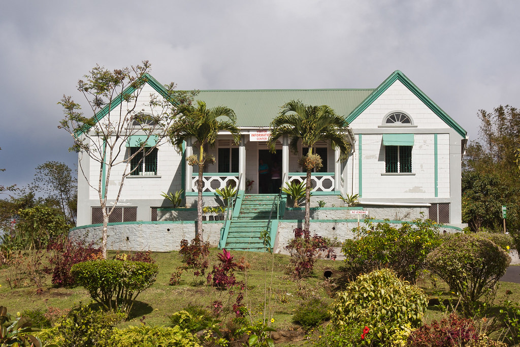
Above: The visitor centre next to Grand Etang Lake.

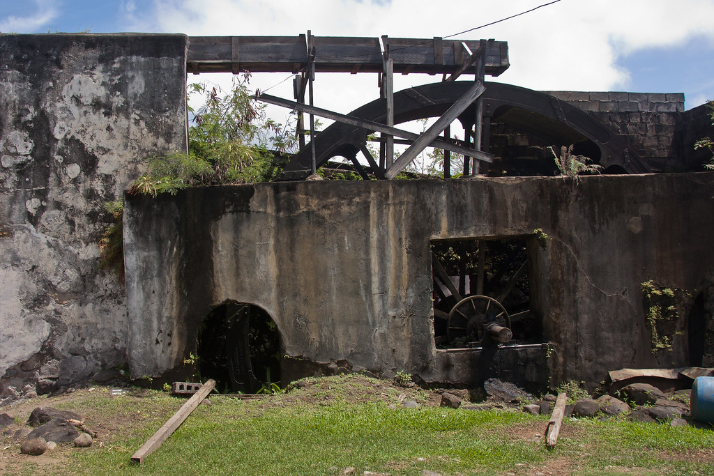
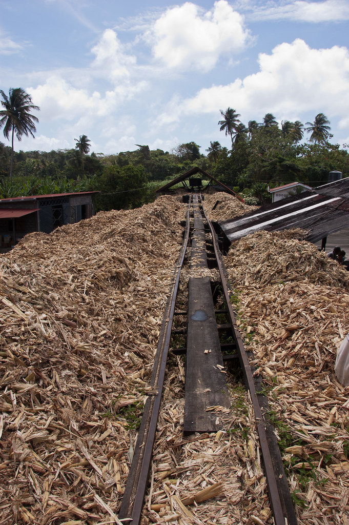
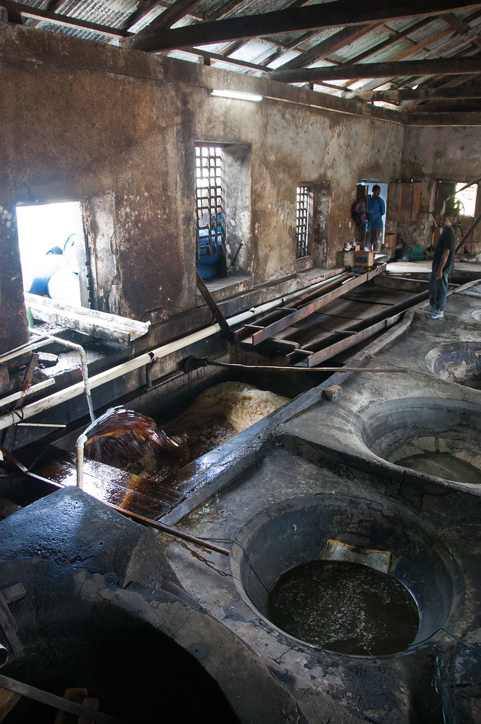
During our tour we also visited the River Antoine Estate where we experienced the age-old rum making process.

DSC_6086
Above: The oldest functioning water wheel in the Western Hemisphere.

DSC_6093
Above: Discarded sugar cane forms a path through the rum factory.

DSC_6103
Above: The inside of the factory with pools of liquid sugar.

DSC_6082
Above: One of the more beautiful parts of the rum estate.

I hope you enjoyed this tour of the island. We have visited so many islands on my cruise that it is difficult to keep track so this blog is a great way to organise everything! I'll leave you with a final shot from Fort Frederick of inland St George's.

Untitled_Panorama1